Severe line of storms in forecast for Wednesday's rush hour
FOX 2 (WJBK) - Keep an eye on the sky for Wednesday - the chance for severe weather will be high.
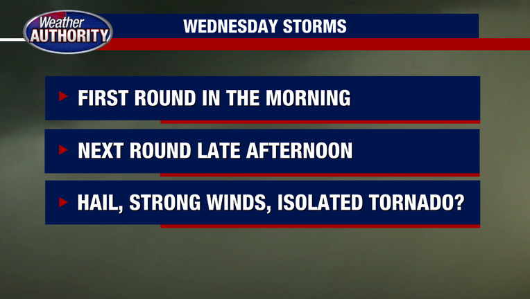
Two rounds of unsettled weather are expected with it kicking off early in the morning, but it is the second wave of around rush hour that will have a better chance to pack a punch.
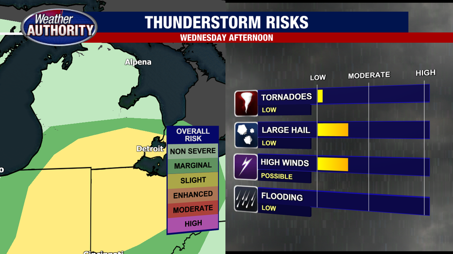
Damaging winds, hail, and a chance for a tornado are all possible between 4 p.m. and 6 p.m. We have a stronger area of low pressure approaching the state Wednesday which will generate the chance for storms. We have two rounds of storms.
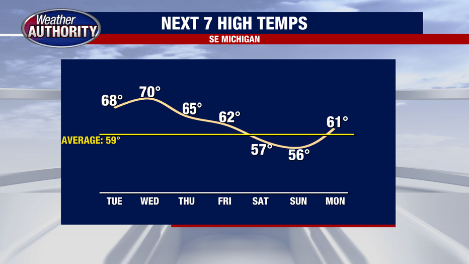
We've had great weather to start the week with highs well above the seasonal high with 80 on Sunday and upper 60s to lower 70s through Tuesday afternoon.
First Round:
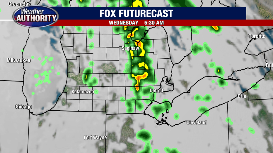
The first round of storms arrives early Wednesday morning. These will be non-severe with pockets of moderate rain possible. Those will move out by mid-morning and skies will clear with some sunshine possible which in that case will help fuel the atmosphere for the late afternoon and early evening storms.
Second Round:
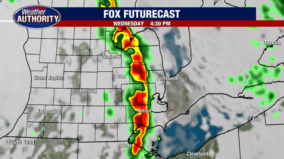
There will be a few hours of dry and potentially sunny hours in between. That usually helps juice up the atmosphere and helps fuel the storms for later. The line of stronger storms will arrive between 4 p.m. to 6 p.m. The main concerns with this line of storms will be damaging winds, hail and an isolated tornado. Temperatures during the day will also be above the seasonal high by 10 degrees with most spots in the mid to upper 60s.
Once the cold front moves through the state temperatures will start to come down and we'll have more of a seasonal feel. By the end of the week highs will settle into the 50s and will stick around heading into the weekend.