Severe weather in SE Michigan expected late Tuesday into overnight
FOX 2 (WJBK) - The forecast for storms earlier this morning may have fizzled, but tonight's expected weather may not be so kind.
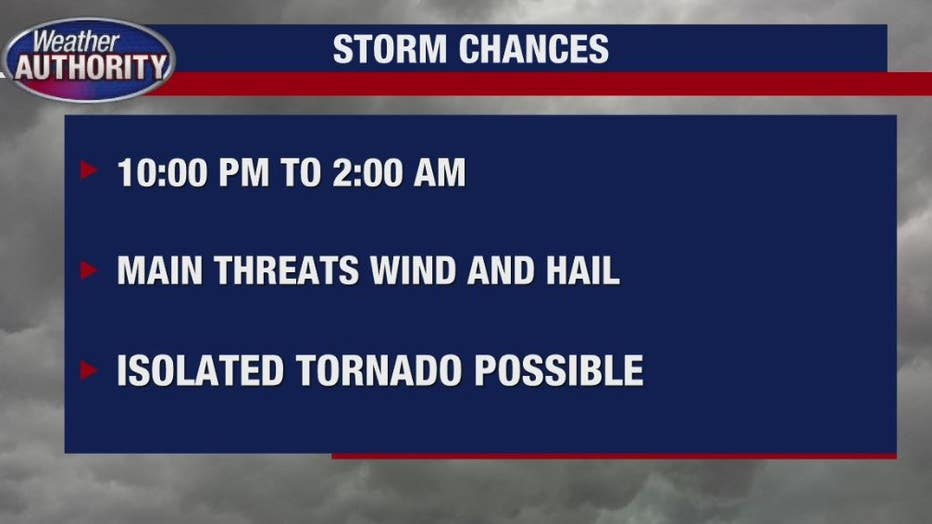
The severe weather window is expected from 10 p.m. to 2 a.m. with the main threats are going to be wind and hail with a chance for an isolated tornado. A Wind Advisory is already in place for SE Michigan until Wednesday evening.
Weather Authority Rich Luterman says that same storm system as of early Tuesday evening has caused a tornado watch , close to Chicago up toward northern Illinois.
Today's unusually early warm weather - which included a record-setting 72 degrees, will be changing.
The cold front will quickly race across lower Michigan and we currently have a wind advisory. The 10 p.m. to 2 a.m. window. could pack a punch.
The Wind Advisory was issued Tuesday afternoon and runs until 7 p.m. Wednesday by the National Weather Service. West winds from 20 to 30 miles per hour with gusts of 45 mph are expected.
The NWS advises that gusty winds could blow around unsecured objects and tree limbs could be blown down causing power outages as a result.
Related: Detroit breaks record for high temperatures in February
Track outages in your area by checking the DTE Energy Outage Map HERE.
Take our weather team with you and download the free FOX 2 Weather App.