Thunderstorm Watch issued for entire Metro Detroit area
FOX 2 (WJBK) - Springtime in Michigan is here and oftentimes that means severe thunderstorms. Today it means exactly that. Let's get to it. A Severe Thunderstorm Watch is in effect for all of Metro Detroit until 7 p.m.
Watch live coverage in the player above.
The warning still in effect is for Lapeer, Macomb and Oakland counties until 4:45 p.m.
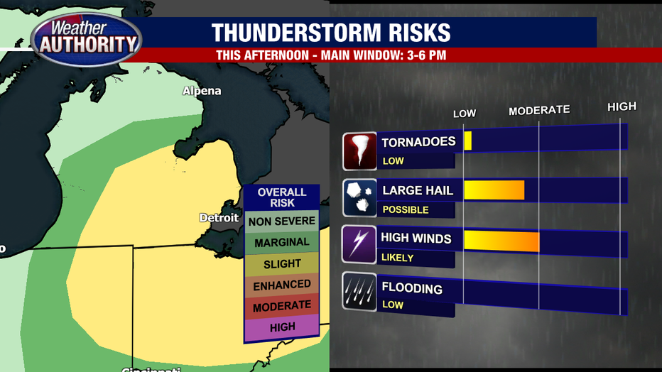
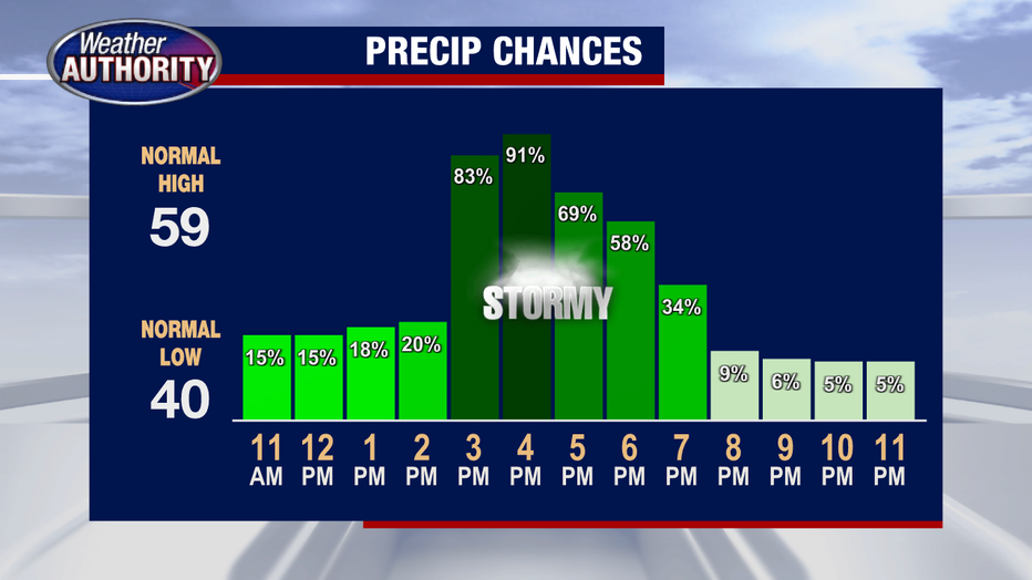
A collision of unstable air masses is what will prompt the threat of severe weather between 3 p.m. and 6 p.m. today. Due to the difference in air mass temperatures, one of the primary threats we could see is large hail, followed by a likelihood for strong gusty winds along the line of storms.
Lansing lawmakers already got a taste of the severe storms in our state, as a Tornado Warning for Ingham County caused elected officials to evacuate off the House floor at 2:05 p.m.
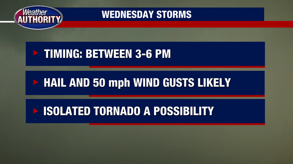
High winds will be a concern as they could gust over 50 mph as the storms pass.
Additionally, the threat for an isolated tornado is possible today thanks to some weak spin in the atmosphere. This spin could prompt a cluster of storms to rotate, thus creating a rotating column of air and possibly a tornado. The time frame remains consistent with the passage of the storms, between 3 p.m. and 6:00 p.m.
Following the storms today we will see a calmer pattern overnight and into Thursday. The cold front itself will move over Michigan late Thursday into Friday bringing another round of showers... but storms look unlikely. Cooler temperatures will follow into the weekend.