

The holiday weekend continues with a 90 degree forecast, severe humidity

The holiday weekend continues and it continues to be dry! That's the good news
The bad news is it'll be super duper hot and humid. And the UV index will be elevated as well. Summer is back baby!
A strong area of high pressure has built back in over the Southeast, meaning hot and humid air is streaming in from The Gulf of Mexico and making it all the way to the Midwest.
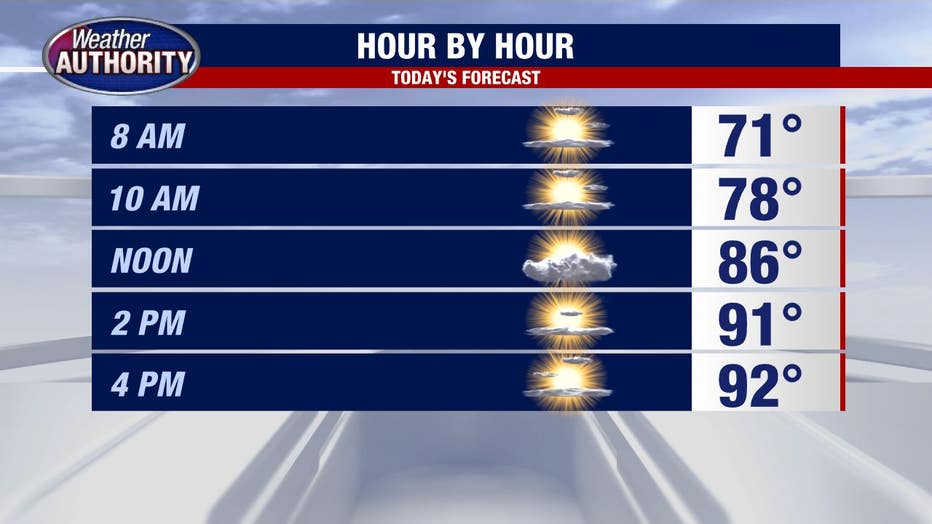
High temps today will build to about 92 degrees but with the humidity, it will feel as hot as 97.
Make sure you limit your time in the sun - hop in the shade, drink lots of water and wear sunscreen! The UV Index is at a robust 8.5 scale, meaning it won't take long to get sunburned.
A series of cold fronts will "chip away" at the high heat beginning Wednesday and Thursday.
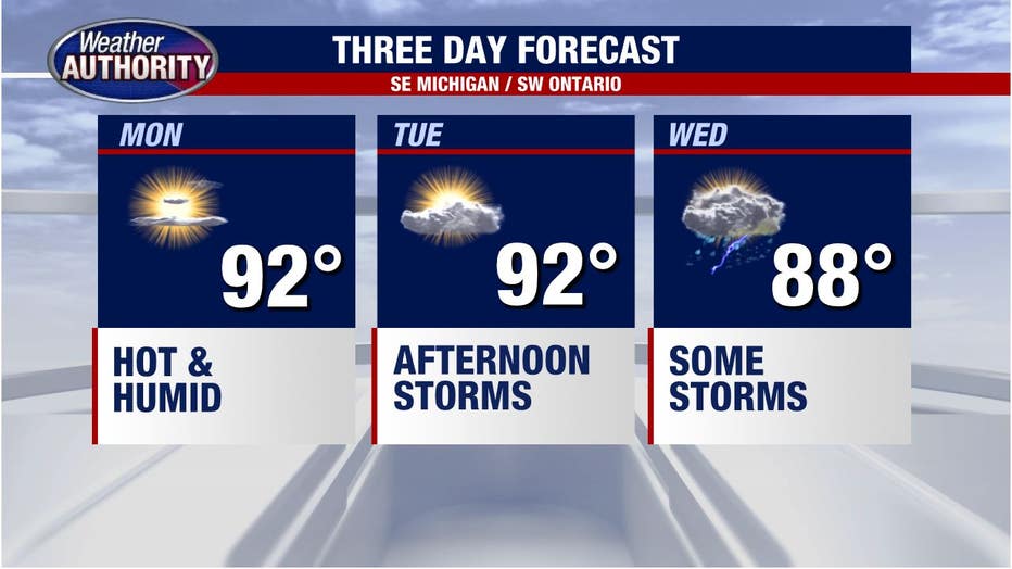
Tuesday remains hot and humid with a chance of storms mainly in the afternoon. The first, weaker front will arrive Wednesday but won't have a large impact on temperatures - we'll still get a high near 88 degrees.
Want to get breaking news straight to your phone? Curious about what events are happening this weekend? Download the FOX 2 News app and the FOX 2 Weather app for iOS and Android today.
Wednesday's showers and storms will be more widespread and will impact more of the area. By Thursday the stronger front arrives and really chops the temperature down into the upper 70s as it brings with it rain showers and the chance for a t-storm.
At least the humidity will get kicked out of here!