


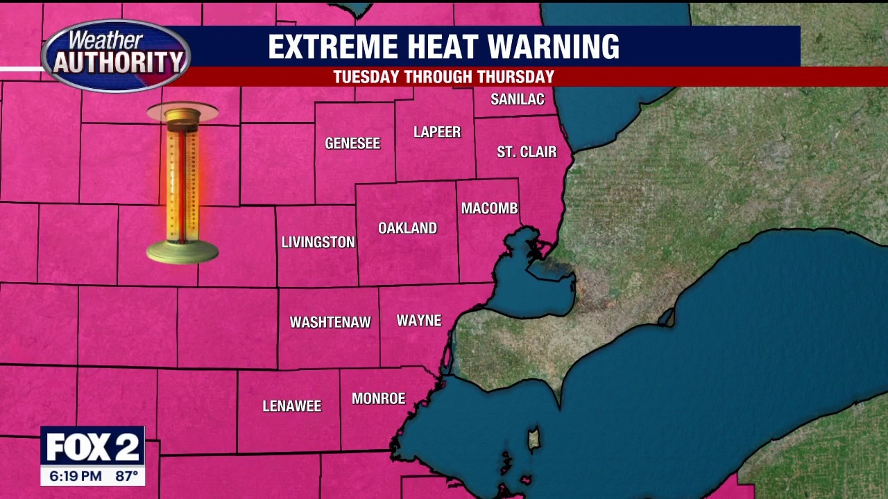
Record-setting heat possible today in Metro Detroit amid Extreme Heat Warning
Temperatures in Metro Detroit today could tie or break the record of 95 degrees originally set in 1931, while heat index values (combination of high heat and humidity) could exceed 103 degrees today.
Temperatures in Metro Detroit today could tie or break the record of 95 degrees originally set in 1931, while heat index values (combination of high heat and humidity) could exceed 103 degrees today.

Hot & Humid Tuesday
We could tie or break the record of 95 degrees today with heat index values exceeding 100 degrees. Meteorologist Lori Pinson has your forecast.
We could tie or break the record of 95 degrees today with heat index values exceeding 100 degrees. Meteorologist Lori Pinson has your forecast.
Breezy and 97 degrees for Tuesday as hot temps crank up
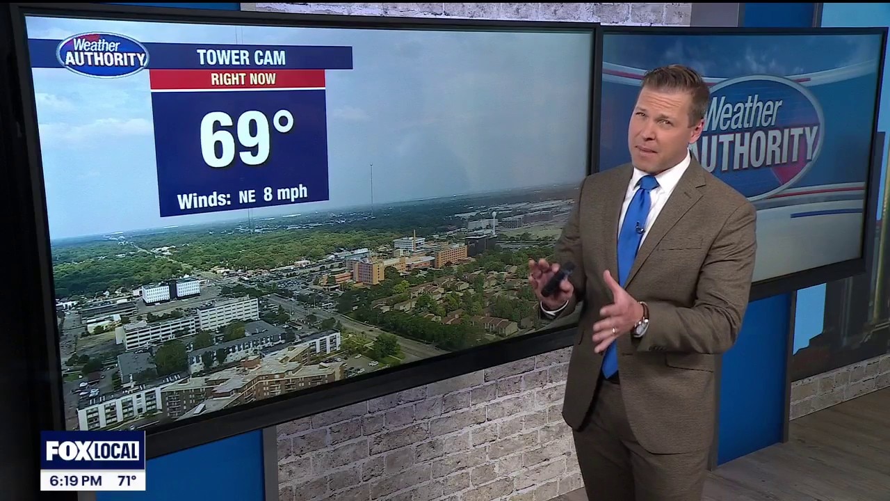
Rich Luterman has the forecast.
Rich Luterman has the forecast.


How extreme heat can have a dangerous impact on the body
It will feel like over a hundred degrees this week. When temperatures rise that high, it can have a dangerous impact on the body.
It will feel like over a hundred degrees this week. When temperatures rise that high, it can have a dangerous impact on the body.
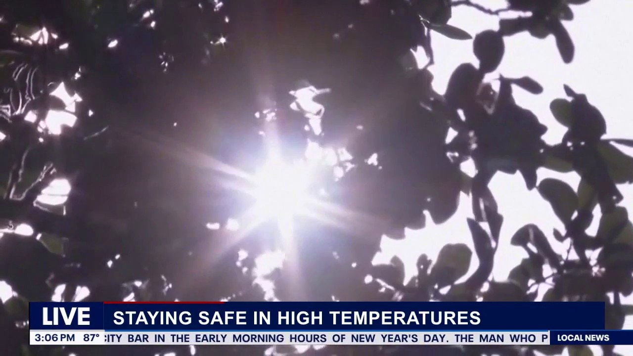
Staying safe in extreme heat
Dr. Glen Clark, Emergency Center Chief at Corewell Health Beaumont Grosse Pointe Hospital joins FOX 2 Detroit Live Host Aaron Jordan to discuss how people can stay safe during the extreme heat.
Dr. Glen Clark, Emergency Center Chief at Corewell Health Beaumont Grosse Pointe Hospital joins FOX 2 Detroit Live Host Aaron Jordan to discuss how people can stay safe during the extreme heat.


How to stay cool and save on energy as heat dome brings triple-digit temperatures to millions
Temperatures in the 90s are spreading across the Midwest and will reach the East Coast by midweek, when it will feel like 100 to 110 degrees for tens of millions of people ahead of the 4th of July weekend. Here are some tips to stay cool, save on energy, and not break the bank.
Temperatures in the 90s are spreading across the Midwest and will reach the East Coast by midweek, when it will feel like 100 to 110 degrees for tens of millions of people ahead of the 4th of July weekend. Here are some tips to stay cool, save on energy, and not break the bank.
Extreme heat has arrived and it will stick around
The heat index today will be near 95 degrees
The heat index today will be near 95 degrees


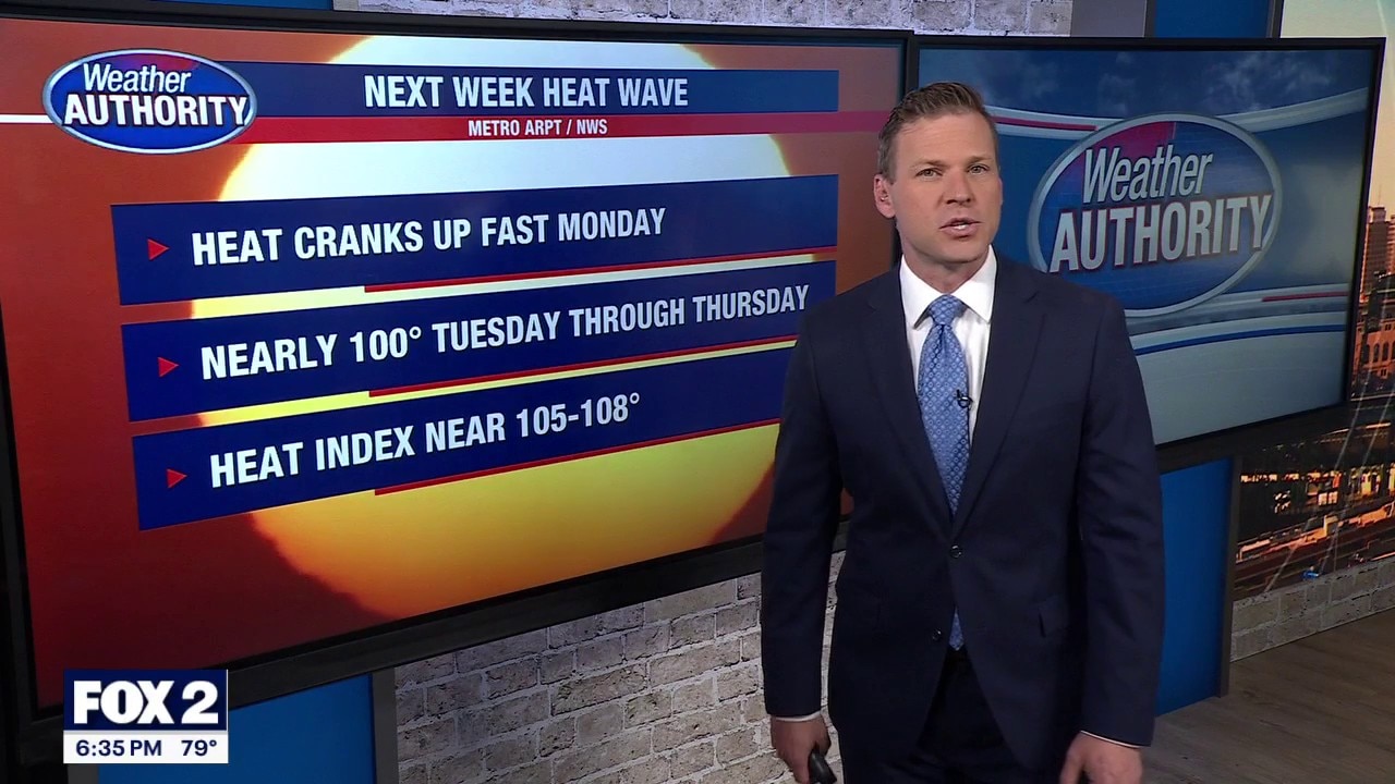
Metro Detroit weather: Hot start to the week ahead of days-long Extreme Heat Watch
The week in Metro Detroit begins with a hot day, but it's only just the beginning. Temperatures near 100 and head indices closer to 105 are expected later this week.
The week in Metro Detroit begins with a hot day, but it's only just the beginning. Temperatures near 100 and head indices closer to 105 are expected later this week.
Hot start to an even hotter week
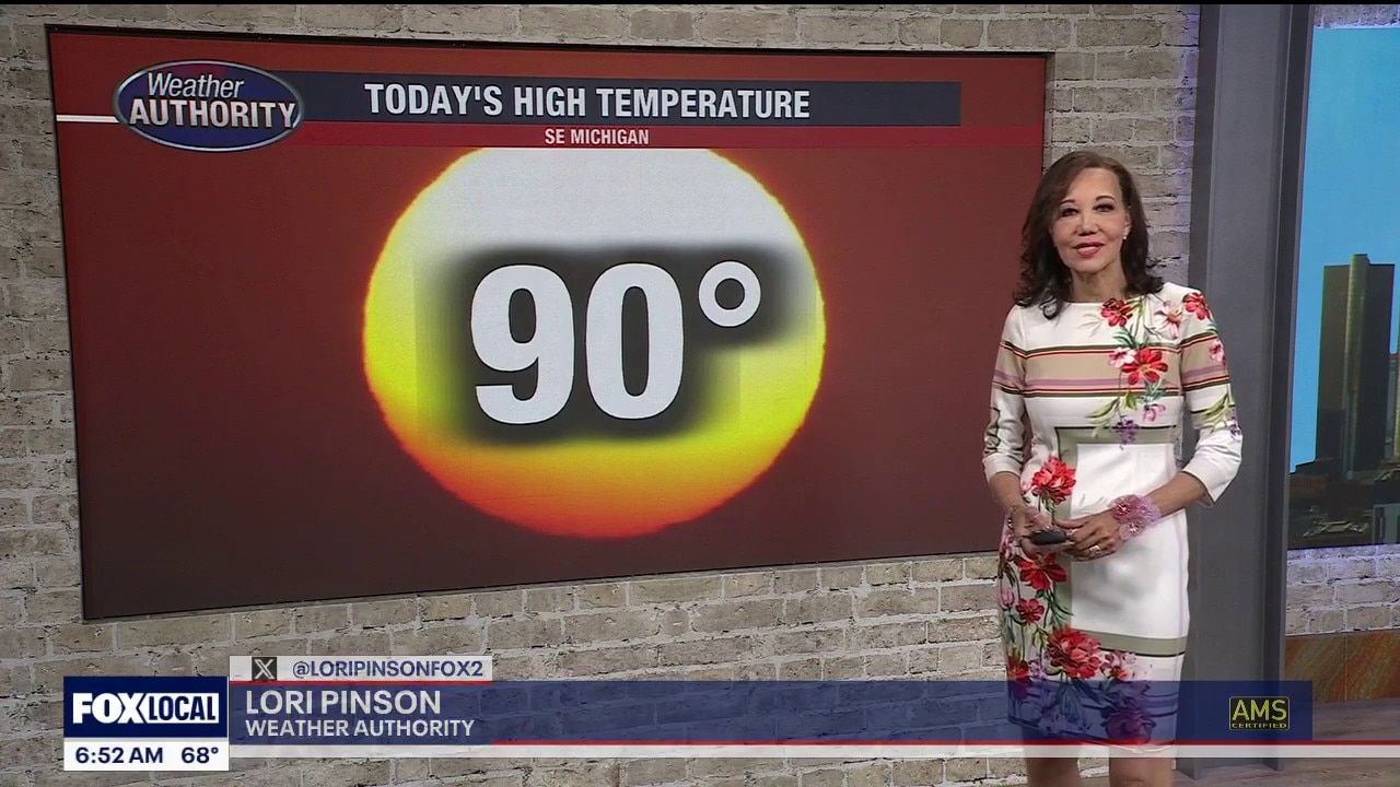
Highs Monday will be around 90, and the temperature will climb even higher as the week progresses.
Highs Monday will be around 90, and the temperature will climb even higher as the week progresses.
EXTREME HEAT WATCH: Tuesday afternoon through Thursday evening this week. Heat index values could top 105 midweek.
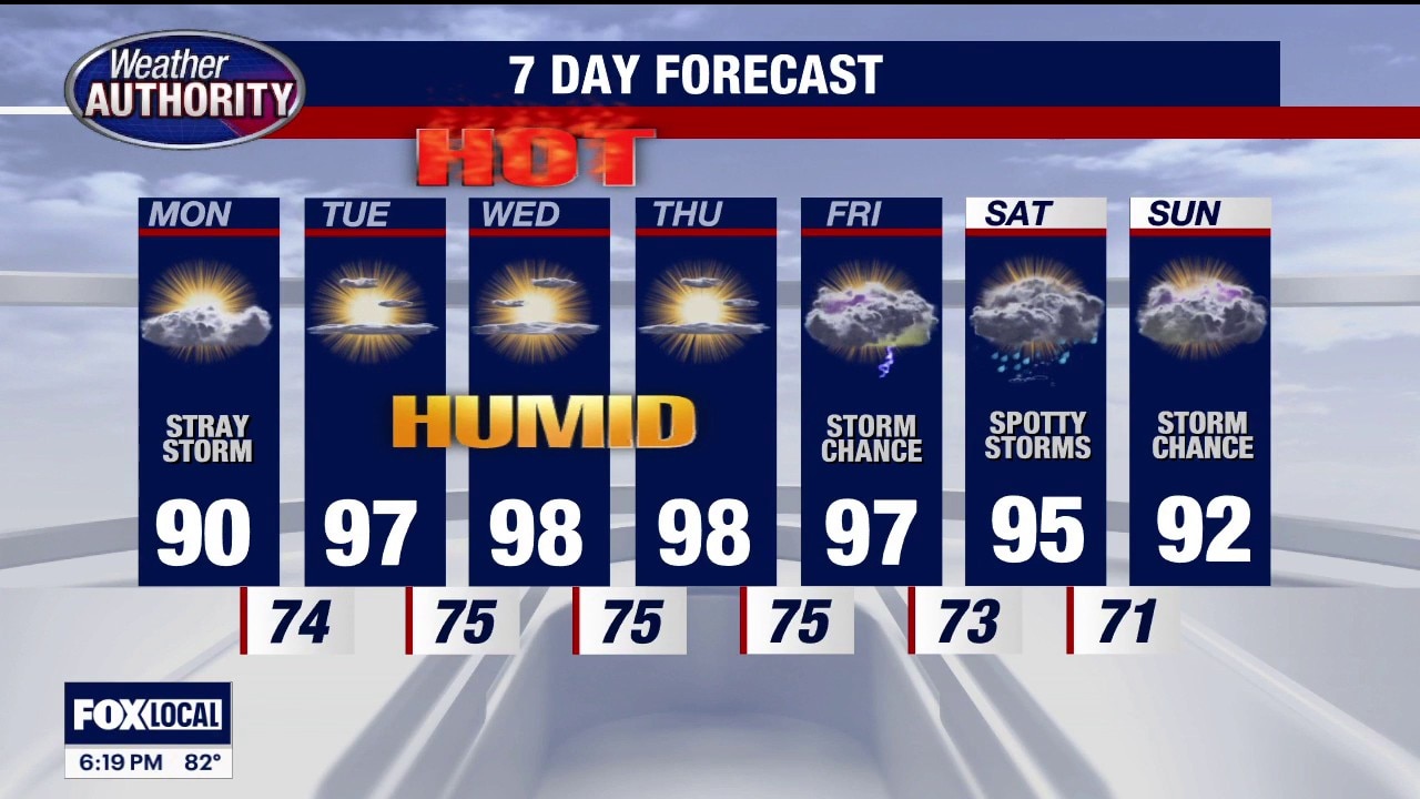
Sunday evening/night: Partly cloudy. Very mild. Low 66. Monday: Partly sunny. VERY WARM & MORE HUMID. Chance for a stray thunderstorm. High near 90. Tuesday: Hazy. HOT AND HUMID. High 97. Wednesday: Hazy. HOT AND HUMID. High 98. Thursday: Hazy. HOT AND HUMID. High 98. Friday: Hazy. HOT AND HUMID. Storm chance. High 97. Saturday (July 4): VERY WARM AND HUMID. With spotty storms. High 95. Sunday: VERY WARM AND HUMID. Storm chance. High 92.
Sunday evening/night: Partly cloudy. Very mild. Low 66. Monday: Partly sunny. VERY WARM & MORE HUMID. Chance for a stray thunderstorm. High near 90. Tuesday: Hazy. HOT AND HUMID. High 97. Wednesday: Hazy. HOT AND HUMID. High 98. Thursday: Hazy. HOT AND HUMID. High 98. Friday: Hazy. HOT AND HUMID. Storm chance. High 97. Saturday (July 4): VERY WARM AND HUMID. With spotty storms. High 95. Sunday: VERY WARM AND HUMID. Storm chance. High 92.

Warmer Sunday
The last day this week without high heat and humidity. Temps this week could exceed 100 degrees. Meteorologist Lori Pinson has your forecast.
The last day this week without high heat and humidity. Temps this week could exceed 100 degrees. Meteorologist Lori Pinson has your forecast.
All eyes are on next week's heat
Some extreme humidity and heat start Monday
Some extreme humidity and heat start Monday
Extreme heat on the way for all of next week
Excessive heat watches and warnings are likely
Excessive heat watches and warnings are likely


Utah wildfire grows rapidly, forcing more evacuations
A fast-moving wildfire in southern Utah grew rapidly overnight, fueled by intense heat, strong winds, and extremely dry conditions, prompting additional evacuation orders.
A fast-moving wildfire in southern Utah grew rapidly overnight, fueled by intense heat, strong winds, and extremely dry conditions, prompting additional evacuation orders.

Warmer Saturday
Near seasonal values today yet slightly warmer than yesterday. Hot & humid weather on the way next week. Meteorologist Lori Pinson has your forecast
Near seasonal values today yet slightly warmer than yesterday. Hot & humid weather on the way next week. Meteorologist Lori Pinson has your forecast

Hot weather with a dry stretch coming in
Lori Pinson says we are looking at near 100 degree weather coming up this week.
Lori Pinson says we are looking at near 100 degree weather coming up this week.
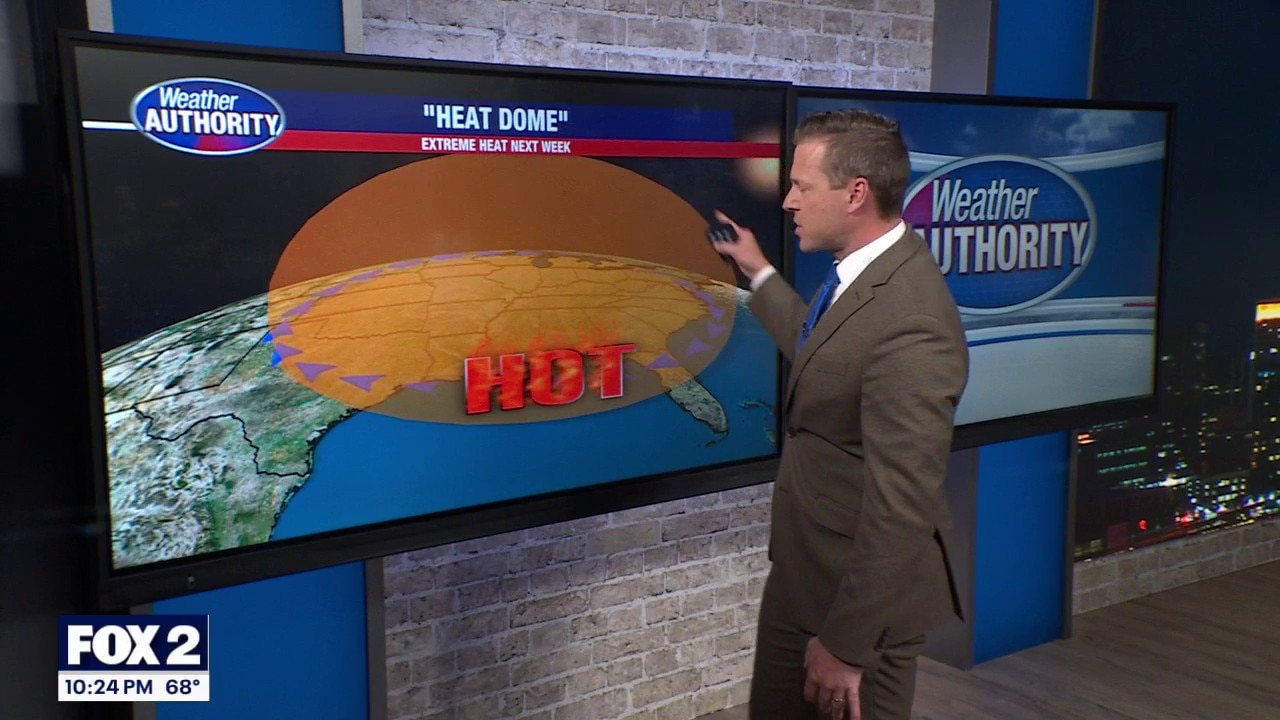
Extreme heat builds in next week
Weekend temps look quite nice!
Weekend temps look quite nice!
Some extreme heat to build in next week
The weekend looks quite nice though!
The weekend looks quite nice though!


See the photos: Before and after satellite images show aftermath of deadly earthquakes in Venezuela
Satellite images captured the devastating aftermath of the deadly back-to-back earthquakes that struck Venezuela late Wednesday.
Satellite images captured the devastating aftermath of the deadly back-to-back earthquakes that struck Venezuela late Wednesday.


Michigan faces major heat wave next week after sweet weekend temperatures
A big-time heat wave is set to take over next week, but the weather between now and then looks pretty sweet.
A big-time heat wave is set to take over next week, but the weather between now and then looks pretty sweet.