

Hurricane Lee forms, expected to rapidly intensify into 'extremely dangerous' major storm by weekend

Hurricane Lee expected to strengthen quickly, become major storm by weekend
Hurricane Lee has now developed in the Atlantic Ocean as the storm continues to strengthen through the week and is on track to form into a major hurricane before the weekend. Lee is forecast to reach major hurricane strength – defined as Category 3 or higher — by Friday afternoon. Over the weekend, winds could reach Category 4 or 5 strength. LiveNOW's Carel Lajara spoke about Lee's forecast with meteorologist Alex Tardy from the National Weather Service. More LiveNOW from FOX streaming video
Hurricane Lee has now developed in the Atlantic Ocean as the storm continues to strengthen through the week and is on track to form into an "extremely dangerous" major cyclone.
Maximum winds have increased to at least 75 mph, and continued strengthening is forecast through the week, according to the National Hurricane Center.
"This storm is going to be a monster," FOX Weather meteorologist Stephen Morgan said.
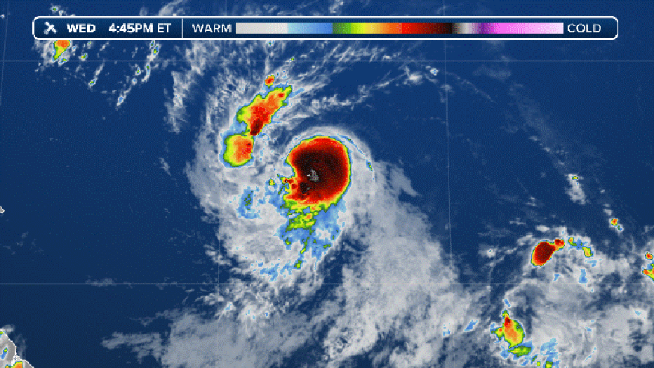
Current infrared satellite loop (FOX Weather)
Will Lee have any impacts on the US East Coast?
By the weekend, Hurricane Lee is expected to bring gusty winds and rough seas to Lesser Antilles and Puerto Rico.
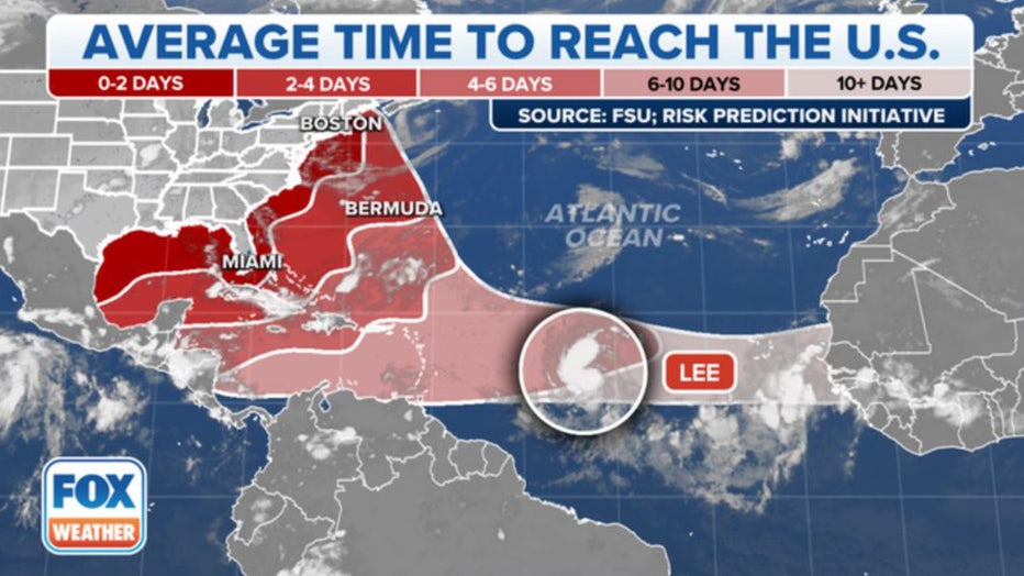
Beyond the weekend, the hurricane is expected to pass north of the islands and into the southwest Atlantic.
FOX Weather hurricane specialist Bryan Norcross stated that Lee is not likely to be a direct threat to Florida, Georgia, or South Carolina, but the storm will generate high surf with powerful waves that may cause damage along the shorelines.
While computer models predict Lee will stay offshore, some indicate that the Mid-Atlantic and Northeast coasts may still feel effects from the storm and monitoring future forecasts is recommended.
WHAT IS THE 'CONE OF UNCERTAINTY' IN HURRICANE FORECASTS?
Where is Hurricane Lee?
According to the National Hurricane Center, Hurricane Lee is more than 1,100 miles to the east of the northern Leeward Islands.
The hurricane continues to head in a west-northwest heading in the general direction of the northeast Caribbean and southwest Atlantic.
Lee is forecast to reach major hurricane strength – defined as Category 3 or higher — by Friday afternoon. Over the weekend, winds could reach Category 4 or 5 strength.
"The atmospheric and oceanic conditions appear extremely favorable for rapid intensification during the next several days," NHC forecasters said. "(Lee is) expected to rapidly intensify into an extremely dangerous hurricane by the weekend."
HOW ARE HURRICANES RATED? THE SAFFIR-SIMPSON HURRICANE WIND SCALE EXPLAINED
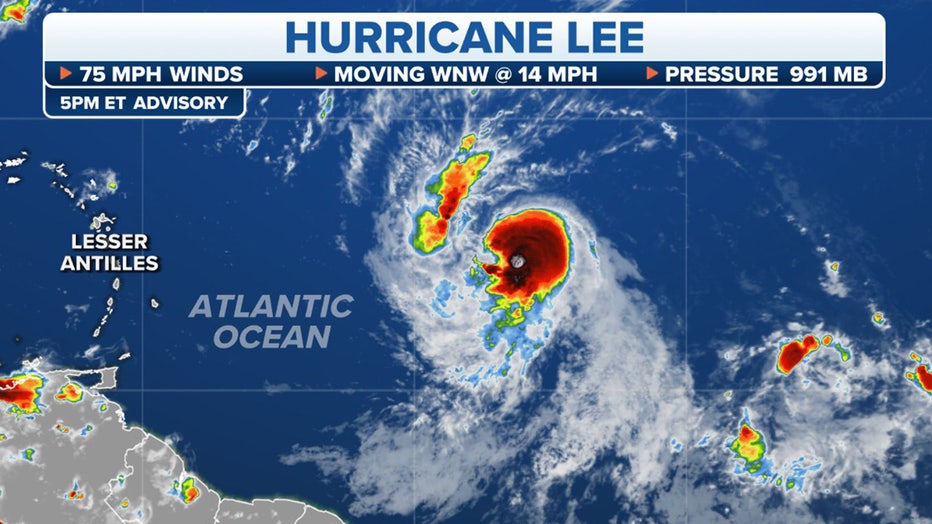
Tracking Hurricane Lee (FOX Weather)
What is the forecast track for Hurricane Lee?
Hurricane Lee is expected to move west-northwest during the coming days and near the islands in the northeast Caribbean during the next 96 hours.
While the cyclone is forecast to pass north of the islands, its close proximity could force the issuance of watches over the next 48 hours.
A Tropical Storm Watch is issued when winds sustained 39 to 73 mph winds are possible within the next 48 hours.
A Hurricane Watch is issued when winds of at least 74 mph are possible within the next 48 hours. These winds may be accompanied by storm surge and coastal flooding.
A cyclone is declared a tropical storm when maximum sustained winds reach at least 39 mph and a hurricane when winds reach 74 mph.
WHAT DOES IT MEAN WHEN A HURRICANE UNDERGOES ‘RAPID INTENSIFICATION’?
Tropical Storm Lee is expected to become a hurricane later Wednesday and is likely to rapidly intensify into an extremely dangerous major hurricane by Saturday, the National Hurricane Center said. (FOX Weather)