


The summer feel sticks through the week with a cooler weekend coming!
Friday showers and storms possible as a cold front sweeps through.
Friday showers and storms possible as a cold front sweeps through.
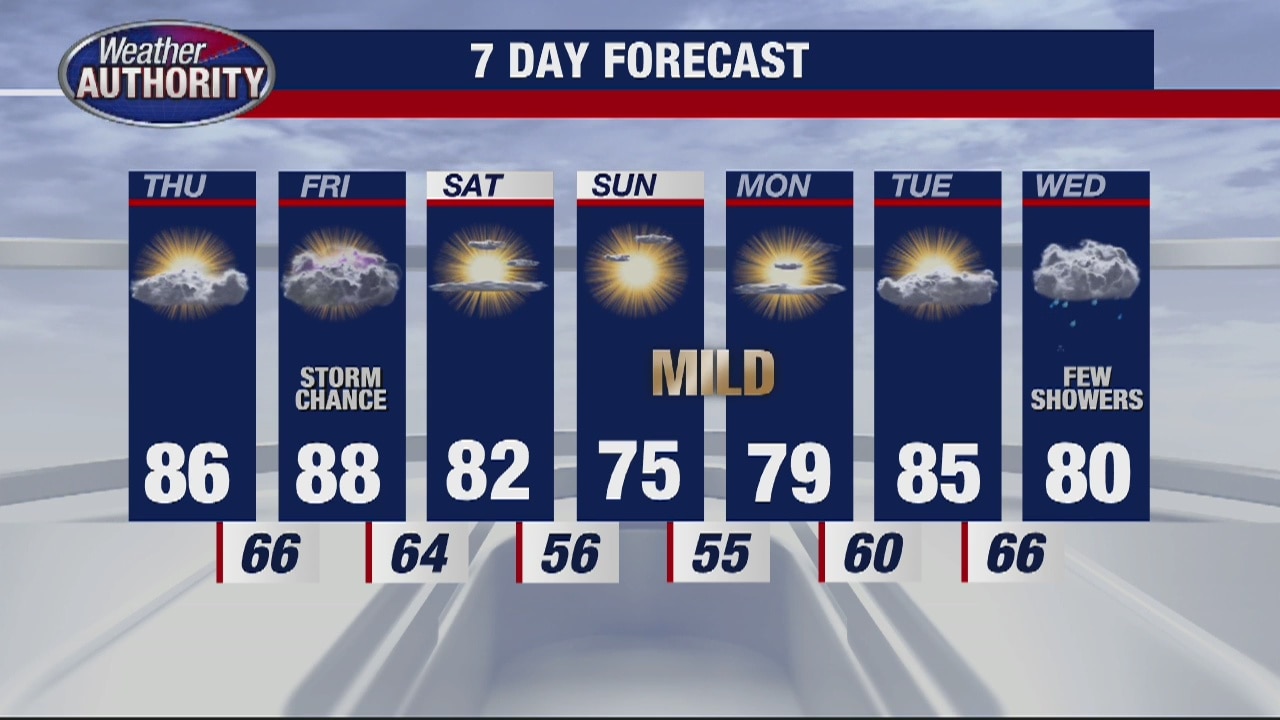
Beautiful stretch of weather continues
Rich Luterman has the forecast.
Rich Luterman has the forecast.
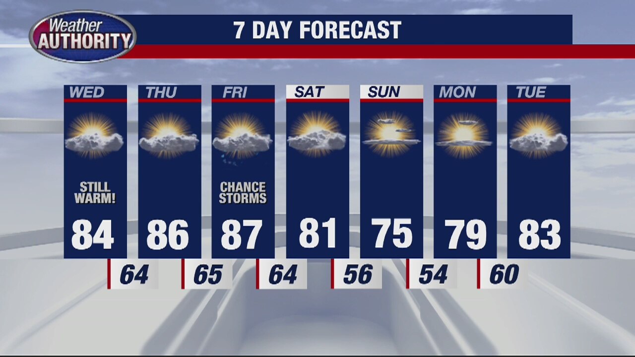
A warm few days and humidity returns
Next chance for showers comes Friday
Next chance for showers comes Friday

Early showers fade, a mostly dry Wednesday!
Temps still top out in the low 80's with a great looking weekend ahead.
Temps still top out in the low 80's with a great looking weekend ahead.
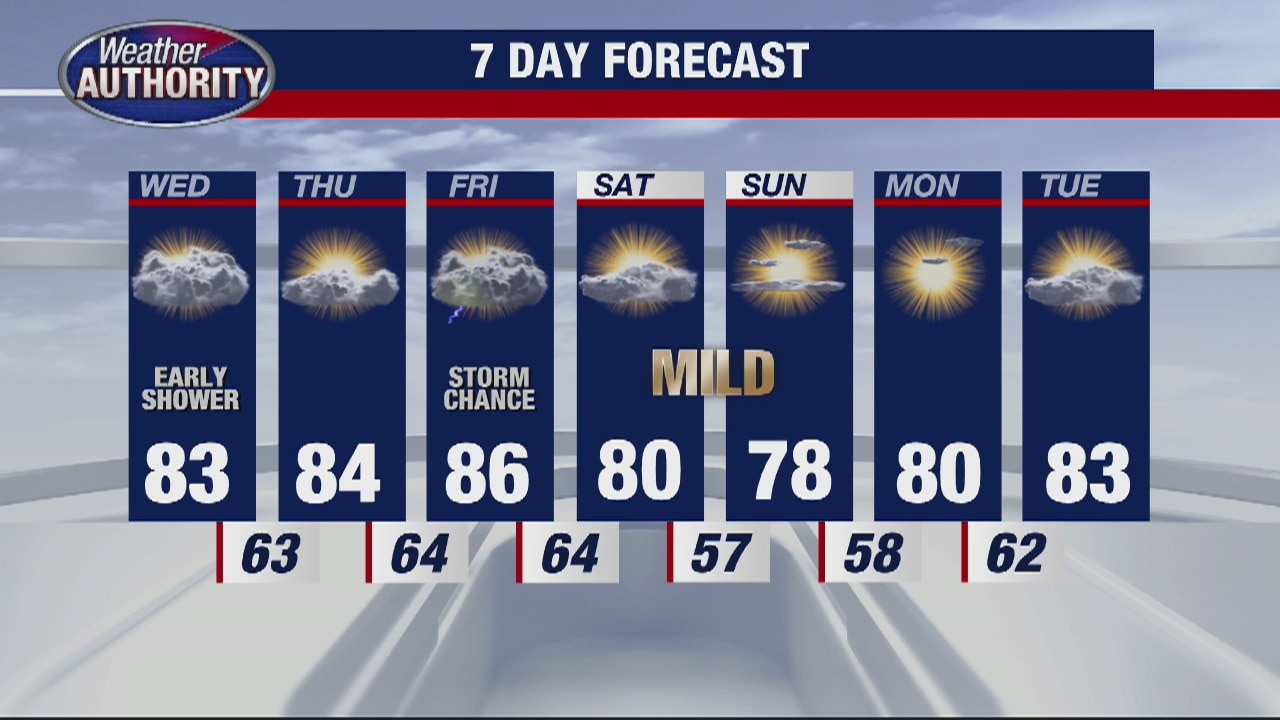
Warming trend continues
Rich Luterman has the forecast.
Rich Luterman has the forecast.

Clouds turn to sun, temps set to reach into the 80's this afternoon!
We're sweating it out today with storms possible tonight into tomorrow morning. Severe weather possible.
We're sweating it out today with storms possible tonight into tomorrow morning. Severe weather possible.
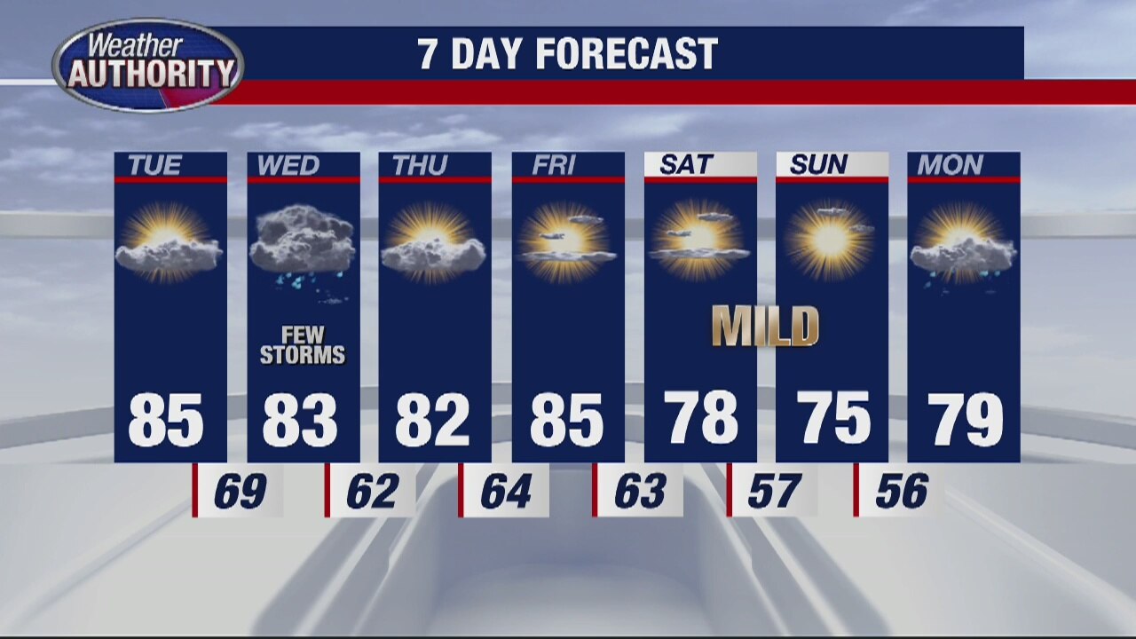
Partly sunny and warmer
Rich Luterman has the forecast.
Rich Luterman has the forecast.
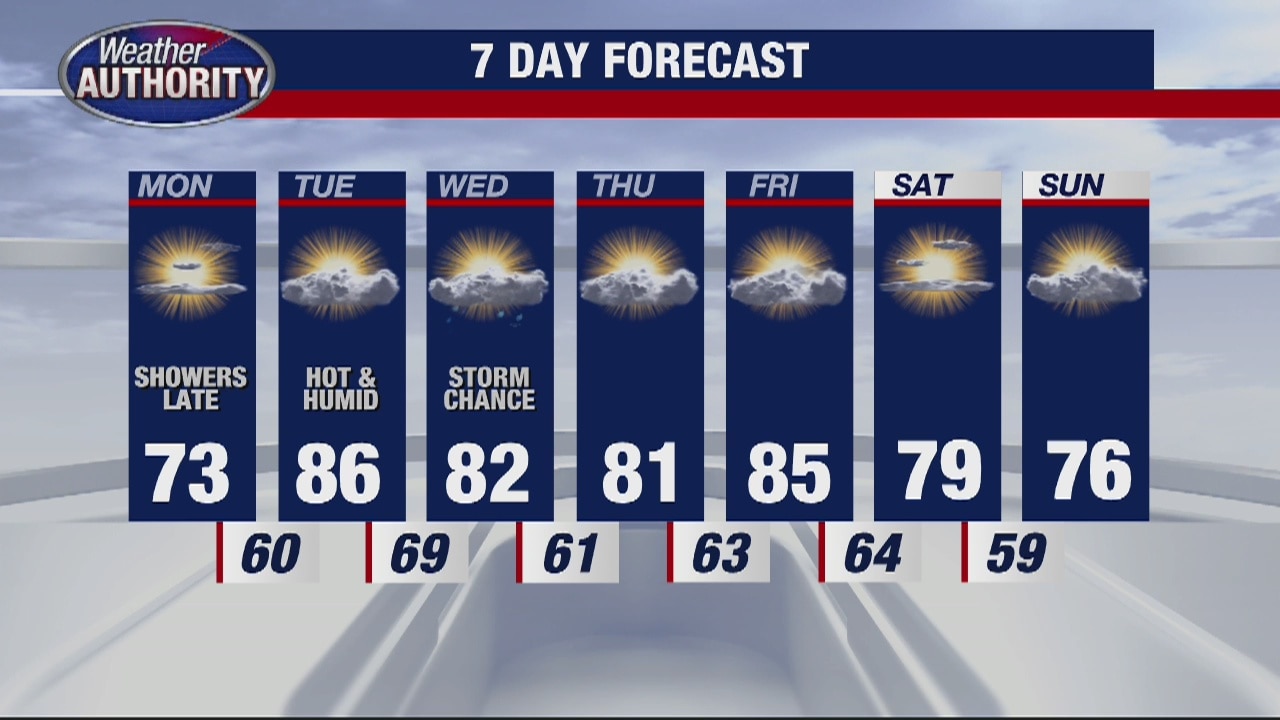
Another nice day to start the week
Showers possible late tonight and early Tuesday morning
Showers possible late tonight and early Tuesday morning

Chilly Monday morning, heating up Tuesday afternoon!
Mostly sunny skies this morning give way to a cloudier finish with some rain tonight.
Mostly sunny skies this morning give way to a cloudier finish with some rain tonight.

Cool and Sunny Sunday
Grab a jacket if you're heading out the door this morning. We are waking up to temperatures in the low 40s this Sunday morning. Into this afternoon, we are expecting highs a good 10 degrees below normal in the mid 60s. Thankfully, we will keep skies mostly sunny from start to finish. Enjoy the dry weather while it lasts because changes are in store by Monday. Most of Monday looks great, but by Monday evening a warm front will be an increased threat for rain and a few rumbles into Tuesday morning.
Grab a jacket if you're heading out the door this morning. We are waking up to temperatures in the low 40s this Sunday morning. Into this afternoon, we are expecting highs a good 10 degrees below normal in the mid 60s. Thankfully, we will keep skies mostly sunny from start to finish. Enjoy the dry weather while it lasts because changes are in store by Monday. Most of Monday looks great, but by Monday evening a warm front will be an increased threat for rain and a few rumbles into Tuesday morning.
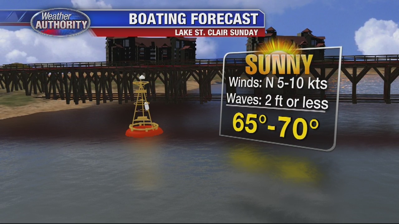
Weekend Sun
Meteorologist Lori Pinson has your forecast
Meteorologist Lori Pinson has your forecast
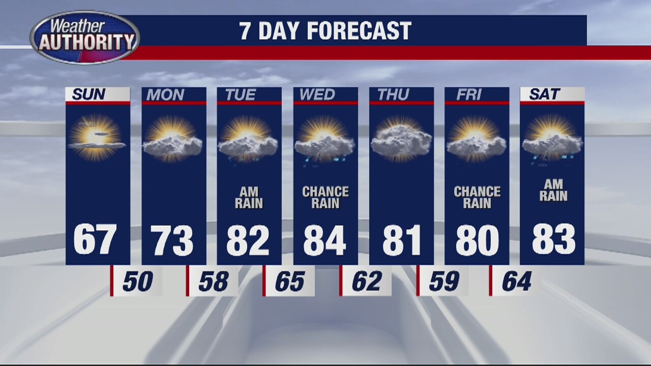
More Sun For Sunday
Meteorologist Lori Pinson has your forecast
Meteorologist Lori Pinson has your forecast
Refreshingly Cool Saturday
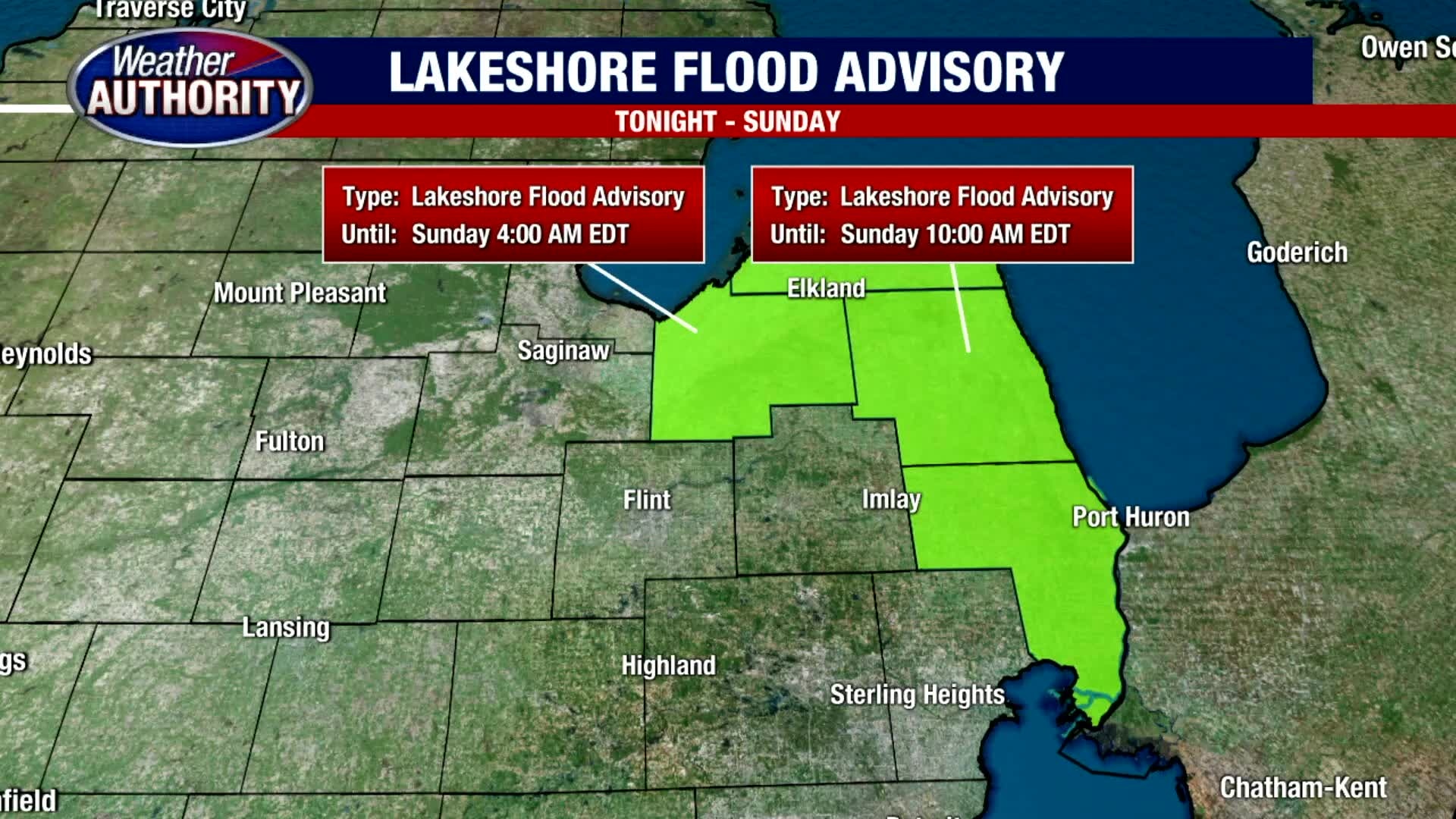
Although we soared into the 80s earlier this week, a refreshingly cool weekend is ahead of us. Expect more sunshine to start your Saturday with temperatures eventually climbing into the upper 60s this afternoon. Mostly sunny skies should become partly cloudy this afternoon as a surface trough swings through. Though it could produce an isolated sprinkle, most areas should stay nice and dry. It will be breezy at times with winds from the NW between 10 to 20 kts. Given the winds, a Lakeshore Flood Advisory has been posted for parts of St. Clair and Sanilac Counties tonight through Sunday afternoon. Mid 60s should dominate the day on Sunday with more sunshine.
Although we soared into the 80s earlier this week, a refreshingly cool weekend is ahead of us. Expect more sunshine to start your Saturday with temperatures eventually climbing into the upper 60s this afternoon. Mostly sunny skies should become partly cloudy this afternoon as a surface trough swings through. Though it could produce an isolated sprinkle, most areas should stay nice and dry. It will be breezy at times with winds from the NW between 10 to 20 kts. Given the winds, a Lakeshore Flood Advisory has been posted for parts of St. Clair and Sanilac Counties tonight through Sunday afternoon. Mid 60s should dominate the day on Sunday with more sunshine.
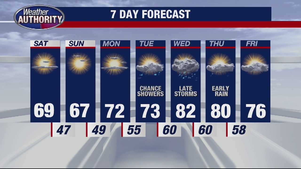
A cooler but sunny weekend
High temps will be in the upper 60s but the humidity will be gone!
High temps will be in the upper 60s but the humidity will be gone!
Friday Rain and Storms
We are continuing to track scattered showers and thunderstorms moving out of metro Detroit this Friday afternoon with cooler air moving in. High temperatures topped out in the 70s this morning, but after our cold front moves through, the majority of the day will be spent in the 60s under mostly cloudy skies along with pockets of light to moderate rain. Thankfully, the rain should wind down after 5pm leading to a cool and dry evening. Saturday and Sunday look fantastic with highs in the 60s with more sunshine.
We are continuing to track scattered showers and thunderstorms moving out of metro Detroit this Friday afternoon with cooler air moving in. High temperatures topped out in the 70s this morning, but after our cold front moves through, the majority of the day will be spent in the 60s under mostly cloudy skies along with pockets of light to moderate rain. Thankfully, the rain should wind down after 5pm leading to a cool and dry evening. Saturday and Sunday look fantastic with highs in the 60s with more sunshine.

Friday showers and storms will fade for the weekend. The summer heat leaves too!
A much cooler stretch is on the way!
A much cooler stretch is on the way!
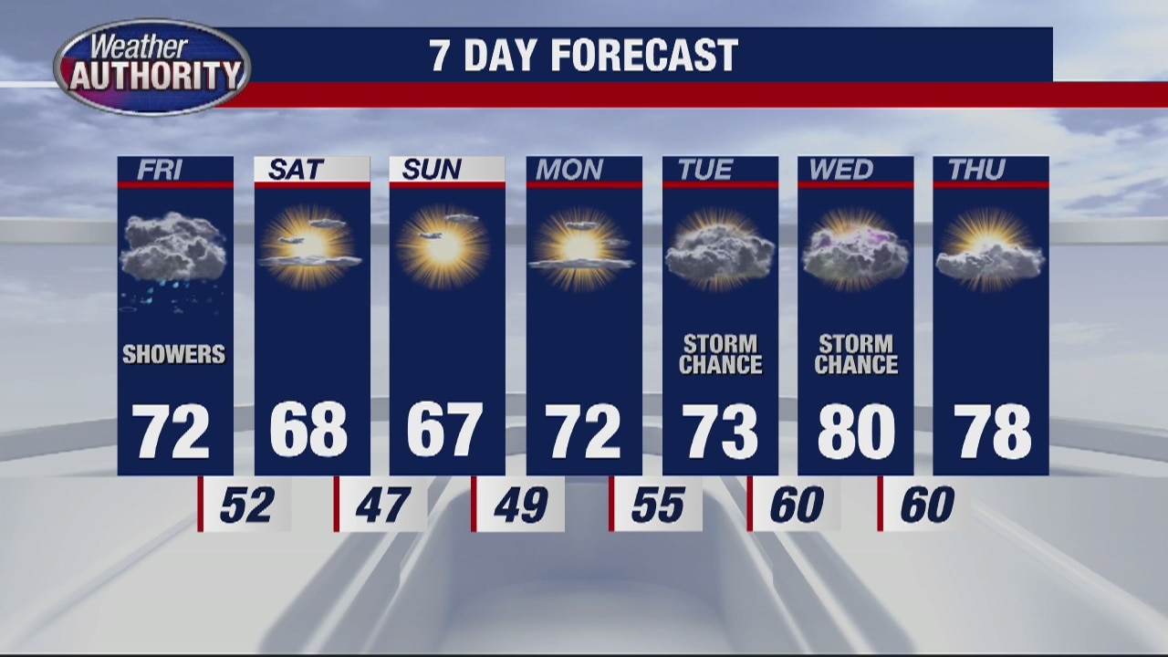
Cool down is coming
Rich Luterman has the forecast.
Rich Luterman has the forecast.

Some spotty showers and storms today
Temps not quite as hot... but still warm
Temps not quite as hot... but still warm

Thursday showers and storms. The weekend cool down is coming!
We'll keep the summer feel in place another day!
We'll keep the summer feel in place another day!
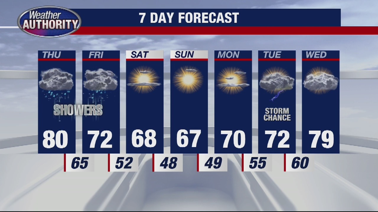
Chance for thundershowers Thursday
Rich Luterman has the forecast.
Rich Luterman has the forecast.