


4th of July Weekend Forecast
We are in for a long stretch of hot weather days in Metro Detroit. We made it to 90 degrees on Thursday and we will easily make it into the 90s again today and this weekend. Though an isolated storm is possible Friday afternoon along a surface trough moving through southeast Michigan, most areas will stay dry. You will feel the added humidity this afternoon as well. Overnight lows should fall into the upper 60s. Independence Day looks great with lots of sunshine and highs in the low 90s. Rain does not look to be an issue on Saturday. If you plan on being outside for an extended period of time this weekend, please make sure to drink plenty of water, find shady spots to enjoy, wear light and loose fitted clothes and if you have a pool, make good use of it over the next week.
We are in for a long stretch of hot weather days in Metro Detroit. We made it to 90 degrees on Thursday and we will easily make it into the 90s again today and this weekend. Though an isolated storm is possible Friday afternoon along a surface trough moving through southeast Michigan, most areas will stay dry. You will feel the added humidity this afternoon as well. Overnight lows should fall into the upper 60s. Independence Day looks great with lots of sunshine and highs in the low 90s. Rain does not look to be an issue on Saturday. If you plan on being outside for an extended period of time this weekend, please make sure to drink plenty of water, find shady spots to enjoy, wear light and loose fitted clothes and if you have a pool, make good use of it over the next week.

A mostly dry and all the way hot holiday weekend is on tap!
Other than a stray storm this afternoon we're good to go!
Other than a stray storm this afternoon we're good to go!

Welcome to the 90s as summer sets in
Rich Luterman has the very warm forecast.
Rich Luterman has the very warm forecast.
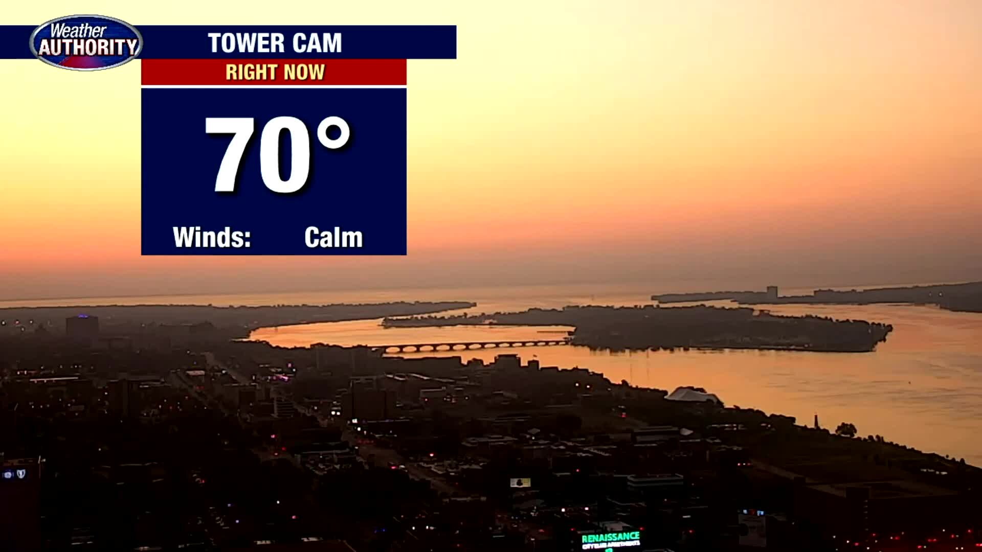
Our heat wave kicks off. Temps should hit 90 today, without much relief in view.
A hot holiday weekend is on the way.
A hot holiday weekend is on the way.
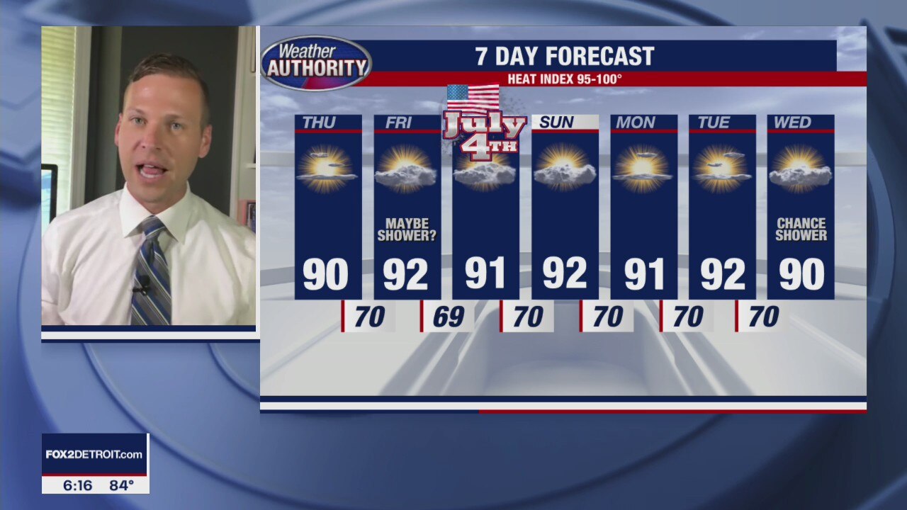
A Hot Stretch Continues
Heat Indices will be between 95-100 degrees for at least a week!
Heat Indices will be between 95-100 degrees for at least a week!

Our pattern remains on repeat another day with a heat wave to come.
Temps should get to 90 tomorrow afternoon and remain there through next week.
Temps should get to 90 tomorrow afternoon and remain there through next week.

Sunny and warm
Rich Luterman has the forecast.
Rich Luterman has the forecast.

Plan for another warm day with a hot holiday weekend to come!
Highs in the 80's for another we'll take it to 90? by Thursday.
Highs in the 80's for another we'll take it to 90? by Thursday.
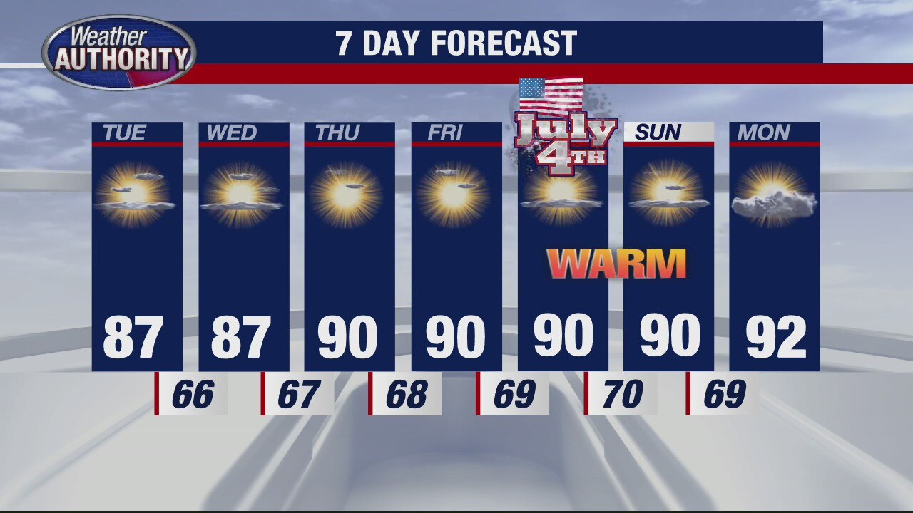
Great summer weather stretch continuing
Dry, warm weather is continuing in Michigan throughout the week and into the weekend.
Dry, warm weather is continuing in Michigan throughout the week and into the weekend.

Dry weather reigns this week! Rain likely stays away through the holiday weekend.
Temps in the 80's the next few with 90 on the way!
Temps in the 80's the next few with 90 on the way!

Sunny Sunday
After a bit of patchy fog this morning, expect lots of sunshine this afternoon with highs in the mid 80s. It should be a beautiful day with light northerly winds at 5 mph. By lunchtime today, temperatures should jump into the 70s. Don't forget to wear your sunscreen and bottle of water if you plan on being outside for a longer period of time. Temperatures will eventually fall into the low to mid 60s overnight. We are back in the 80s on Monday with highs jumping into the upper 80s and low 90s by Thursday and into our 4th of July weekend.
After a bit of patchy fog this morning, expect lots of sunshine this afternoon with highs in the mid 80s. It should be a beautiful day with light northerly winds at 5 mph. By lunchtime today, temperatures should jump into the 70s. Don't forget to wear your sunscreen and bottle of water if you plan on being outside for a longer period of time. Temperatures will eventually fall into the low to mid 60s overnight. We are back in the 80s on Monday with highs jumping into the upper 80s and low 90s by Thursday and into our 4th of July weekend.
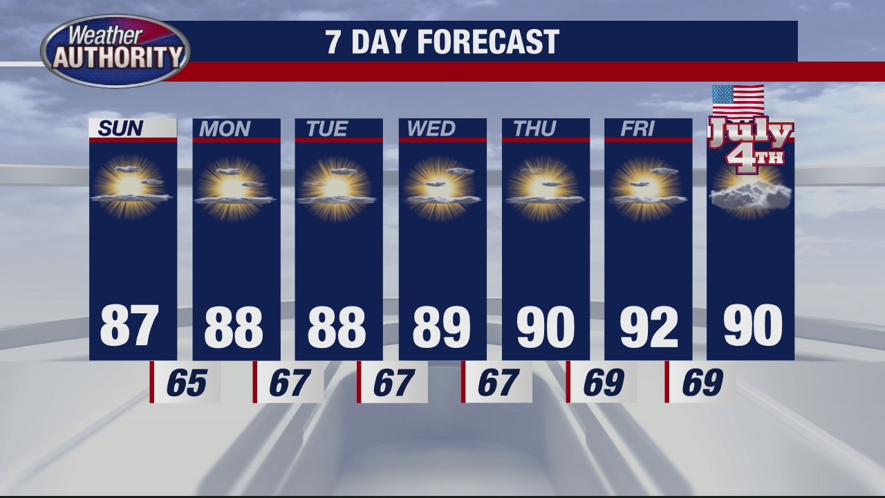
Dry, Warm Week Ahead
Meteorologist Lori Pinson has your forecast
Meteorologist Lori Pinson has your forecast
Spotty Shower Possible Saturday
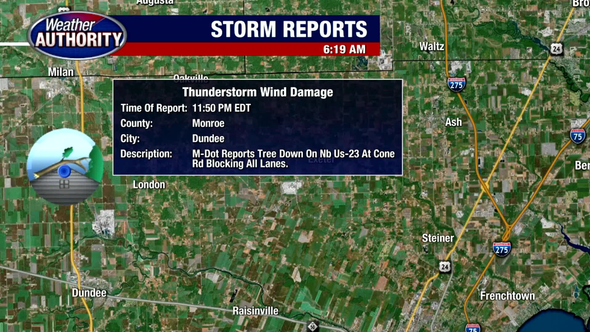
After last night's storms knocked down trees and a few power lines across parts of Metro Detroit, expect a mostly cloudy and foggy start to your Saturday. Thankfully, clouds should begin to thin this afternoon with highs in the mid 80s. There is a slight chance for a stray shower with a cold front moving through southeast Michigan. More sunshine is expected Sunday and through the week next week.
After last night's storms knocked down trees and a few power lines across parts of Metro Detroit, expect a mostly cloudy and foggy start to your Saturday. Thankfully, clouds should begin to thin this afternoon with highs in the mid 80s. There is a slight chance for a stray shower with a cold front moving through southeast Michigan. More sunshine is expected Sunday and through the week next week.
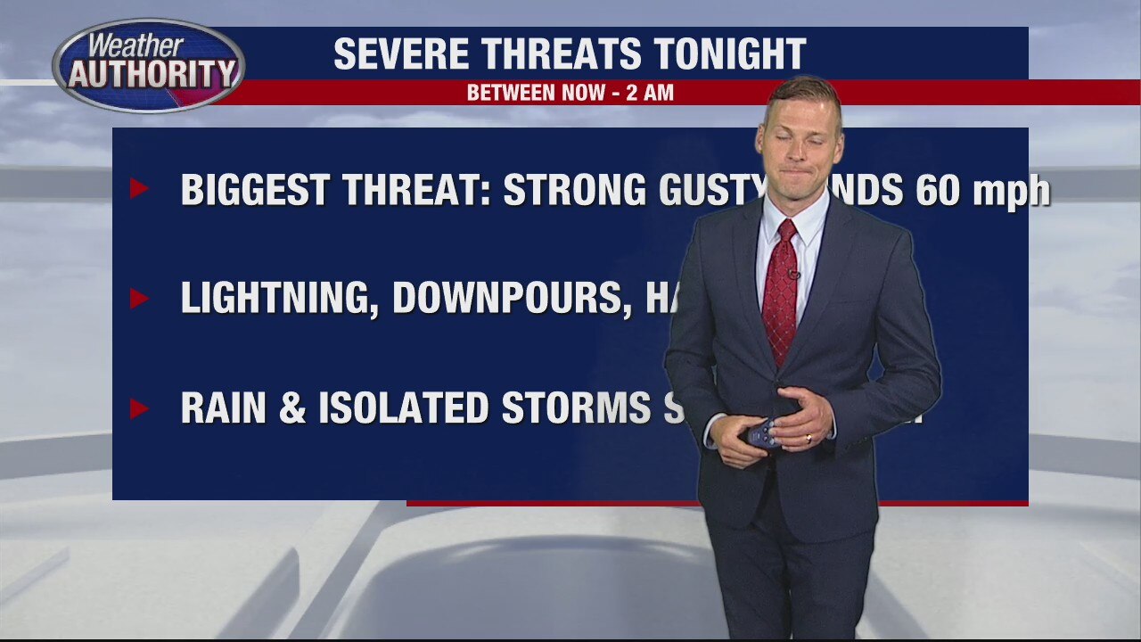
Severe weather threats overnight
Derek Kevra tells us what to expect
Derek Kevra tells us what to expect

Severe weather watches and warnings in effect overnight
Derek Kevra tells us what to expect.
Derek Kevra tells us what to expect.

Severe weather moves in with two bands of storms
Derek Kevra has details on the severe storms moving through SE Michigan.
Derek Kevra has details on the severe storms moving through SE Michigan.

Storms to finish the week may pack a punch. Severe weather is possible late today into the night.
We're drying out for most of the weekend!
We're drying out for most of the weekend!

Chance for strong storms Friday night
Rich Luterman has the forecast.
Rich Luterman has the forecast.
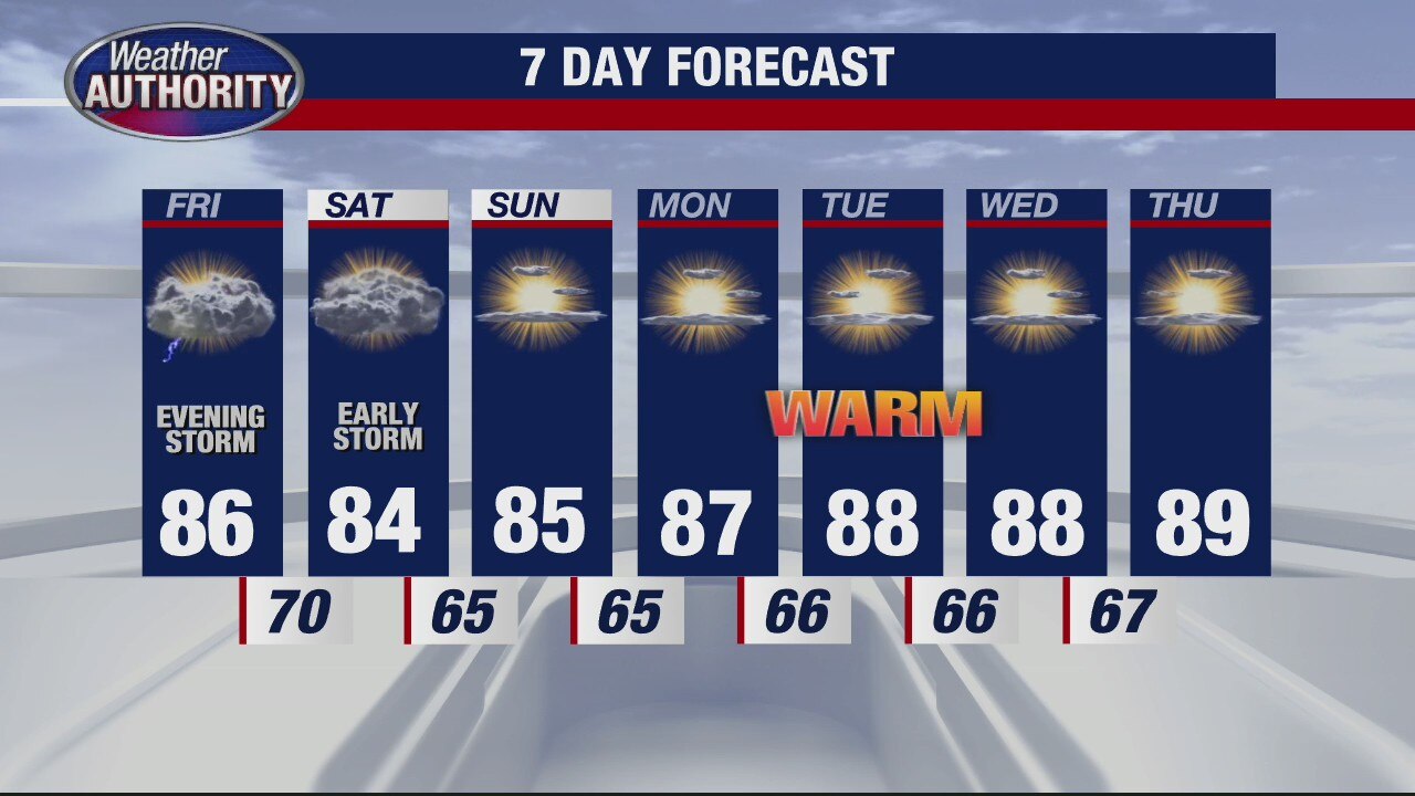
Warming up
Rich Luterman has the forecast.
Rich Luterman has the forecast.

Friday Night Storms
Thursday looks great here in Metro Detroit. Expect a mix of clouds and sunshine along with temperatures in the upper 70s to near 80 degrees. Though an isolated shower is possible, most of us should stay nice and dry today. Friday morning and Friday afternoon look good with highs spiking in the mid and upper 80s. That heat and humidity will help to fuel a line of scattered showers and thunderstorms Friday evening after sunset. Our main threat will be damaging winds. Down trees and power lines are possible. Stay weather aware Friday after sunset through sunrise on Saturday.
Thursday looks great here in Metro Detroit. Expect a mix of clouds and sunshine along with temperatures in the upper 70s to near 80 degrees. Though an isolated shower is possible, most of us should stay nice and dry today. Friday morning and Friday afternoon look good with highs spiking in the mid and upper 80s. That heat and humidity will help to fuel a line of scattered showers and thunderstorms Friday evening after sunset. Our main threat will be damaging winds. Down trees and power lines are possible. Stay weather aware Friday after sunset through sunrise on Saturday.