

Muggy and warm conditions on Wednesday with a chance of wet weather this afternooon

Storms return to the forecast, but don't expect a washout
Showers and storms bubble up today as what's left of T.S. Fred moves to our east.
Wednesday is going to be warm and muggy as a bit of wet weather returns!
There's just a hint of fog in some spots this morning and I don't expect that to change as what's left of Tropical Storm Fred moving across Ohio is tossing some high clouds our way.
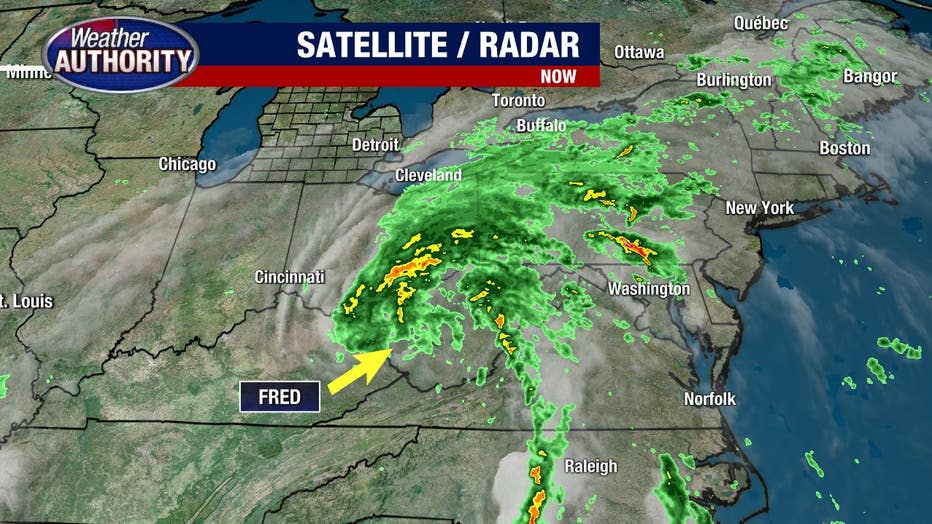
Ahead of Fred, we've had an influx of moisture and you're feeling that with dewpoints in the '60s for another day with no dry air offering relief anytime soon.
That moisture will interact with an incoming weakening midlevel wave and will be enough to produce a few showers and storms which will be possible mid/late morning with continued chances this afternoon.
Any storm will be capable of gusty winds and heavy rain with a healthy amount of moisture available in the atmosphere.
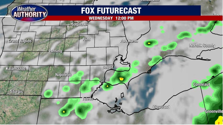
With that said, the action should be more miss than hit with much of the day remaining dry. For example, check out our in house model for noon:
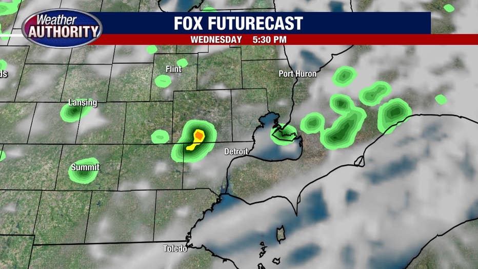
Here is our house model for 5 p.m.
A weak mid-level low will be over the top of us Thursday, keeping the chance for an isolated storm in the forecast while the heat and humidity will continue to build through the weekend.
I'll keep Saturday dry with a cold front bringing the opportunity for Sunday storms.