

Hot weather pattern continues with chance for spotty storms

FOX 2 - The never-ending Summer weather pattern continues today as the heat and humidity crank back up. Oh and some spotty storms are possible later too. Sigh.
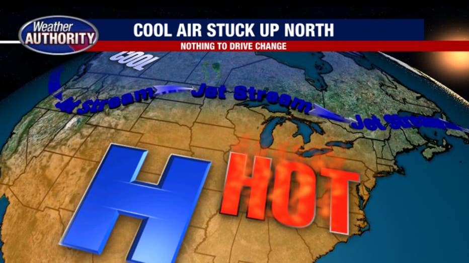
I want to tackle this question first: why is this hot pattern so relentless? One huge factor is the location of the jet stream and why it isn't moving (and it isn't moving). Strong High Pressure in the upper layers of the atmosphere is socked over the southern United States and is holding the jet stream well north of us in Michigan.
The jet stream acts as a barrier for cool air and hot air - and thanks to our position, it's hot air for us. The issue is that nothing is expected to come in and "jostle" the stream south - which would give us cooler air. Instead, we're stuck in the heat.
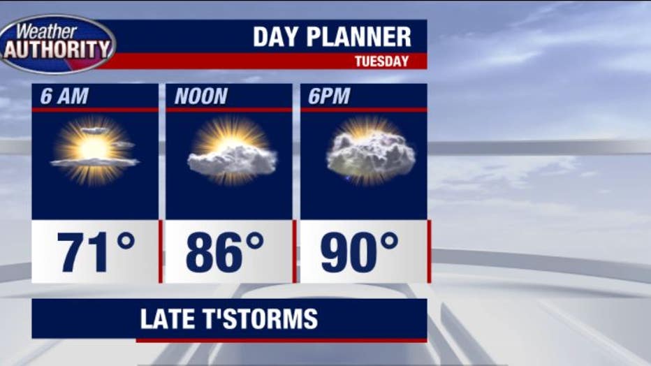
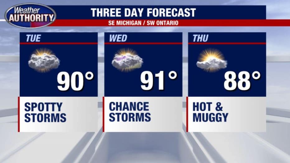
Tuesday's high will be near 90 but thanks to the high humidity it will feel more like 95. The humidity will be thick!
Heading into the late afternoon/dinner time hours we can expect a few storms to pop up. These storms could blossom into large cells with gusty winds and heavy downpours at times.
Severe weather looks unlikely, but will need to be watched.
This pattern sticks with us all week with more chances of thunderstorms Wednesday to Sunday.