

Metro Detroit severe weather forecast brings strong storms
DETROIT (FOX 2) - Hot and humid conditions leading to severe weather is in the forecast Wednesday.
For a brief period, Macomb County was under a tornado warning - which was then canceled.
Strong storms hit Macomb County in the early afternoon today, impacting Fraser, Roseville, and Clinton Township.

Wednesday storms roll through Macomb County
Video by Brian Kinzer in Fraser. This was taken on Masonic between Utica and Grosebeck.
A severe thunderstorm capable of producing a tornado had been located over Royal Oak, or near Troy, moving northeast at 35 mph according to the National Weather Service.

Severe weather moving through SE Michigan Wednesday
Macomb County received some of the strong early storms Wednesday afternoon.
Stay ahead of the weather with the FOX 2 Weather app. It's free on your phone and provides live radar, alerts, and more.
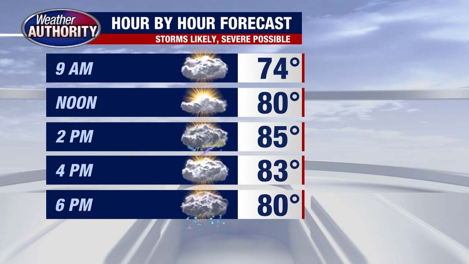
Timeline:
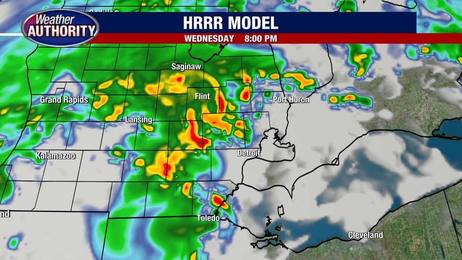
Take a look at future radar around 8 p.m, when storm coverage is expected to peak, but remember - all models are wrong, but some are useful.
Severe weather is possible. The prime window is 6–9 p.m., with damaging winds and heavy rain the main threats. According to the National Weather Service, winds could exceed 70 mph, while hail larger than 1 inch is also possible.
The tornado risk is low, but not zero.
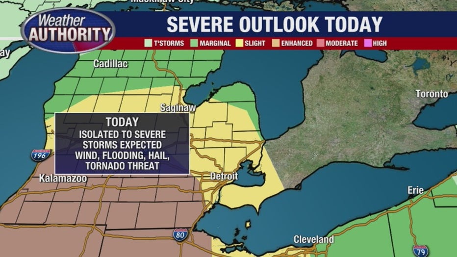
Metro Detroit falls into the Slight Risk threat category, meaning that scattered severe storms are possible but are not expected to be widespread.
The further west you are - beginning around the Ann Arbor area - the greater the threat. The NWS has that area in the Enhanced Risk category. This means that peristent, widespread storms that could be intense are in the forecast. This area is more likely to experience damaging winds.
What's next:
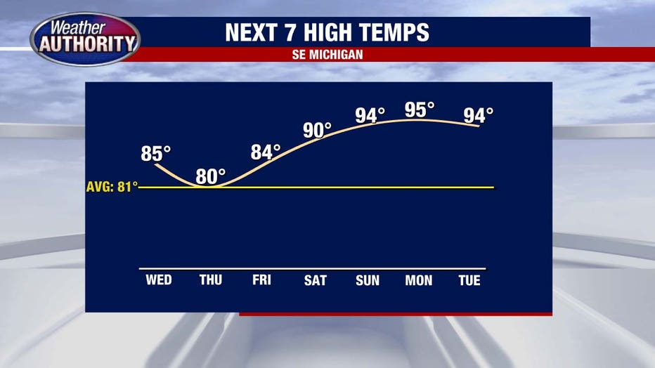
Storms wind down tonight, and we’ll catch a brief break from the heat before 90s return this weekend and carry us into next week; once we hit the 90s Saturday, we firmly stay there for days.
The Source: Information from the FOX 2 Weather Authoritiy and National Weather Service were used in this report.