

Metro Detroit Weather: Snowflakes in forecast by end of week
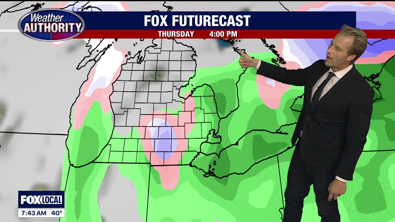
Big cooldown, possible snow flakes coming by end of week
We’re starting the week with a warmup, but the coldest air so far of the season and possible snow flakes are in the forecast by the end of the week.
Another week, another warm-up.
Temps rise and fall
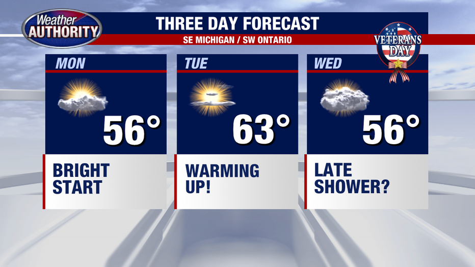
Big picture view:
We’re seeing temps warm up early this week.
Though the warmup one will be followed by the coldest air of the season, and we may even toss in some wet snow by the end of the week. So, soak in the next couple of days.
RELATED: Winter 2026-27 Outlook: How much snow will Michigan get?
Wet weather later this week
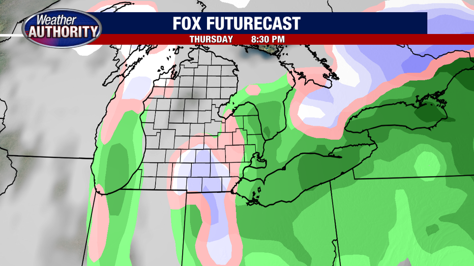
Timeline:
Rain is a good bet Thursday, and by Thursday night some wet, melting snow could mix in.
This is not a snow shoveling situation. Rather, some spots may simply see a few flakes. Check out future radar in the photo above.
Measurable snowfall isn’t likely.
Cold temps ahead
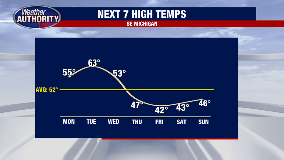
By the numbers:
Temps drop in a big way by the end of the week, with highs struggling to get out of the 30s and lows falling into the 20s and 30s.
First snow in metro Detroit
Timeline:
The earliest first snow on record came on Oct. 12 in 2026.
The latest snow on record came on Dec. 29 in 1998.
The average first snow is Nov. 16.
The Source: Information in this article was taken from FOX 2 meteorologist Alan Longstreet.