


Friday Winter Weather Advisory in effect until 10 am
The snow fades but the wind picks up! Get ready for a cold ride.
The snow fades but the wind picks up! Get ready for a cold ride.

Snow tapers off overnight, frigid temps and high winds await Friday
Derek Kevra has the forecast.
Derek Kevra has the forecast.
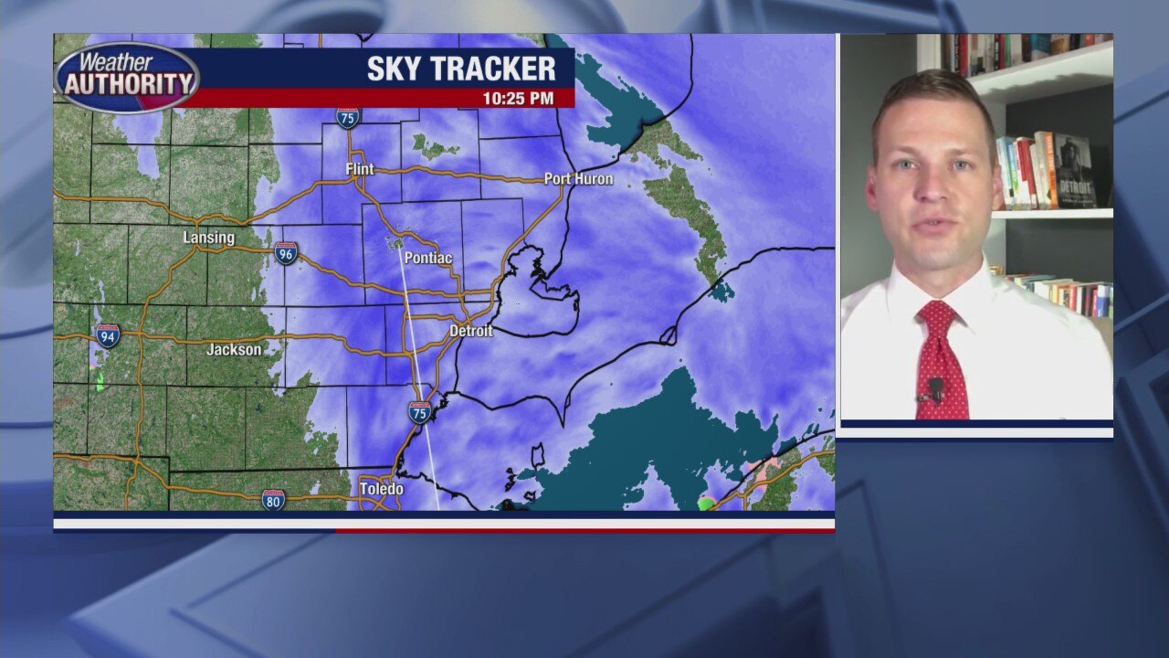
Snow expected to tail off during Winter Weather Advisory overnight
Derek Kevra has the latest on tonight's winter storm and what to expect for Friday.
Derek Kevra has the latest on tonight's winter storm and what to expect for Friday.

Winter Weather Advisory with plenty of wet snow
Derek Kevra has the forecast.
Derek Kevra has the forecast.

Here Comes the Snow
Shower showers are expected for all areas of Metro Detroit this evening through early Friday morning. In total, we should pick up between 1 to 3 inches of a heavy, wet snow. This could lead to big slow downs during Friday morning's commute into work, so plan accordingly. Friday afternoon will be much colder and more windy with wind gusts between 30 to 40 mph.
Shower showers are expected for all areas of Metro Detroit this evening through early Friday morning. In total, we should pick up between 1 to 3 inches of a heavy, wet snow. This could lead to big slow downs during Friday morning's commute into work, so plan accordingly. Friday afternoon will be much colder and more windy with wind gusts between 30 to 40 mph.

Thursday forecast: Winter Weather Advisory goes into effect at 4 pm.
A burst of snow this evening will be followed by a cold and windy Friday.
A burst of snow this evening will be followed by a cold and windy Friday.

Another few inches of snow arriving Thursday evening
Then some Arctic air arrives to put us in a deep freeze
Then some Arctic air arrives to put us in a deep freeze

Sunshine Today. Accumulating Snow Thursday night into Friday
Enjoy the sunshine we see today with temperatures hovering around freezing for highs because accumulating snow showers are on the way Thursday after sunset and into early Friday morning. By the time everything is said and done, most of Metro Detroit could pick up between 1 to 3 inches of snow. The coldest air in years is forecast into early next week with highs topping out in the low teens and single digits overnight. We are trending toward sub zero overnight lows by midweek next week.
Enjoy the sunshine we see today with temperatures hovering around freezing for highs because accumulating snow showers are on the way Thursday after sunset and into early Friday morning. By the time everything is said and done, most of Metro Detroit could pick up between 1 to 3 inches of snow. The coldest air in years is forecast into early next week with highs topping out in the low teens and single digits overnight. We are trending toward sub zero overnight lows by midweek next week.

Midweek sun with a Thursday night mix on the way!
Plus the coldest air of the season is set to arrive next week.
Plus the coldest air of the season is set to arrive next week.
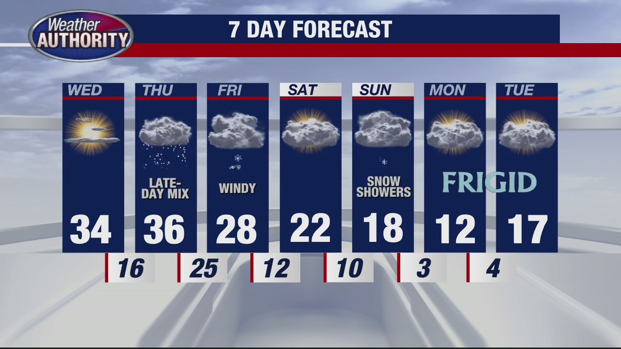
More sun for Wednesday
Rich Luterman has the forecast.
Rich Luterman has the forecast.

Groundhog Day! Whether or not Phil (or Woody!) see's his shadow, we have some cold air coming.
Plus! Rain/snow breaks out late Thursday.
Plus! Rain/snow breaks out late Thursday.
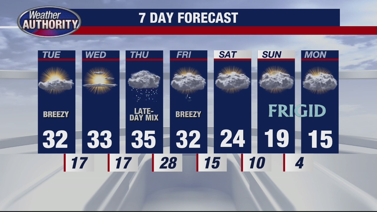
Brisk and cold for Tuesday
Rich Luterman has the forecast.
Rich Luterman has the forecast.

A few light snow showers linger Monday. Brighter skies midweek.
Light showers don't amount to much if anything today.
Light showers don't amount to much if anything today.

2 Dogs Hot Sauce
FOX 2 News Weekend
FOX 2 News Weekend

Snow Showers Sunday
Winter Weather Advisory is in effect for Wayne, Monroe, Washtenew and Lenawee counties through this afternoon. Light to moderate accumulating snow is in our forecast for Sunday with the highest amount toward the Ohio border.
Winter Weather Advisory is in effect for Wayne, Monroe, Washtenew and Lenawee counties through this afternoon. Light to moderate accumulating snow is in our forecast for Sunday with the highest amount toward the Ohio border.

Sunday Snow Showers
Winter Weather Advisory will go into effect tonight through Sunday evening. After a freezing cold start this morning, we are expecting more clouds through today with highs only in the upper 20s. Snow starts to move in overnight and through the day on Sunday. Area wide, we are expecting between a trace to 4 inches of snow.
Winter Weather Advisory will go into effect tonight through Sunday evening. After a freezing cold start this morning, we are expecting more clouds through today with highs only in the upper 20s. Snow starts to move in overnight and through the day on Sunday. Area wide, we are expecting between a trace to 4 inches of snow.

More clouds Saturday, Snow Sunday
An approaching Low pressure system will bring snow to the state Sunday with the heaviest amounts south of the city. Meteorologist Lori Pinson has your forecast.
An approaching Low pressure system will bring snow to the state Sunday with the heaviest amounts south of the city. Meteorologist Lori Pinson has your forecast.
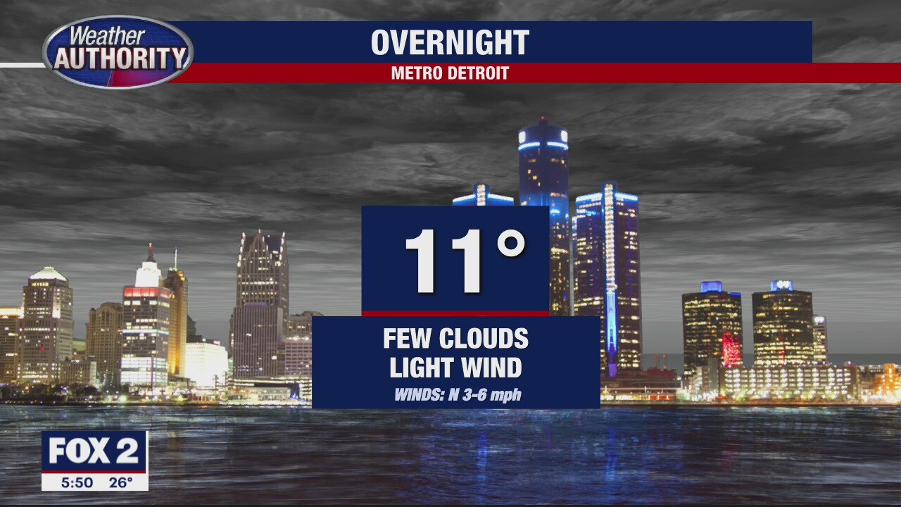
Quiet & Cold Now, Sunday Snow Later
An approaching system will bring snow Sunday. Higher amounts to our south. Meteorologist Lori Pinson has your forecast
An approaching system will bring snow Sunday. Higher amounts to our south. Meteorologist Lori Pinson has your forecast

Sunday Snow on the way
Dry weather (and cold) until then
Dry weather (and cold) until then
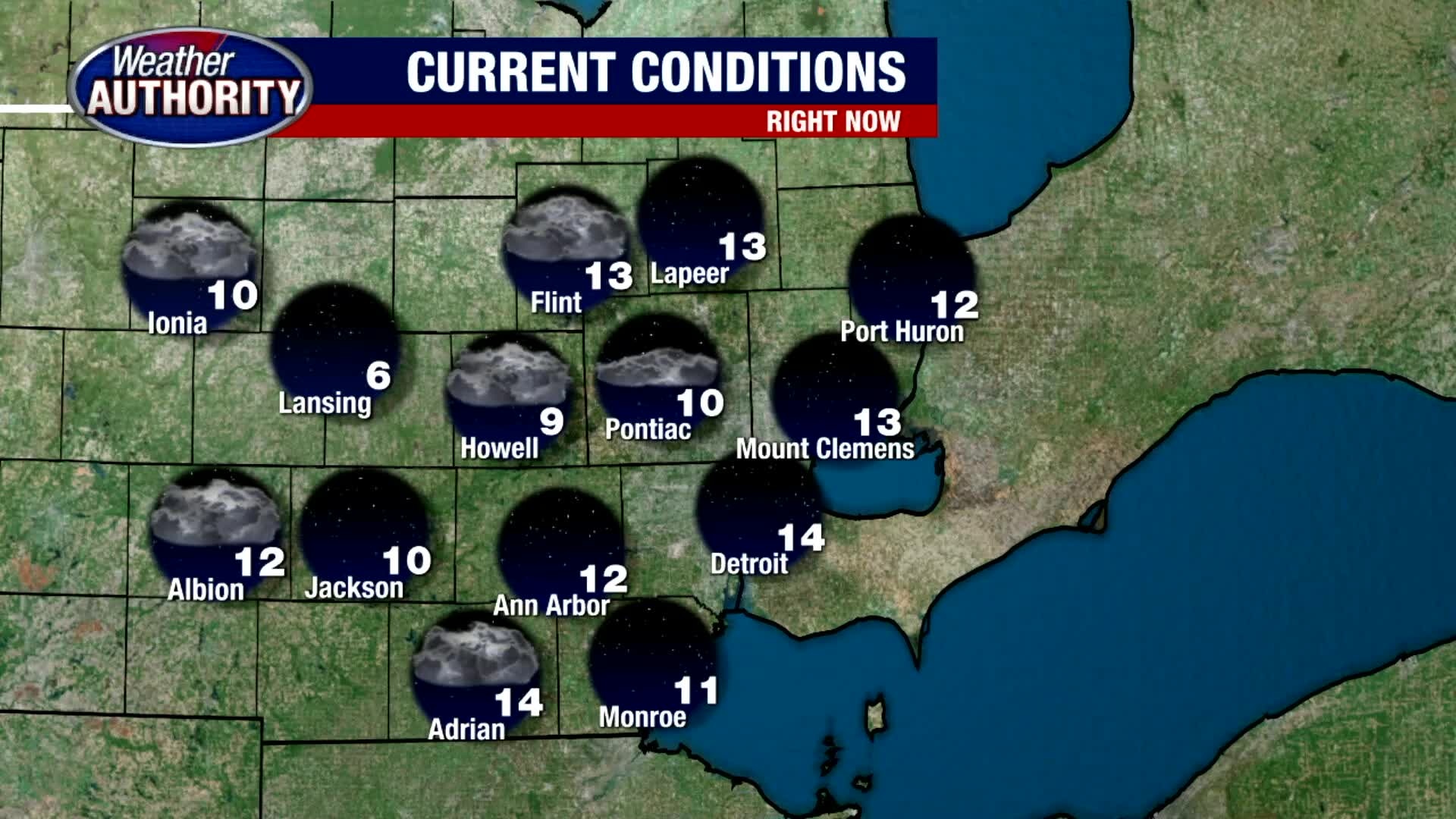
Friday forecast! Cold but bright, with some weekend snow on the way!
We're talking Sunday snow totals.
We're talking Sunday snow totals.