

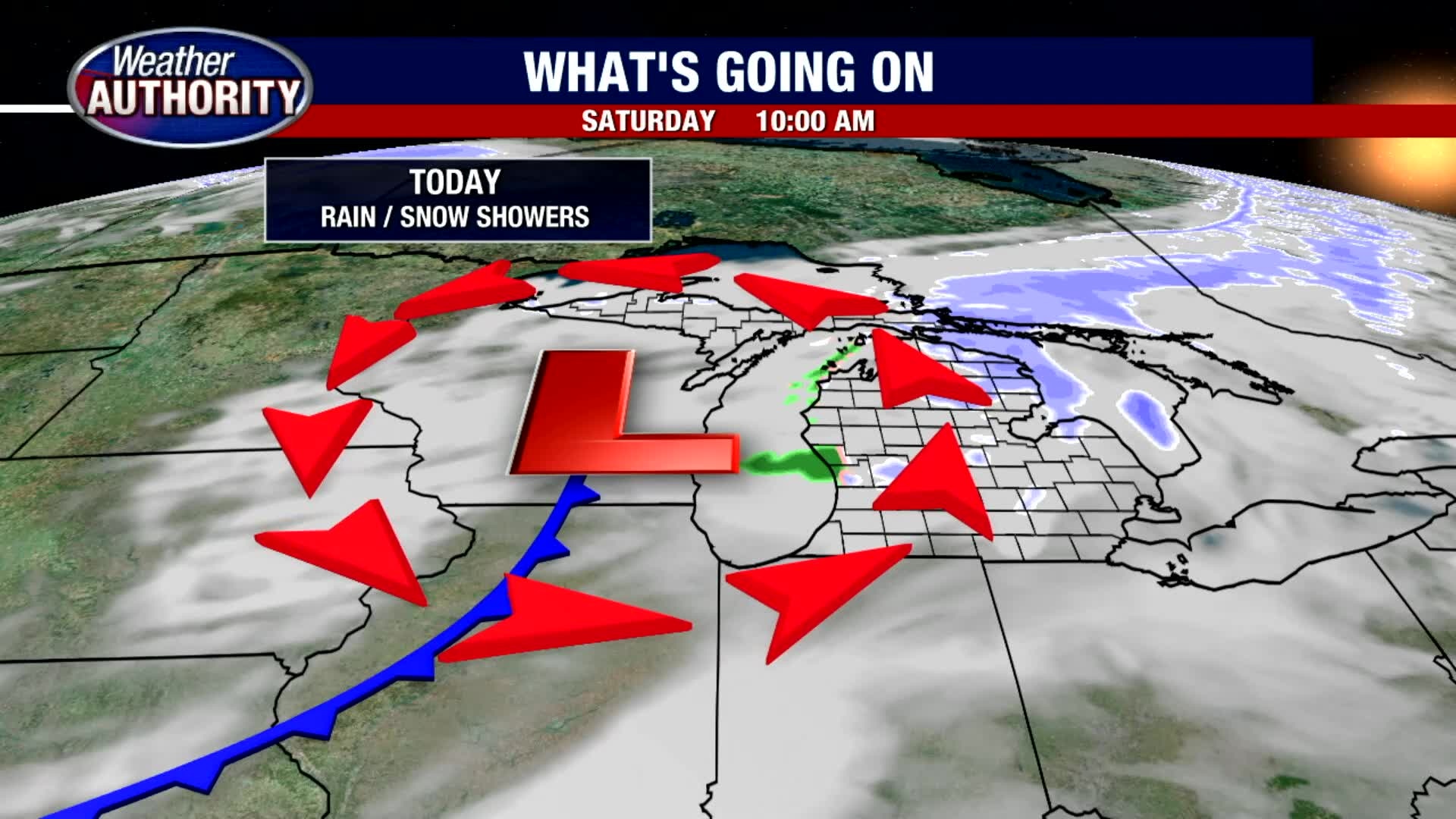
Rain & Snow Showers Today
We are expecting rain and snow showers this afternoon in Michigan. Mostly cloudy skies will prevail with highs in the mid 30s. Light accumulations are possible between 0.5" to 1". Flurries are in our forecast on Sunday. Much colder air will move in just in time for Christmas.
We are expecting rain and snow showers this afternoon in Michigan. Mostly cloudy skies will prevail with highs in the mid 30s. Light accumulations are possible between 0.5" to 1". Flurries are in our forecast on Sunday. Much colder air will move in just in time for Christmas.
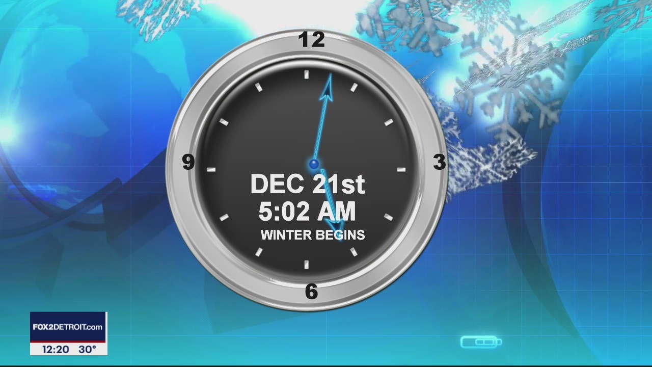
Winter is Coming!
Light snow for Saturday with more chances for snow by the end of the week. Meteorologist Lori Pinson has your forecast.
Light snow for Saturday with more chances for snow by the end of the week. Meteorologist Lori Pinson has your forecast.
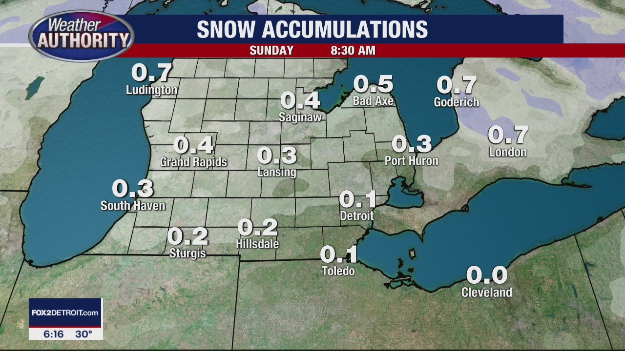
Weekend Snow Possible
Meteorologist Lori Pinson has your forecast
Meteorologist Lori Pinson has your forecast

A bit of Friday sun is on the way, with weekend snow lurking!
Plus a look at your Christmas forecast.
Plus a look at your Christmas forecast.

So-called 'Christmas Star' set to peak on Monday as Saturn, Jupiter align
On Monday, if you look to the sky you'll see two planets so closely aligned, it will appear to be the brightest star in the sky.
On Monday, if you look to the sky you'll see two planets so closely aligned, it will appear to be the brightest star in the sky.

Chilly overnight
Rich Luterman has the forecast.
Rich Luterman has the forecast.

Snow possible on Christmas Eve as storm builds on west coast
Michigan gets a snow storm on Christmas roughly once every four years and it's possible that we're due in 2020.
Michigan gets a snow storm on Christmas roughly once every four years and it's possible that we're due in 2020.

Some flurries for Thursday
Rich Luterman has the forecast.
Rich Luterman has the forecast.

Expect a little more snow tonight
Rich Luterman has the forecast.
Rich Luterman has the forecast.

Mid week snow and continued cold!
Light snow breaks out across SE Michigan through the morning.
Light snow breaks out across SE Michigan through the morning.

Cold overnight, 1 inch of snow or less Wednesday
Rich Luterman has the forecast.
Rich Luterman has the forecast.

Light dusting of snow for Wednesday
Rich Luterman has the forecast.
Rich Luterman has the forecast.
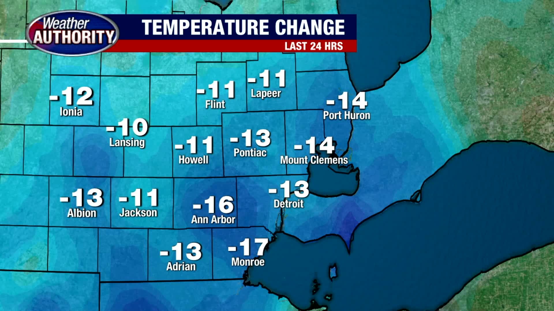
Tuesday cold with a bit of Wednesday snow!
High temps struggle to get to freezing today.
High temps struggle to get to freezing today.

Cold overnight
Rich Luterman has the forecast.
Rich Luterman has the forecast.

Still chilly for Tuesday
Rich Luterman has the forecast.
Rich Luterman has the forecast.

A colder week of weather is on the way!
Not much snow on the way either!
Not much snow on the way either!

FOX 2 News Weekend

Cold Sunday and Week Ahead
We're stuck in the 30s today under mostly cloudy skies. If you plan on being out and about don't forget your hats, gloves, heavy coat. Temperatures will continue to fall through the week with highs below freezing by Tuesday.
We're stuck in the 30s today under mostly cloudy skies. If you plan on being out and about don't forget your hats, gloves, heavy coat. Temperatures will continue to fall through the week with highs below freezing by Tuesday.

Colder Week Ahead
Meteorologist Lori Pinson has your forecast
Meteorologist Lori Pinson has your forecast

Wet and Windy Saturday
Have your umbrellas ready to go if you plan on being out and about this today. Highs should make it to around 50 before falling into the 30s overnight.
Have your umbrellas ready to go if you plan on being out and about this today. Highs should make it to around 50 before falling into the 30s overnight.