


Warmer temps are here
Rich Luterman has the forecast.
Rich Luterman has the forecast.

A Wind Advisory and a Warm Up!
Wind Advisory runs from 10 am until 5 pm.
Wind Advisory runs from 10 am until 5 pm.
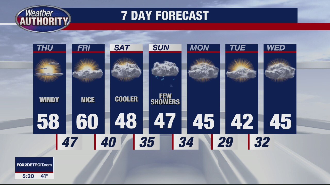
Warmer temps for week's end
Rich Luterman has the forecast.
Rich Luterman has the forecast.

A frosty Wednesday morning with a warm up on the way!
Near 60 Thursday and Friday.
Near 60 Thursday and Friday.

Still chilly for Wednesday
Rich Luterman has the forecast.
Rich Luterman has the forecast.

Tuesday snow showers will end early, flurries and cold air persists!
Highs today in the 30's, with a late week warm up lurking!
Highs today in the 30's, with a late week warm up lurking!
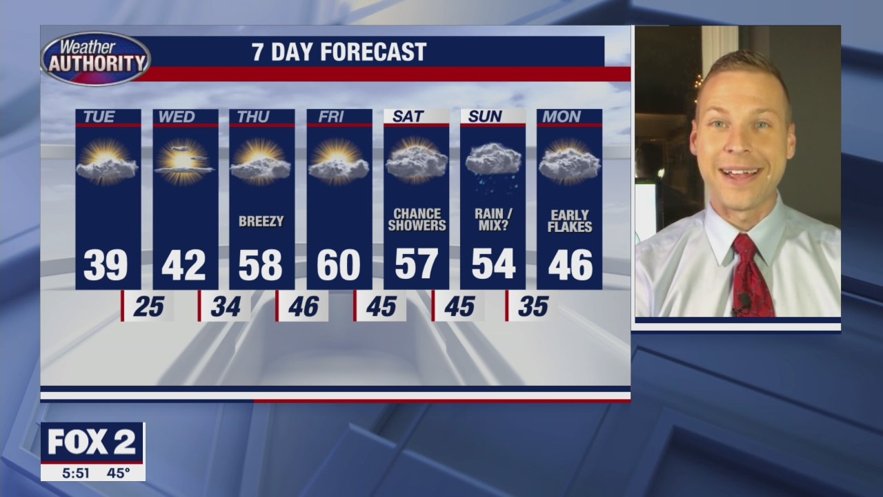
Colder air coming back Tuesday
But then a warm up by the end of the week
But then a warm up by the end of the week

Mostly Cloudy and Breezy Monday
We are still a little breezy today with wind gusts upwards of 25 to 35 mph. Thankfully those winds should die down later in the day under partly to mostly cloudy skies with highs in the mid 40s. There is a slight chance for a rain/snow mix late this evening.
We are still a little breezy today with wind gusts upwards of 25 to 35 mph. Thankfully those winds should die down later in the day under partly to mostly cloudy skies with highs in the mid 40s. There is a slight chance for a rain/snow mix late this evening.
High Wind Warning Sunday
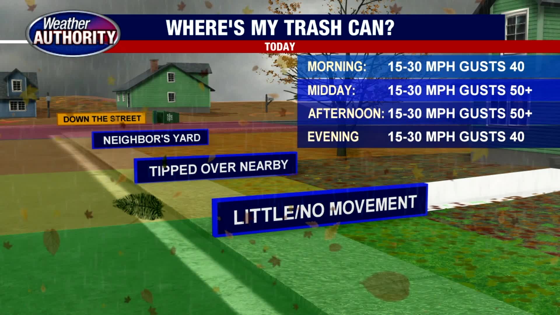
A High Wind Warning will go into effect late morning through this evening for all of Southeast Michigan. At times, wind gusts could exceed 50 mph. Damage to trees and power lines is possible. Highs should top out in the low to mid 50s during the early afternoon before falling quick and in a hurry into the 30s overnight. Rain will linger through midday before becoming more isolated this evening. A few snowflakes could mix in with the rain this evening. Warmer air is on the way by the end of the workweek.
A High Wind Warning will go into effect late morning through this evening for all of Southeast Michigan. At times, wind gusts could exceed 50 mph. Damage to trees and power lines is possible. Highs should top out in the low to mid 50s during the early afternoon before falling quick and in a hurry into the 30s overnight. Rain will linger through midday before becoming more isolated this evening. A few snowflakes could mix in with the rain this evening. Warmer air is on the way by the end of the workweek.

Windy Sunday
Meteorologist Lori Pinson has your forecast
Meteorologist Lori Pinson has your forecast

Sunny Saturday. Rainy and Windy Sunday
After a chilly start, expect more sunshine this afternoon. Lots of rain and wind is expected on Sunday.
After a chilly start, expect more sunshine this afternoon. Lots of rain and wind is expected on Sunday.

Dry Saturday, Wet Sunday
Meteorologist Lori Pinson has your forecast
Meteorologist Lori Pinson has your forecast
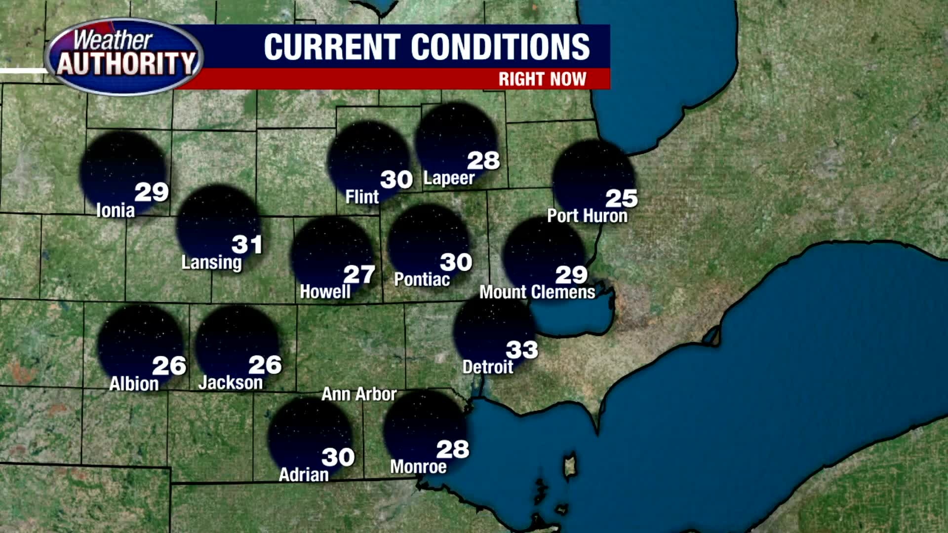
Passing shower early Friday morning, but you can plan for a mainly dry day. But! Weekend rain returns.
Cool weather wins moving ahead.
Cool weather wins moving ahead.

Back to November temps
Rich Luterman has the cool forecast.
Rich Luterman has the cool forecast.

It's a frosty Thursday morning with bright skies on the way!
The cooler air is here to stay
The cooler air is here to stay
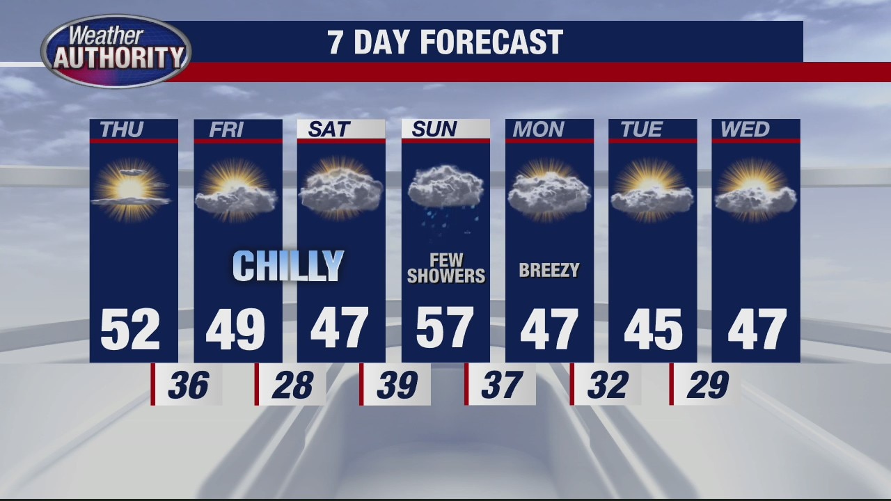
Sunny but chilly for Thursday
Rich Luterman has the forecast.
Rich Luterman has the forecast.

Cool but sunny
Rich Luterman has the forecast.
Rich Luterman has the forecast.

After record-setting start to November, we expect higher than average snow
Shorts in early November aren't usually a common sight in Michigan. But 2020 wasn't a common year. Brace yourselves, however, because winter is knocking on the door.
Shorts in early November aren't usually a common sight in Michigan. But 2020 wasn't a common year. Brace yourselves, however, because winter is knocking on the door.

Normal November weather returns!
Colder air arrives and stays for a while.
Colder air arrives and stays for a while.
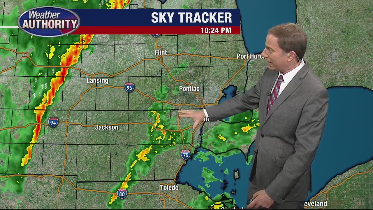
Storms and some rain Tuesday evening
Rich Luterman has the forecast.
Rich Luterman has the forecast.