


Wednesday snow showers and snow squalls
Beginning later this evening, winds will gust to 35 mph which could create dangerous snow squalls
Beginning later this evening, winds will gust to 35 mph which could create dangerous snow squalls


Snow, subzero wind chills hit Southeast Michigan Wednesday
Snow, subzero wind chills, and gale warnings in the nearby Great Lakes are what Southeast Michigan is up against today and tomorrow as winter weather returns to the forecast.
Snow, subzero wind chills, and gale warnings in the nearby Great Lakes are what Southeast Michigan is up against today and tomorrow as winter weather returns to the forecast.

Few snow showers then bitter cold!
Few snow showers set up through the day! Accumulation looks unimpressive with most spots picking up1"-2''. Winds kick up through the evening. Frigid start Thursday with feel like temperatures in spots sub-zero!
Few snow showers set up through the day! Accumulation looks unimpressive with most spots picking up1"-2''. Winds kick up through the evening. Frigid start Thursday with feel like temperatures in spots sub-zero!

Snow showers for Wednesday
Rich Luterman has the forecast.
Rich Luterman has the forecast.

See what the Christmas season forecast has in store for the US
With just over two weeks before the arrival of holidays such as Christmas, Hanukkah and Kwanzaa, the forecast is looking rather complicated with at least one, if not more, pattern changes before the end of December.
With just over two weeks before the arrival of holidays such as Christmas, Hanukkah and Kwanzaa, the forecast is looking rather complicated with at least one, if not more, pattern changes before the end of December.


Southeast Michigan snow forecast: How much to expect Wednesday
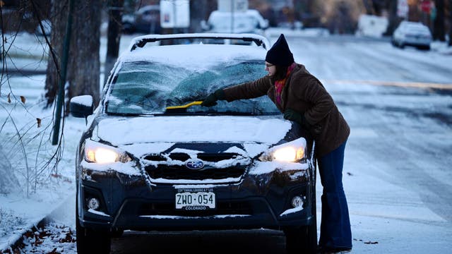
Winter is coming and metro Detroit is in the crosshairs of another band of lake effect snow this week. The first flakes will fall Wednesday morning.
Winter is coming and metro Detroit is in the crosshairs of another band of lake effect snow this week. The first flakes will fall Wednesday morning.


Michigan snow forecast: Lake effect snow, squalls to hit Metro Detroit on Wednesday
After a comfortable start to the week, snow and cold move in mid-week, with the potential to make for a messy drive Wednesday evening.
After a comfortable start to the week, snow and cold move in mid-week, with the potential to make for a messy drive Wednesday evening.


Metro Detroit weather: Calm day before snow returns - how much to expect
We are stuck in the middle of yesterday’s 50° weather and Thursday's 22° weather… with a lot happening in between! Derek Kevra has how much snow to expect after today.
We are stuck in the middle of yesterday’s 50° weather and Thursday's 22° weather… with a lot happening in between! Derek Kevra has how much snow to expect after today.

Early morning drizzle on Tuesday then cloudy
Snow showers and high winds are expected Wednesday - Thursday
Snow showers and high winds are expected Wednesday - Thursday


Earthquakes increase at Hawaii's Kilauea Volcano; scientists note increased level of unrest
The summit region had gone from experiencing 10 earthquakes per day to 20 per day, officials said during their weekly update on the volcano.
The summit region had gone from experiencing 10 earthquakes per day to 20 per day, officials said during their weekly update on the volcano.

Dry and mild for Tuesday; colder temps are here by end of week
Rich Luterman has the forecast.
Rich Luterman has the forecast.


Warmer temps prompt ice warning in Metro Detroit after skater falls into pond
After a person went through thin ice while skating in Riverview over the weekend, police are reminding people to stay off the ice as temperatures rise.
After a person went through thin ice while skating in Riverview over the weekend, police are reminding people to stay off the ice as temperatures rise.


Metro Detroit weather: Rainy start to a mild day with highs around 50
Constant rain eventually switches to spotty sprinkles.
Constant rain eventually switches to spotty sprinkles.

A wet start to your Monday morning
Rain will transition to light sprinkles through the afternoon, then drier.
Rain will transition to light sprinkles through the afternoon, then drier.

Rich Luterman with the 7-day forecast
Expect some rain late Sunday night into Monday morning. A much colder blast arrives Wednesday night into Friday with a few lake-effect snow showers Wednesday and Thursday. Rest of Sunday evening / night?. Increasing clouds? rain showers developing after 3:00 AM?.. low 36 Monday: Cloudy with rain showers, especially before noon?. Breezy?.. high near 50 Tuesday: Mostly cloudy ? cooler?. high 44 Wednesday: Cloudy and colder?.. a few snow showers?.. high 34 Thursday: BRISK and COLD?. occasional snow showers?. high 22 Friday: Partly cloudy?. COLD?.. high 27 Saturday: Mostly cloudy?. rain/snow shower possible?. High 36 Sunday: Mostly cloudy?.. high 38
Expect some rain late Sunday night into Monday morning. A much colder blast arrives Wednesday night into Friday with a few lake-effect snow showers Wednesday and Thursday. Rest of Sunday evening / night?. Increasing clouds? rain showers developing after 3:00 AM?.. low 36 Monday: Cloudy with rain showers, especially before noon?. Breezy?.. high near 50 Tuesday: Mostly cloudy ? cooler?. high 44 Wednesday: Cloudy and colder?.. a few snow showers?.. high 34 Thursday: BRISK and COLD?. occasional snow showers?. high 22 Friday: Partly cloudy?. COLD?.. high 27 Saturday: Mostly cloudy?. rain/snow shower possible?. High 36 Sunday: Mostly cloudy?.. high 38

Milder start to the day
Mini warm up continues through Monday with highs near 50 degrees. That means the next system coming in will be rain. Behind this, colder air returns and so does a chance for snow. Meteorologist Lori Pinson has your forecast.
Mini warm up continues through Monday with highs near 50 degrees. That means the next system coming in will be rain. Behind this, colder air returns and so does a chance for snow. Meteorologist Lori Pinson has your forecast.

Warmer Sunday!
Mid to upper 40s to end the weekend with mainly cloudy skies. Next chance for rain arrives Monday with highs close to 50?!
Mid to upper 40s to end the weekend with mainly cloudy skies. Next chance for rain arrives Monday with highs close to 50?!

Warmup on the way
Little warmer start to the day. We trade highs in the 30s in for 40s over the next couple of days, bringing rain in on Monday. Meteorologist Lori Pinson has your forecast
Little warmer start to the day. We trade highs in the 30s in for 40s over the next couple of days, bringing rain in on Monday. Meteorologist Lori Pinson has your forecast

Trending warmer this weekend!
Chilly start to the weekend with highs in the 30s to start the weekend! We could be pushing 50 by Sunday with our next chance for rain Monday!
Chilly start to the weekend with highs in the 30s to start the weekend! We could be pushing 50 by Sunday with our next chance for rain Monday!

Colder heading into the weekend
But milder by Sunday... showers Monday
But milder by Sunday... showers Monday