


Temps take a step back as our rain free week marches on.
High will only reach the mid/low 80's today.
High will only reach the mid/low 80's today.

Big storms fizzle out before reaching southeastern Michigan, humidity breaks soon
A big stretch of storms that hit the Chicago and Milwaukee areas, with wind gusts of up to 100 mph, fizzled out before reaching metro Detroit.
A big stretch of storms that hit the Chicago and Milwaukee areas, with wind gusts of up to 100 mph, fizzled out before reaching metro Detroit.
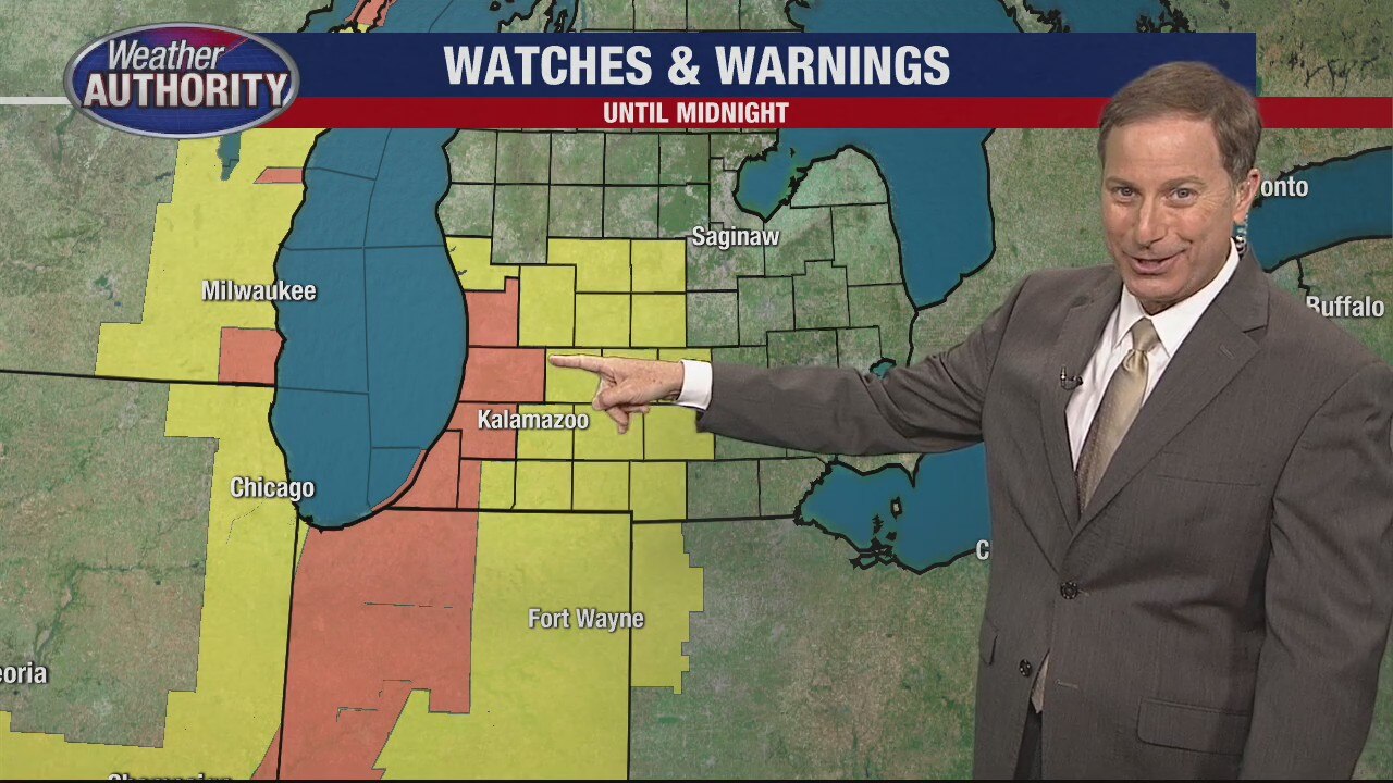
Humidity fueling big storms crossing Chicago into Michigan
Southwestern Michigan is under thunderstorm watches and warnings as storms are rolling in from the Chicago area.
Southwestern Michigan is under thunderstorm watches and warnings as storms are rolling in from the Chicago area.

The heat is on! Near 90° again this afternoon. A few storms are possible this afternoon.
Less muggy air moves in behind tonight's cold front.
Less muggy air moves in behind tonight's cold front.

Warm and Humid Sunday
We are off to a mild and somewhat muggy start this morning with temperatures in the 60s and low 70s to get things going. With a surface trough crossing Michigan, we will have to be on the lookout for a spotty shower or two. Most areas in southeast Michigan will stay dry. Heat and humidity will be our weather headlines today. Our heat index is forecast in the mid 90s this afternoon under partly sunny skies. Make sure you are drinking plenty of water and finding cool, shady spots if you plan on being outside for an extended period of time. More rain and isolated storm chances are on the way Monday and Tuesday.
We are off to a mild and somewhat muggy start this morning with temperatures in the 60s and low 70s to get things going. With a surface trough crossing Michigan, we will have to be on the lookout for a spotty shower or two. Most areas in southeast Michigan will stay dry. Heat and humidity will be our weather headlines today. Our heat index is forecast in the mid 90s this afternoon under partly sunny skies. Make sure you are drinking plenty of water and finding cool, shady spots if you plan on being outside for an extended period of time. More rain and isolated storm chances are on the way Monday and Tuesday.
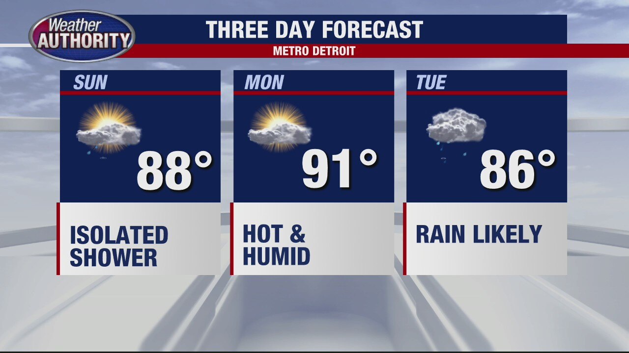
Warmer Weather On The Way
Meteorologist Lori Pinson has your forecast
Meteorologist Lori Pinson has your forecast

Warm and More Humid Weekend
Be on the lookout for some patchy morning fog to start your Saturday. As that fog burns off, sunshine and warm air will be the name of the weather game today with highs making it into the mid 80s. Should be a beautiful day in Metro Detroit. We should fall into the mid 60s overnight under mostly clear skies. More humidity is on the way on Sunday with highs in the upper 80s nearing 90. When you factor in the humidity tomorrow afternoon, it could feel closer to the mid 90s, so make sure you are drinking plenty of water and finding shady spots if you plan on being outside. Rain and storm chances return by Monday and Tuesday.
Be on the lookout for some patchy morning fog to start your Saturday. As that fog burns off, sunshine and warm air will be the name of the weather game today with highs making it into the mid 80s. Should be a beautiful day in Metro Detroit. We should fall into the mid 60s overnight under mostly clear skies. More humidity is on the way on Sunday with highs in the upper 80s nearing 90. When you factor in the humidity tomorrow afternoon, it could feel closer to the mid 90s, so make sure you are drinking plenty of water and finding shady spots if you plan on being outside. Rain and storm chances return by Monday and Tuesday.
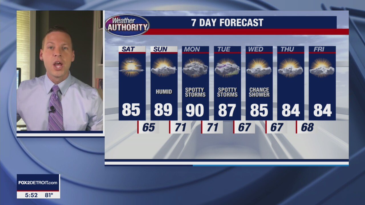
A hotter weekend ahead
Sunday will be humid as well.
Sunday will be humid as well.

Fantastic Friday, warming up for the weekend.
Temps soar back into the 80's Saturday and Sunday.
Temps soar back into the 80's Saturday and Sunday.

Great stretch of weather continues
Rich Luterman has the forecast.
Rich Luterman has the forecast.
Rain free stretch continues! Possibly all the way through the weekend.
Temps will slowly rise through the week.
Temps will slowly rise through the week.
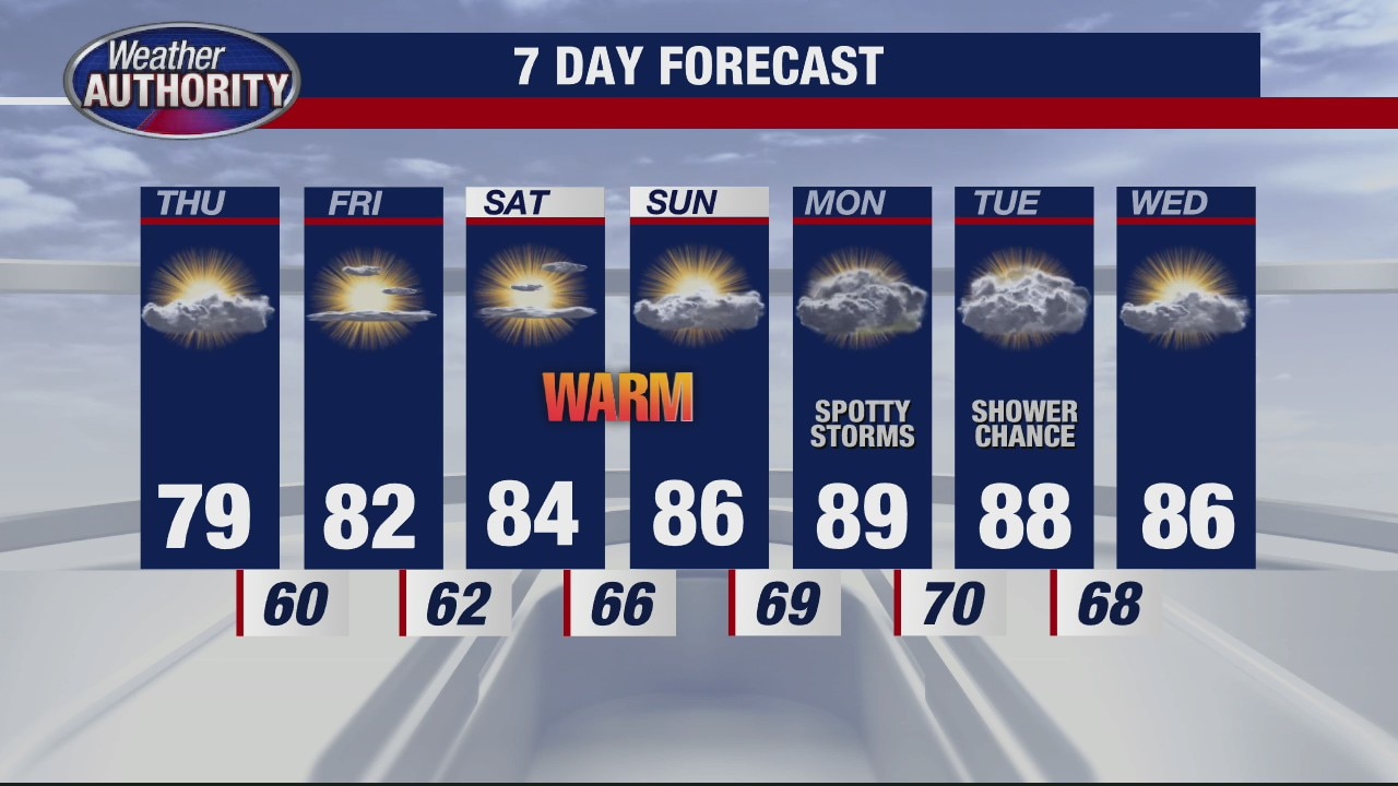
Fall-like feel will warm up
Rich Luterman has the forecast.
Rich Luterman has the forecast.

Mid week cool down followed by a weekend warm up!
The summer feel makes a comeback this weekend.
The summer feel makes a comeback this weekend.
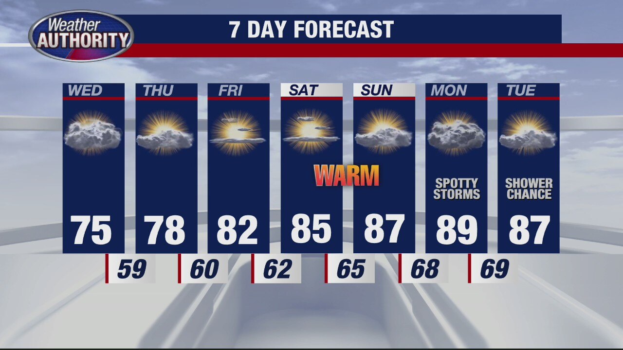
Pleasant looking Wednesday on the way
Rich Luterman has the forecast.
Rich Luterman has the forecast.
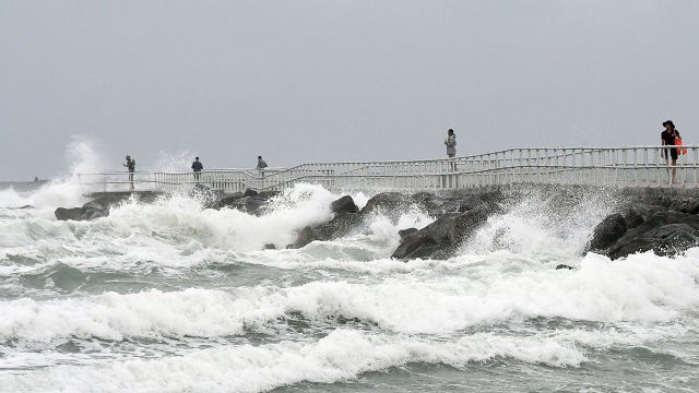

Isaias downgraded to tropical storm as it bears down on East Coast — here’s what you need to know
Isaias pushed ashore into the Carolinas late Monday, before moving up the eastern seaboard. The system could bring heavy rainfall, damaging winds and life-threatening storm surge to the East Coast.
Isaias pushed ashore into the Carolinas late Monday, before moving up the eastern seaboard. The system could bring heavy rainfall, damaging winds and life-threatening storm surge to the East Coast.

A Tuesday cool down, but summer makes a comeback by the weekend.
A few showers are possible today.
A few showers are possible today.

Temps are trending down, the 70's will stick for the next few. Some wet weather will be around to start the week.
Back to the 80s by the weekend.
Back to the 80s by the weekend.

Rain and Storms Sunday
Flash Flood Watch will remain in effect until 2pm today. Scattered showers and thunderstorms will produce more rainfall on the order of another half an inch to inch and a half of rainfall that could produce additional flooding across parts of Metro Detroit. High waters and ponding on the roadways could be an issue in flood prone areas. Highs will only top out in the low and mid 70s due to the rain cooled and cloud cooled air. Rain and storms should become more isolated this afternoon, but another round of rain is expected on Monday. Have your umbrellas near by today and Monday.
Flash Flood Watch will remain in effect until 2pm today. Scattered showers and thunderstorms will produce more rainfall on the order of another half an inch to inch and a half of rainfall that could produce additional flooding across parts of Metro Detroit. High waters and ponding on the roadways could be an issue in flood prone areas. Highs will only top out in the low and mid 70s due to the rain cooled and cloud cooled air. Rain and storms should become more isolated this afternoon, but another round of rain is expected on Monday. Have your umbrellas near by today and Monday.

Soggy Sunday
Meteorologist Lori Pinson has your forecast
Meteorologist Lori Pinson has your forecast
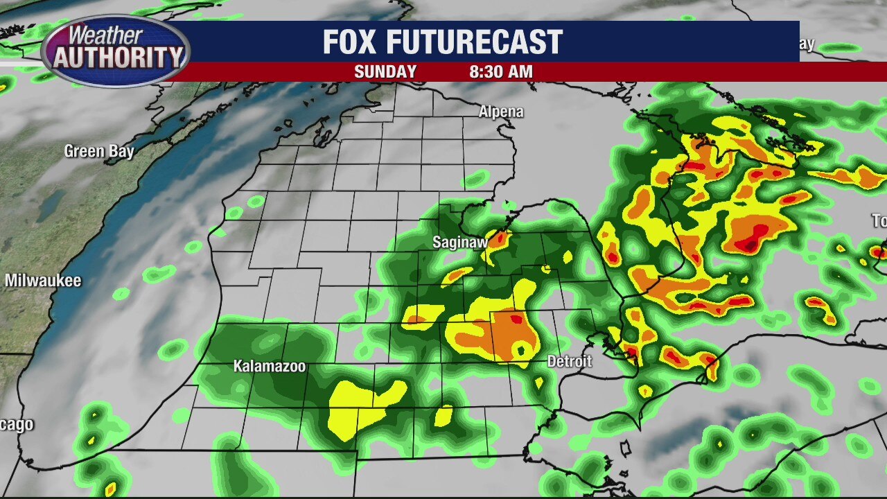
Heavy Rain On The Way
Meteorologist Lori Pinson has your forecast
Meteorologist Lori Pinson has your forecast