

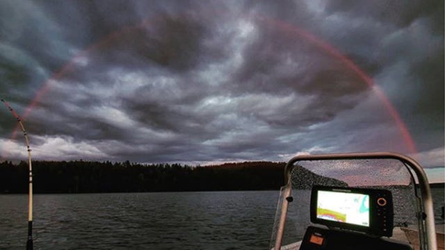

A stunning phenomenon: Rare, red rainbow spotted in Finland
A red rainbow was sighted by a fisherman in Finland over the weekend.
A red rainbow was sighted by a fisherman in Finland over the weekend.

Expect some storms Thursday morning
Rich Luterman has the forecast.
Rich Luterman has the forecast.

Temps are moving up midweek, showers and storms hold off until tonight!
Wet weather late tonight into Thursday morning.
Wet weather late tonight into Thursday morning.

90 degree weather returns
The weekend is when it gets really hot
The weekend is when it gets really hot

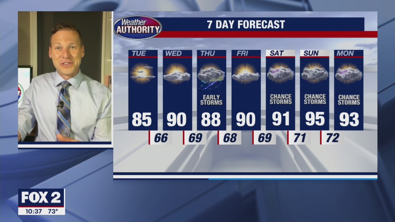
Tuesday temps begin to move up, 90? set to arrive later in the week.
Some wet weather remains possible Wednesday night and Thursday.
Some wet weather remains possible Wednesday night and Thursday.
Starting to get hotter
Back into the 90s by Wednesday
Back into the 90s by Wednesday

We have another hot week on the way. Today will be the exception.
Wet weather returns midweek.
Wet weather returns midweek.
A couple nice days ahead
Then the heat and humidity return!
Then the heat and humidity return!

Comfortable few days
90s return by the middle of the week
90s return by the middle of the week

Stray Shower and Cooler Sunday
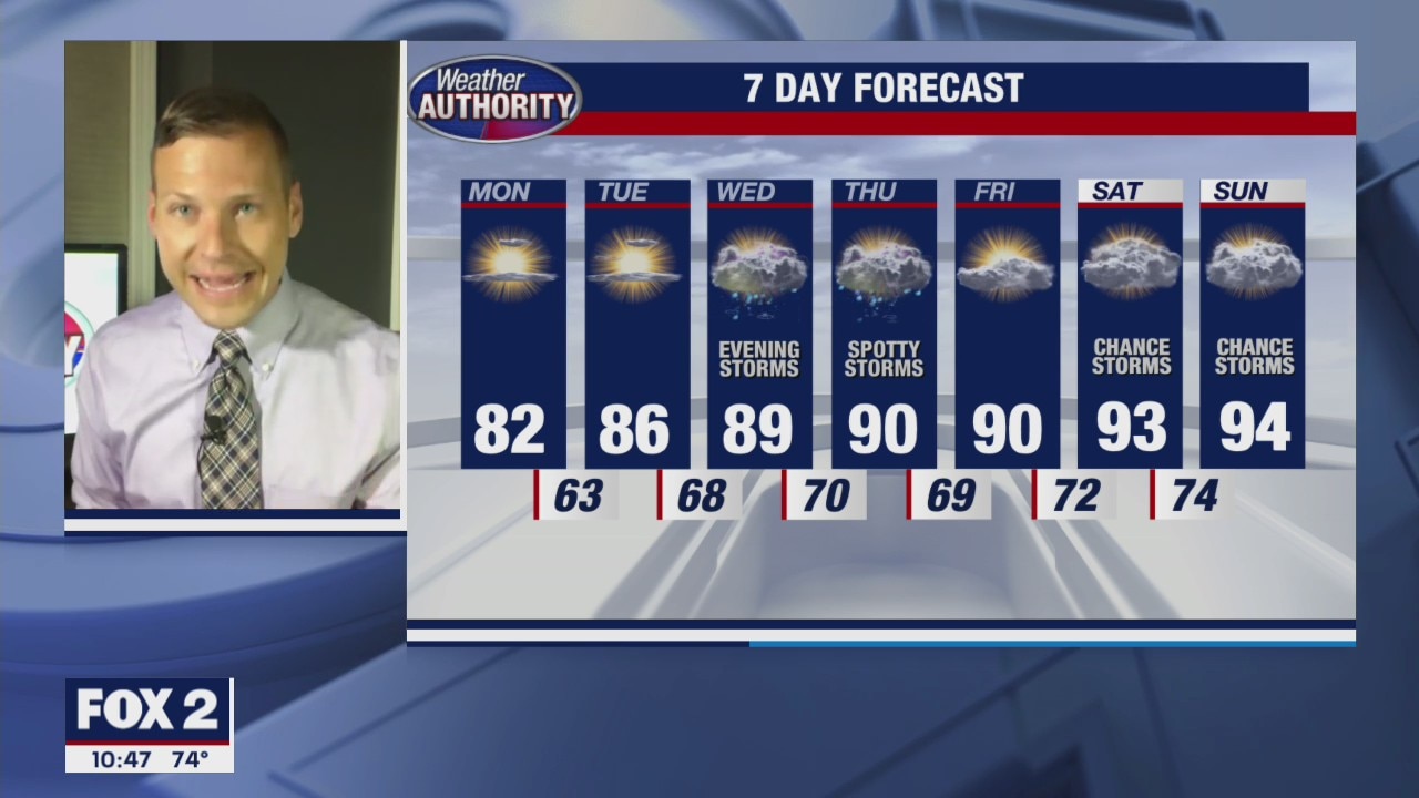
You are waking up this morning to a few more clouds outside along with temperatures in the 60s and low 70s. We will eventually rebound into the 80s by lunchtime with a mix of clouds and sun overhead. High temperatures should top out around 82 degrees. A cold front is moving through Metro Detroit and may help to instigate not only a few more clouds, but also a stray shower or storm through the day. Though we are not expecting much in the way of wet weather, if you are out on one of our beautiful lakes, I would suggest keeping an eye to the sky just to be safe. Otherwise, look for 90s to soar back into our forecast by midweek.
You are waking up this morning to a few more clouds outside along with temperatures in the 60s and low 70s. We will eventually rebound into the 80s by lunchtime with a mix of clouds and sun overhead. High temperatures should top out around 82 degrees. A cold front is moving through Metro Detroit and may help to instigate not only a few more clouds, but also a stray shower or storm through the day. Though we are not expecting much in the way of wet weather, if you are out on one of our beautiful lakes, I would suggest keeping an eye to the sky just to be safe. Otherwise, look for 90s to soar back into our forecast by midweek.
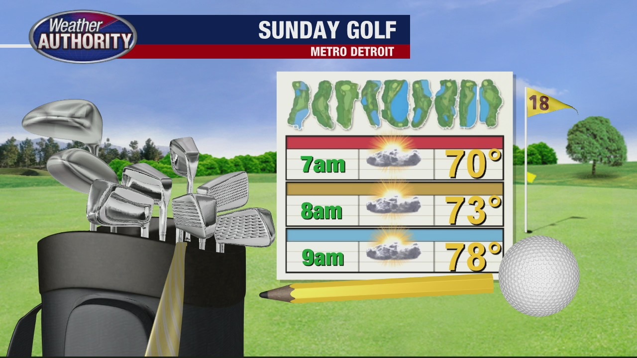
Cooler Sunday
Meteorologist Lori Pinson has your forecast
Meteorologist Lori Pinson has your forecast

Cooler Weekend Ahead
Along with more clouds and a few spotty showers this Saturday morning, expect cooler temperatures as well. After our 8 day stretch of 90 degree heat, highs should only top out in the upper 80s today and low 80s on Sunday. Enjoy it while it lasts because 90s are back by next week.
Along with more clouds and a few spotty showers this Saturday morning, expect cooler temperatures as well. After our 8 day stretch of 90 degree heat, highs should only top out in the upper 80s today and low 80s on Sunday. Enjoy it while it lasts because 90s are back by next week.


A benefit to Michigan's heatwave? The Great Lakes levels are actually falling
An unexpected, but positive consequence of all the heat cooking Michigan right now? The lake levels have fallen a little from their forecasted highs at the beginning of the year.
An unexpected, but positive consequence of all the heat cooking Michigan right now? The lake levels have fallen a little from their forecasted highs at the beginning of the year.
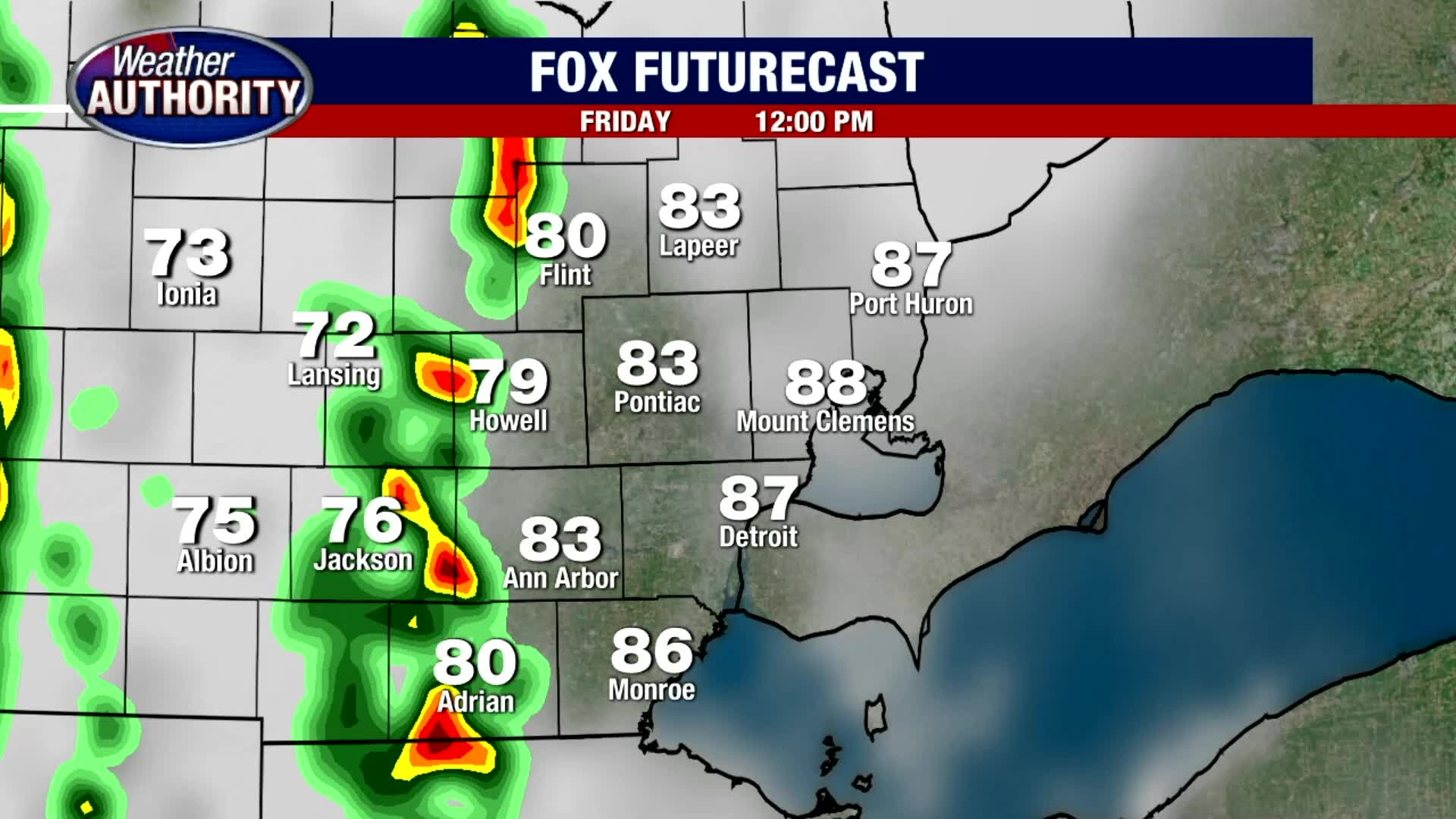
Stormy Friday and Cooler Weekend
Expect scattered showers and thunderstorms to develop late morning and into the early afternoon. A few of the storms that develop could pack a punch with heavy rain, gusty winds, lots of lightning and small hail. Though temperatures will get close to 90 degrees, the extra clouds and rain may suppress our highs into the upper 80s.
Expect scattered showers and thunderstorms to develop late morning and into the early afternoon. A few of the storms that develop could pack a punch with heavy rain, gusty winds, lots of lightning and small hail. Though temperatures will get close to 90 degrees, the extra clouds and rain may suppress our highs into the upper 80s.

Friday cold front will drop some storms and then our temps.
Highs in the 80s for the weekend!
Highs in the 80s for the weekend!

Heat continues, but relief for the weekend is on tap
Rich Luterman has the forecast.
Rich Luterman has the forecast.

Day 8 of the heat wave with some relief on the way!
90's for another day with some pop up storms this afternoon.
90's for another day with some pop up storms this afternoon.
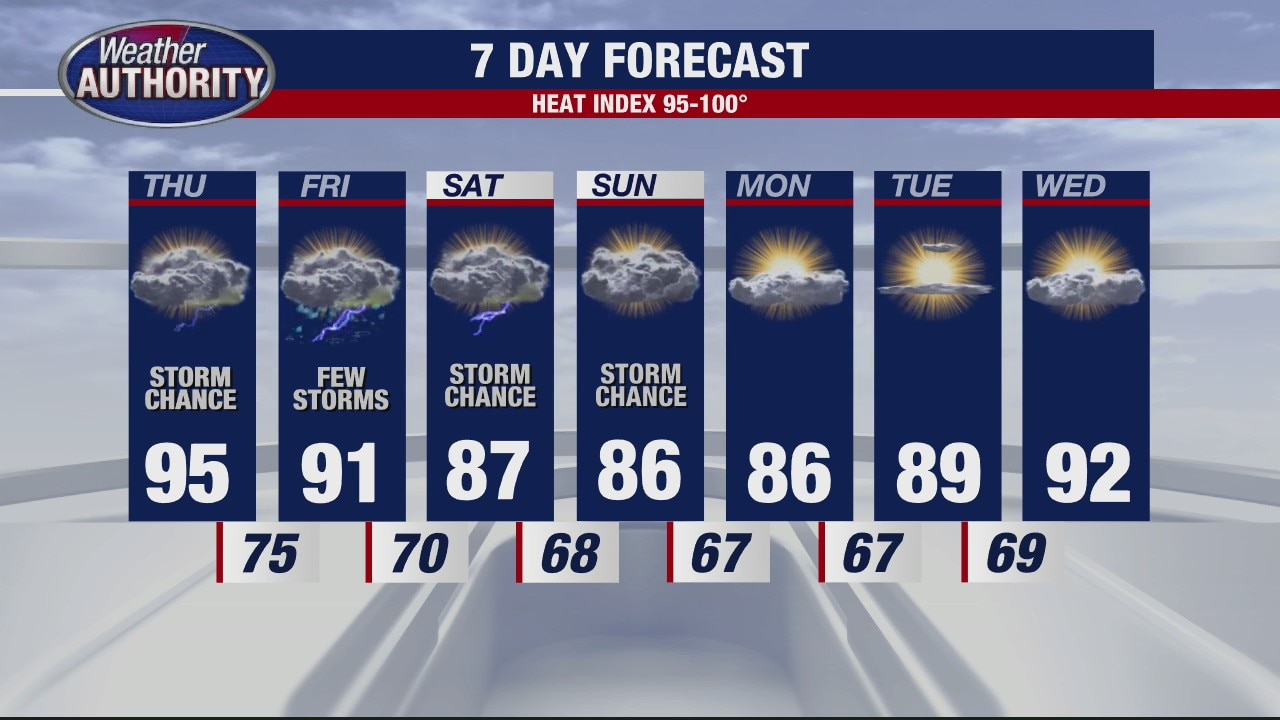
Still hot and humid
Rich Luterman has the forecast.
Rich Luterman has the forecast.

The heat wins another day, afternoon storms bubble up.
Isolated to widely scattered storms will be around this afternoon.
Isolated to widely scattered storms will be around this afternoon.
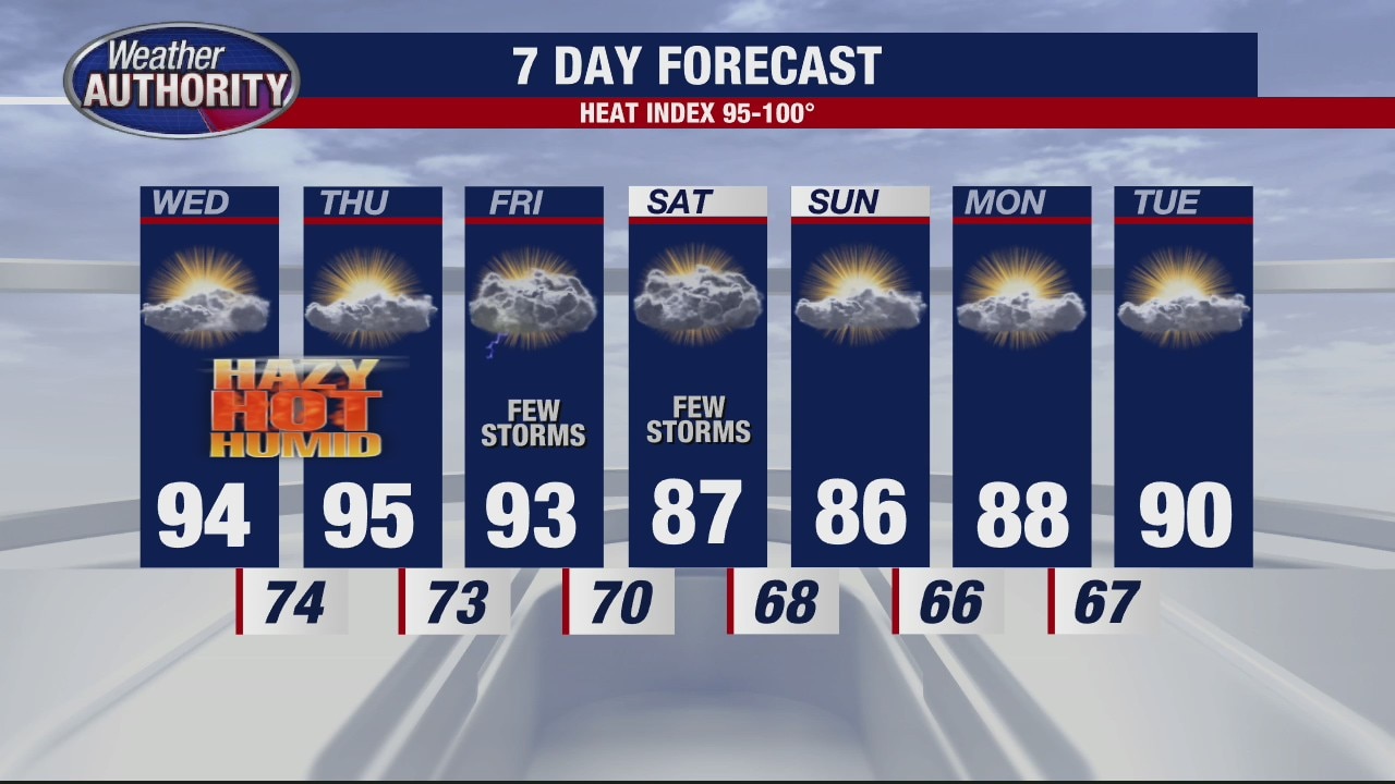
The heat wave continues
Rich Luterman has the forecast.
Rich Luterman has the forecast.