


Weather perfection continues another day with some changes lurking late week/weekend.
80's with sun today near 90 Friday/Saturday.
80's with sun today near 90 Friday/Saturday.
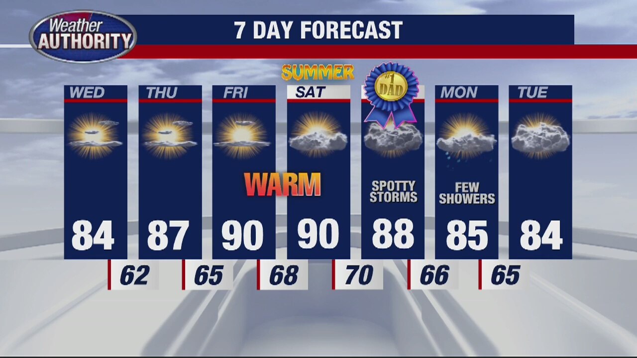
Warming trend continues through the week
Rich Luterman has the forecast.
Rich Luterman has the forecast.
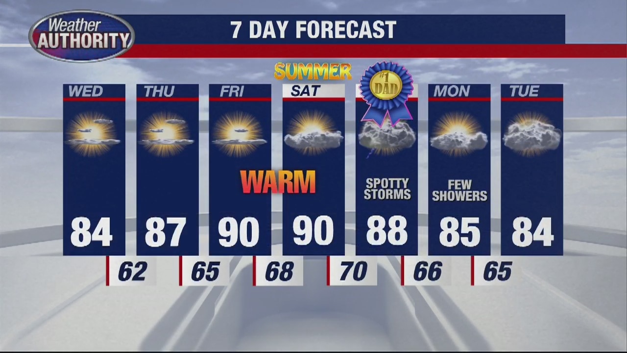
Great stretch of weather continues as temps get warmer
Rich Luterman has the forecast.
Rich Luterman has the forecast.

Another Beautiful Day
Warm and sunny week continues
Warm and sunny week continues
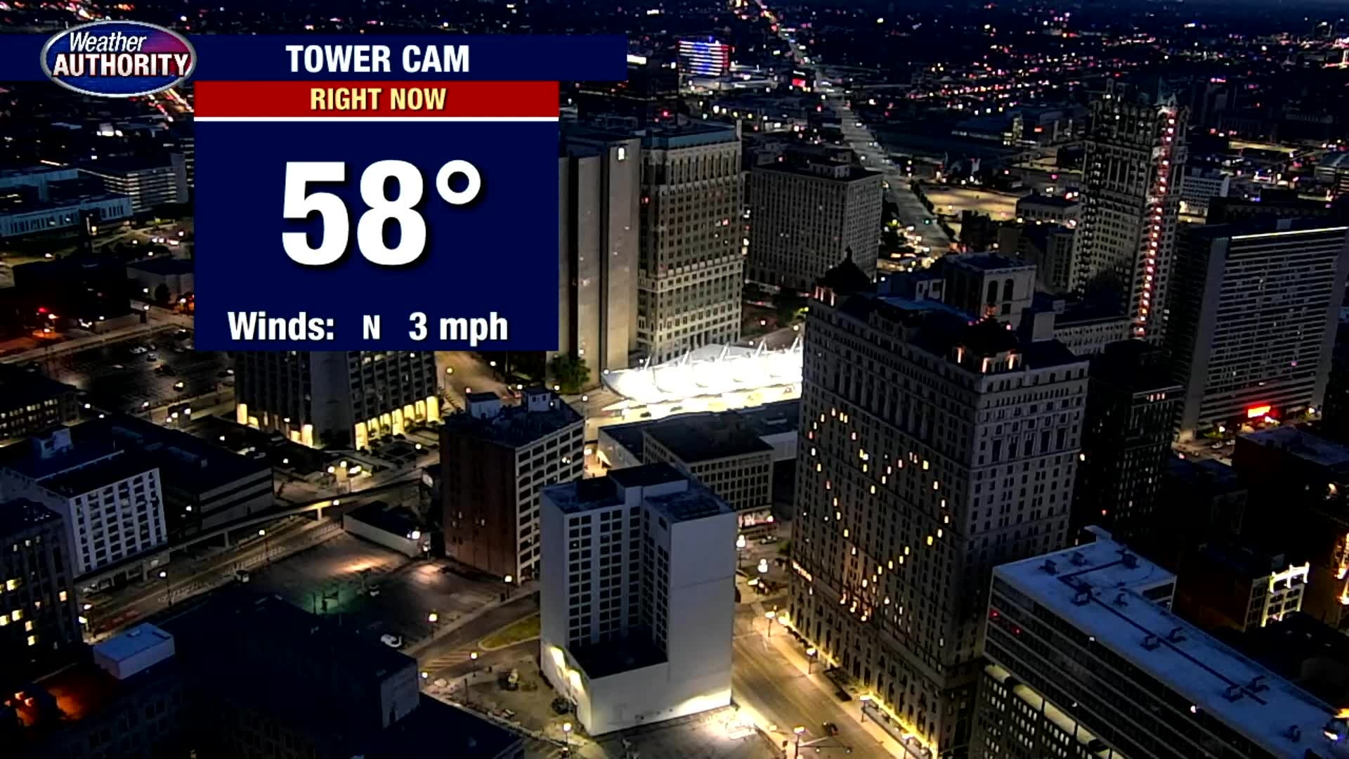
Tuesday weather is taking a bit of a turn... Temps are heading up!
Low 80's today, 90? by the end of the week.
Low 80's today, 90? by the end of the week.
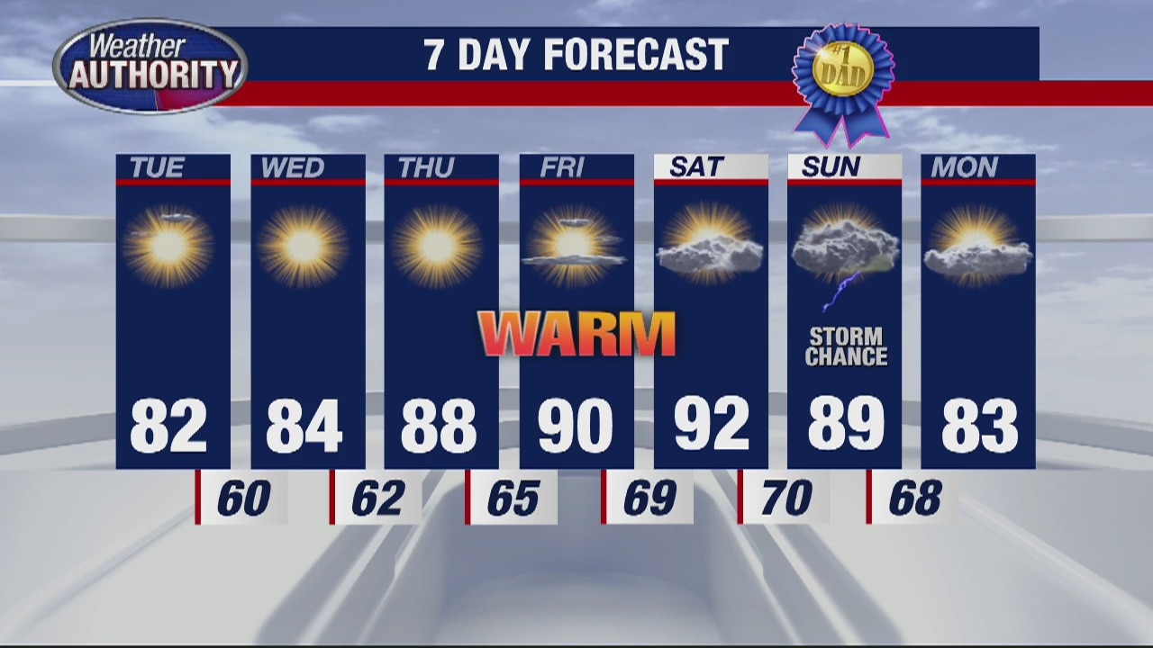
Temps warm up by weekend
Rich Luterman has the forecast.
Rich Luterman has the forecast.

A chilly Monday morning with a warm up coming!
Temps make a run for 90 by the weekend.
Temps make a run for 90 by the weekend.
Cool and Breezy Sunday
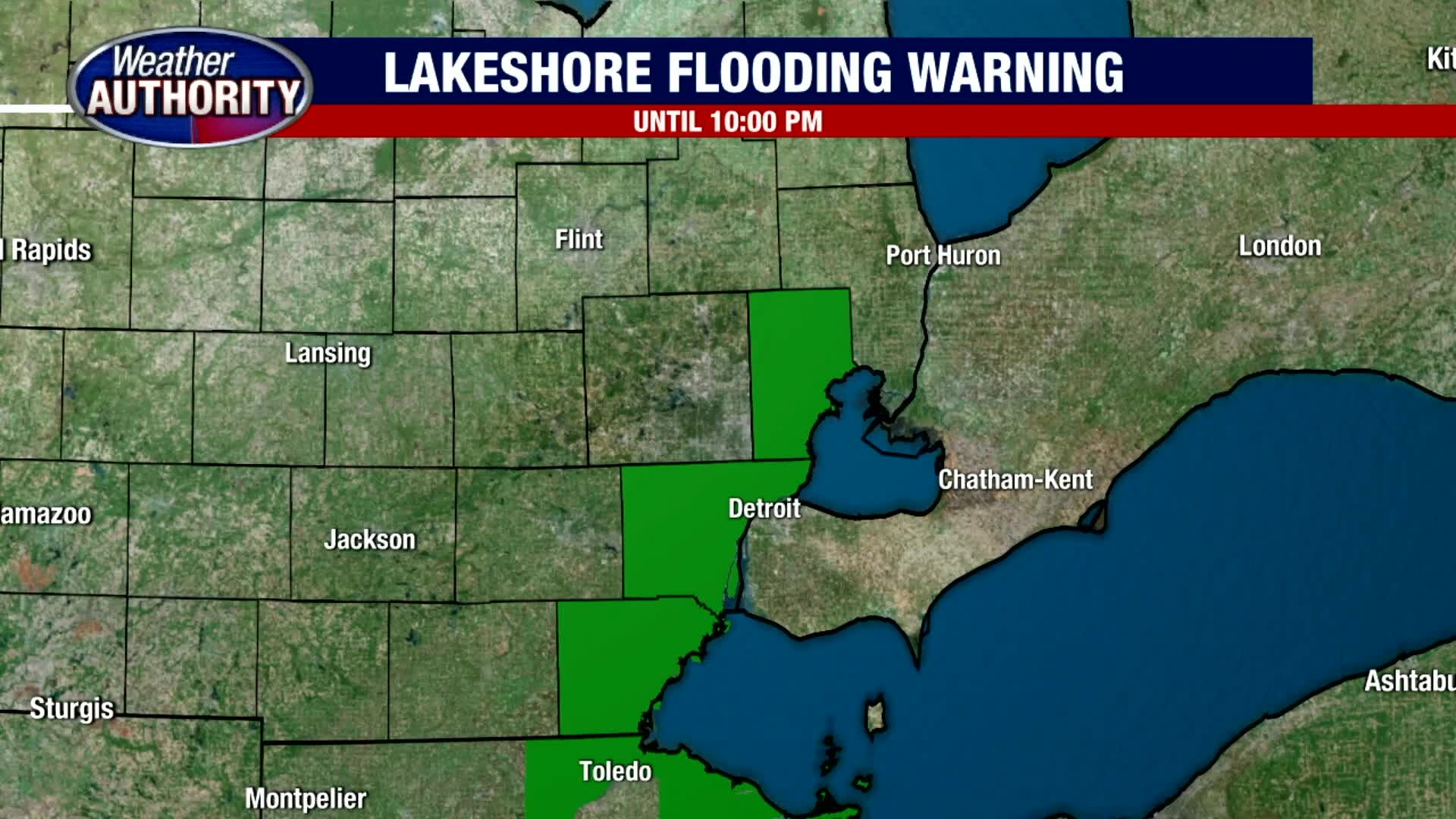
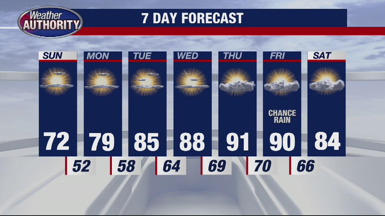
Although it is a cool start this Sunday morning with temperatures in the 40s and 50s, with more sunshine this afternoon, we will warm things up into the low 70s under mostly sunny skies. Thankfully, that sunshine should last all day long with a northeast breeze between 5 to 15 mph gusting at times up to 30 mph. If you are heading out on Lake St. Clair, we are expecting 1 to 2 foot waves on the water, so it could be a little choppy at times. Otherwise, look for temperatures to fall into the low 50s overnight. This upcoming workweek looks great with highs eventually jumping into the 80s by Tuesday, Wednesday and Thursday before topping out around 90 by Friday.
Although it is a cool start this Sunday morning with temperatures in the 40s and 50s, with more sunshine this afternoon, we will warm things up into the low 70s under mostly sunny skies. Thankfully, that sunshine should last all day long with a northeast breeze between 5 to 15 mph gusting at times up to 30 mph. If you are heading out on Lake St. Clair, we are expecting 1 to 2 foot waves on the water, so it could be a little choppy at times. Otherwise, look for temperatures to fall into the low 50s overnight. This upcoming workweek looks great with highs eventually jumping into the 80s by Tuesday, Wednesday and Thursday before topping out around 90 by Friday.
Warmer Temps On The Way
Meteorologist Lori Pinson has your forecast
Meteorologist Lori Pinson has your forecast
Cool Weekend Ahead
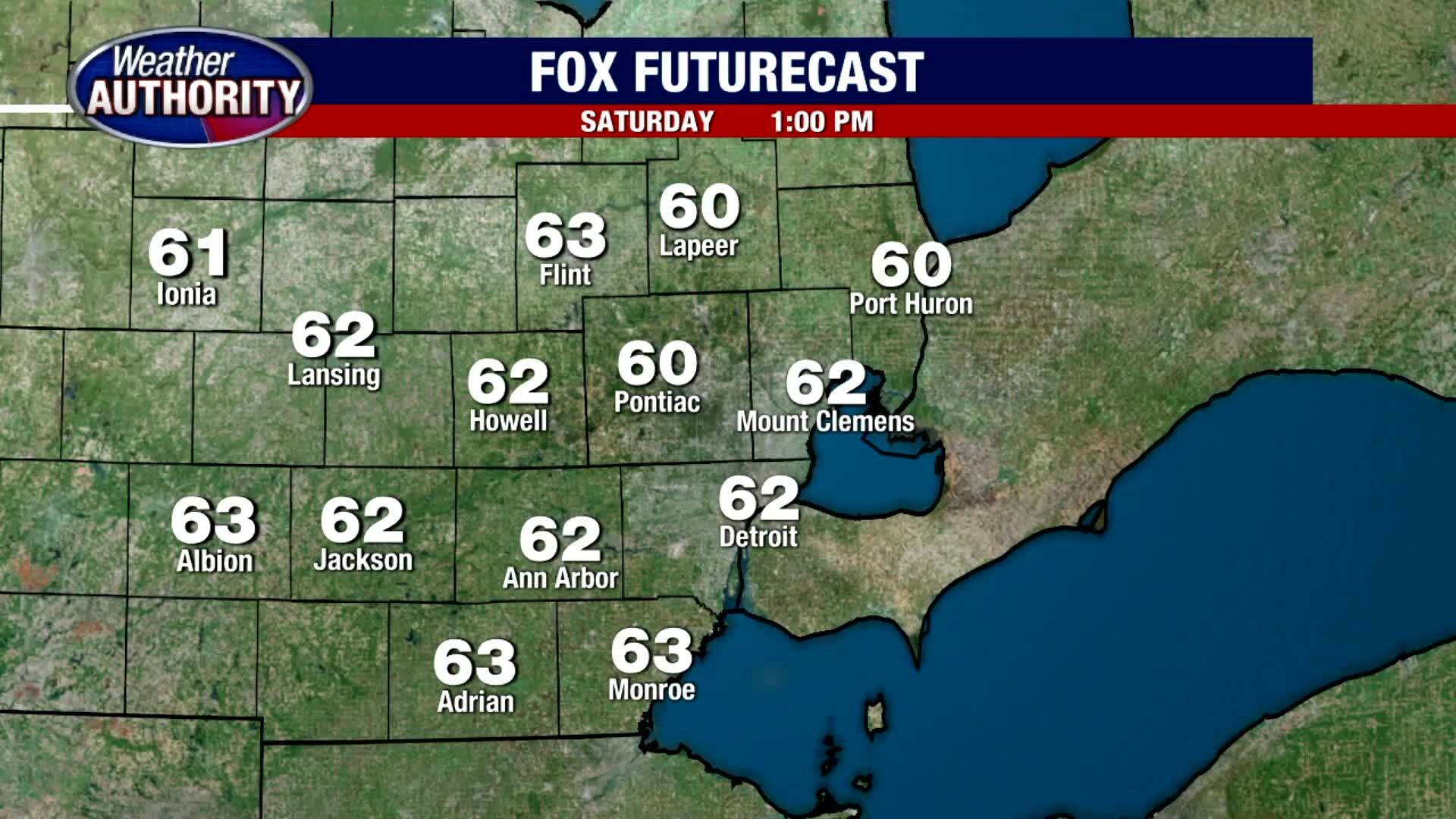
Temperatures both today and Sunday are expected to be below normal. Typically highs should top out in the upper 70s to near 80 degrees, but given the cool Canadian air in place, we will struggle to make it out of the 60s today. Given our NE winds between 5 to 15 mph, Lakeshore Flood Advisories and Warnings have been posted today and Sunday. Temperatures will fall into the upper 40s tonight, so might be a great night for a bonfire.
Temperatures both today and Sunday are expected to be below normal. Typically highs should top out in the upper 70s to near 80 degrees, but given the cool Canadian air in place, we will struggle to make it out of the 60s today. Given our NE winds between 5 to 15 mph, Lakeshore Flood Advisories and Warnings have been posted today and Sunday. Temperatures will fall into the upper 40s tonight, so might be a great night for a bonfire.
A cooler weekend
But plenty of sunshine!
But plenty of sunshine!


Lakes Michigan, Huron, Erie, St. Clair set record highs for May water levels
Three of the Great Lakes and Lake St. Clair set a record high for water levels for May, a sign that extreme weather is continuing to set unprecedented numbers.
Three of the Great Lakes and Lake St. Clair set a record high for water levels for May, a sign that extreme weather is continuing to set unprecedented numbers.

Noticeably Cool Weekend Ahead
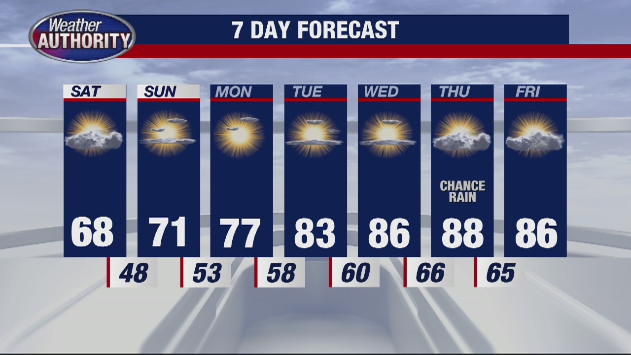
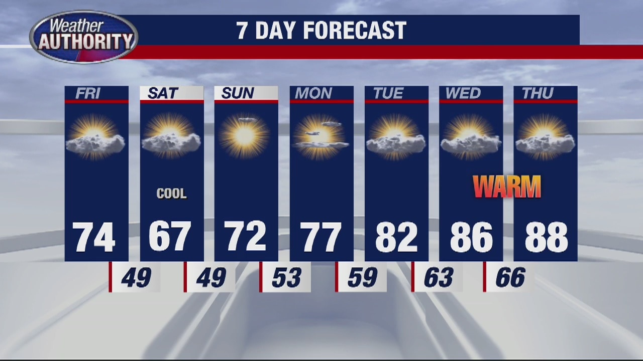
If you're heading out and about this morning, we're in the 50s. By lunchtime, expect temps to jump to around 70s with highs in the low and mid 70s this afternoon. Though most of us should stay nice and dry through your Friday afternoon, there is a slight chance for a few spotty showers this evening. No thunderstorms are anticipated. Saturday will stay cool with highs in the upper 60s. If 70s and 80s aren't your style, we're in the 80s to near 90 by the end of next week.
If you're heading out and about this morning, we're in the 50s. By lunchtime, expect temps to jump to around 70s with highs in the low and mid 70s this afternoon. Though most of us should stay nice and dry through your Friday afternoon, there is a slight chance for a few spotty showers this evening. No thunderstorms are anticipated. Saturday will stay cool with highs in the upper 60s. If 70s and 80s aren't your style, we're in the 80s to near 90 by the end of next week.
Chance for stray shower Friday
Rich Luterman has the forecast.
Rich Luterman has the forecast.
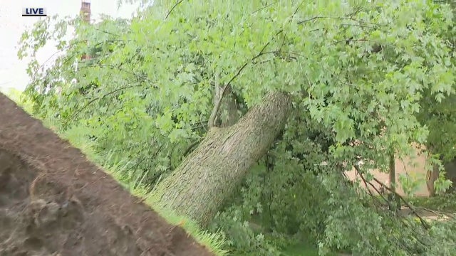

Power still out for over 250K after Wednesday storms, full restoration not expected until Saturday
Among Metro Detroit communities with sustained damage following Wednesday's storms is Grosse Pointe Farms, where uprooted trees fell through homes and branches were scattered across the streets.
Among Metro Detroit communities with sustained damage following Wednesday's storms is Grosse Pointe Farms, where uprooted trees fell through homes and branches were scattered across the streets.
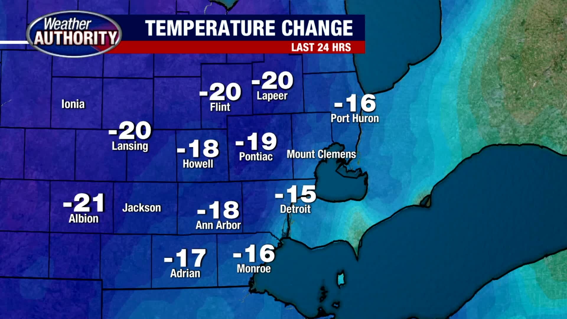
The storms are gone and temperatures are heading down!
We'll make it into the 70's this afternoon with mostly sunny skies.
We'll make it into the 70's this afternoon with mostly sunny skies.
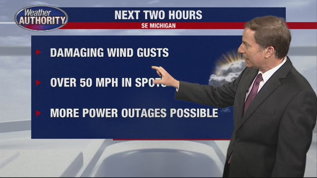

Weather warnings expire, but wind gusts and more power outages expected
Strong to severe thunderstorms are expected Wednesday as the remnants of Tropical Storm Cristobal move into southeast Michigan.
Strong to severe thunderstorms are expected Wednesday as the remnants of Tropical Storm Cristobal move into southeast Michigan.
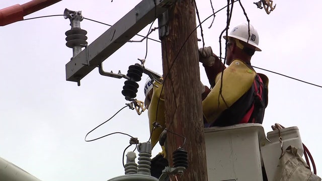

Tracking DTE outages and Consumers Energy outages as reports of storm damage come in
As a powerful storm rolls into southeast Michigan, it's very likely many of us will see the power out as 70 MPH winds could knock out electricity.
As a powerful storm rolls into southeast Michigan, it's very likely many of us will see the power out as 70 MPH winds could knock out electricity.

Strong storms move out, temps to cool down
Rich Luterman has the forecast.
Rich Luterman has the forecast.
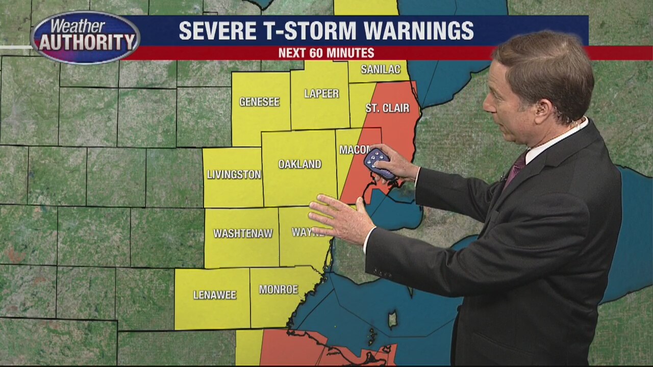
Severe weather rolling through SE Michigan
Rich Luterman says we are almost out of the woods as storms will be moving into Ohio and Ontario within the next couple hours.
Rich Luterman says we are almost out of the woods as storms will be moving into Ohio and Ontario within the next couple hours.