


Much cooler weekend ahead
Temperatures will once again be our big weather headline this Wednesday afternoon with highs jumping into the low and mid 80s. When you factor in the humidity outside, at times, it could feel like upper 80s near 90. That heat and humidity may also trigger an isolated shower or thunderstorm. We will keep skies partly to mostly cloudy from start to finish. More widespread rain and thunderstorms are back by Thursday and especially Friday morning as a cold front pushes through. A much more comfortable weekend is expected with highs in the upper 60s along with lower humidity.
Temperatures will once again be our big weather headline this Wednesday afternoon with highs jumping into the low and mid 80s. When you factor in the humidity outside, at times, it could feel like upper 80s near 90. That heat and humidity may also trigger an isolated shower or thunderstorm. We will keep skies partly to mostly cloudy from start to finish. More widespread rain and thunderstorms are back by Thursday and especially Friday morning as a cold front pushes through. A much more comfortable weekend is expected with highs in the upper 60s along with lower humidity.

The summer feel marches on! The cooldown is still set for the weekend.
A stray storm is possible this afternoon, but most of the day should remain dry.
A stray storm is possible this afternoon, but most of the day should remain dry.

Muggy for Wednesday
Rich Luterman has the forecast.
Rich Luterman has the forecast.
Hot and Humid Tuesday
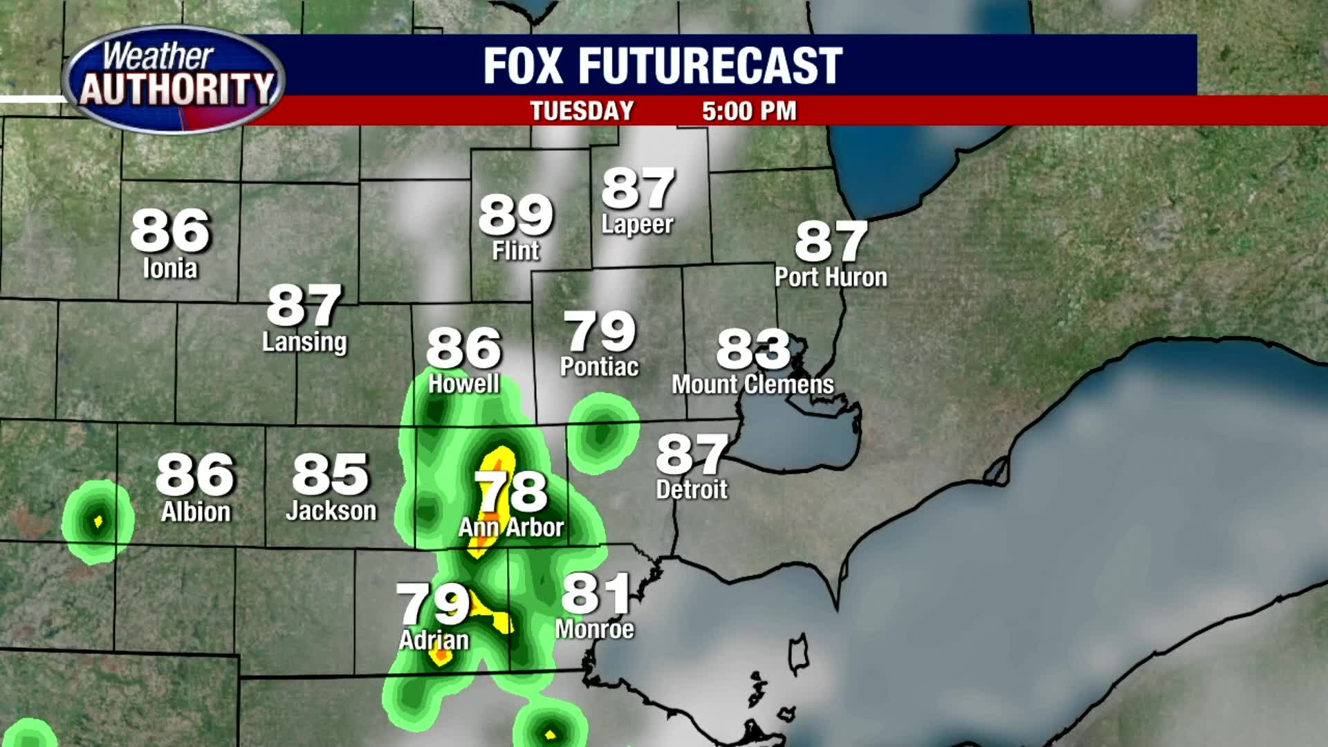
After a beautiful start this Tuesday morning, we are expecting an isolated pop up shower or thunderstorm before the day is through. If you plan on being out on the open waters of Lake Huron, Lake St. Clair or Lake Erie, keep an eye to the sky for a developing storm. Temperatures will be the big weather headline with highs nearing 90. We will get close to our record of 92, but I think we fall just shy of it. Upper 60s and low 70s is expected overnight Tuesday into Wednesday morning. By the end of the week, temperatures should start to normalize with highs in the mid 70s by Friday, and upper 60s this weekend.
After a beautiful start this Tuesday morning, we are expecting an isolated pop up shower or thunderstorm before the day is through. If you plan on being out on the open waters of Lake Huron, Lake St. Clair or Lake Erie, keep an eye to the sky for a developing storm. Temperatures will be the big weather headline with highs nearing 90. We will get close to our record of 92, but I think we fall just shy of it. Upper 60s and low 70s is expected overnight Tuesday into Wednesday morning. By the end of the week, temperatures should start to normalize with highs in the mid 70s by Friday, and upper 60s this weekend.

Summer set to stick another day! High temps near 90? this afternoon. An isolated storm is possible this afternoon
We're going much cooler Friday into the weekend.
We're going much cooler Friday into the weekend.
Warm weather continuing this week with cool down coming
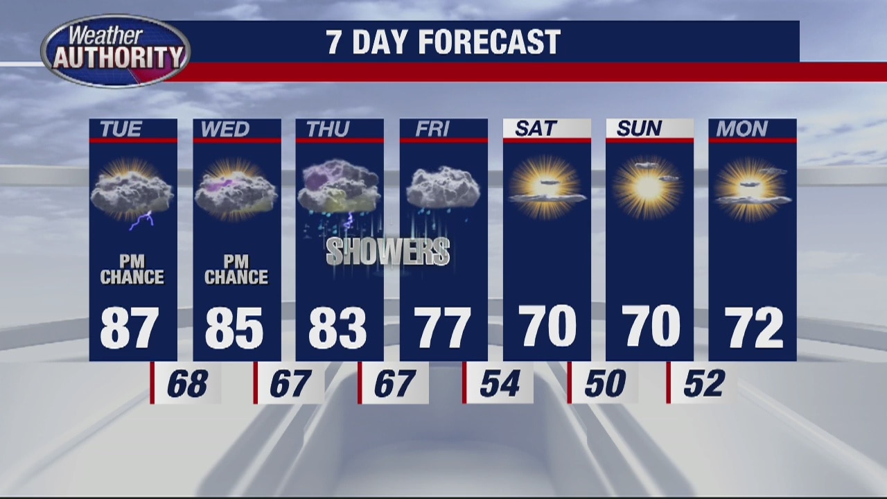
Metro Detroit saw a high temp of about 85 degrees Memorial Day. A cool-down won't be coming until late this week.
Metro Detroit saw a high temp of about 85 degrees Memorial Day. A cool-down won't be coming until late this week.

Hot and Humid Memorial Day
Keep an eye to the sky if you plan on being outside this afternoon. We are expecting temperatures to spike just shy of 90 degrees this afternoon along with a few pop up showers and thunderstorms. Though our official forecast high is 87 degrees, should we hit 90 degrees, that will tie our previous record high for today. Thankfully, we are not expecting severe severe. A few of the storms that do develop could produce frequent cloud to ground lightning along with heavy rain. As we lose the daytime heating this evening, our rain and storm chances will diminish as temperatures fall into the mid 60s overnight. Much like today, Tuesday is also expected to be warm and muggy with afternoon rain and storm chances.
Keep an eye to the sky if you plan on being outside this afternoon. We are expecting temperatures to spike just shy of 90 degrees this afternoon along with a few pop up showers and thunderstorms. Though our official forecast high is 87 degrees, should we hit 90 degrees, that will tie our previous record high for today. Thankfully, we are not expecting severe severe. A few of the storms that do develop could produce frequent cloud to ground lightning along with heavy rain. As we lose the daytime heating this evening, our rain and storm chances will diminish as temperatures fall into the mid 60s overnight. Much like today, Tuesday is also expected to be warm and muggy with afternoon rain and storm chances.

Pop Up Memorial Day Weekend Storms
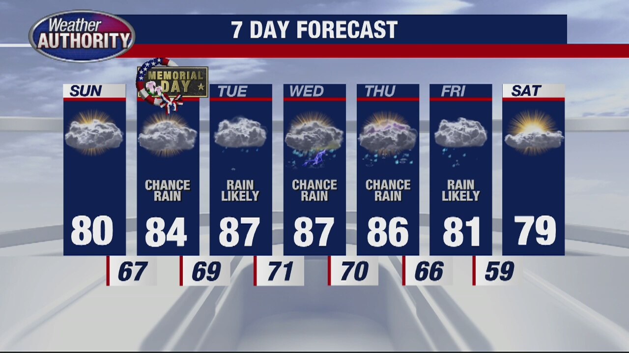
Although a few spotty showers and storms this morning may have slowed down your Sunday plans, as we head into the afternoon, our rain and storm chances will become more isolated. The passage of a warm front will allow for temperatures to surge into the low and mid 80s along with more sunshine than clouds. We should fall to the low 60s overnight under partly cloudy skies. Memorial Day Monday morning looks good, but we will bring in scattered rain and storm chances to metro Detroit through the afternoon. Your Memorial Day outdoor plans should include an umbrella just to be safe.
Although a few spotty showers and storms this morning may have slowed down your Sunday plans, as we head into the afternoon, our rain and storm chances will become more isolated. The passage of a warm front will allow for temperatures to surge into the low and mid 80s along with more sunshine than clouds. We should fall to the low 60s overnight under partly cloudy skies. Memorial Day Monday morning looks good, but we will bring in scattered rain and storm chances to metro Detroit through the afternoon. Your Memorial Day outdoor plans should include an umbrella just to be safe.

Rainy Week Ahead
Meteorologist Lori Pinson has your forecast
Meteorologist Lori Pinson has your forecast
Warmer Sunday
Meteorologist Lori Pinson has your forecast
Meteorologist Lori Pinson has your forecast
Near record heat is on the way
After the morning fog burns off, we're expecting partly to mostly cloudy skies with temperatures on Saturday in the mid 70s. Take full advantage of our dry day because rain and storm chances return on Sunday and through this upcoming week. In fact, a round of rain and storms is possible early Sunday morning as a warm front passes. A few of the storms that develop could be heavy and strong at times. After that warm front moves through, temperatures behind it will surge to around 80 on Sunday with mid 80s returning to metro Detroit next week.
After the morning fog burns off, we're expecting partly to mostly cloudy skies with temperatures on Saturday in the mid 70s. Take full advantage of our dry day because rain and storm chances return on Sunday and through this upcoming week. In fact, a round of rain and storms is possible early Sunday morning as a warm front passes. A few of the storms that develop could be heavy and strong at times. After that warm front moves through, temperatures behind it will surge to around 80 on Sunday with mid 80s returning to metro Detroit next week.


Midland County emergency declaration expanded to include Arenac, Gladwin, and Saginaw Counties
The 500-year flood hit the Midland County hard on Tuesday night when the Tittabawassee River flooded into Wixom Lake and burst two dams. The water is starting to recede in Sanford but the shock is lingering in the community.
The 500-year flood hit the Midland County hard on Tuesday night when the Tittabawassee River flooded into Wixom Lake and burst two dams. The water is starting to recede in Sanford but the shock is lingering in the community.
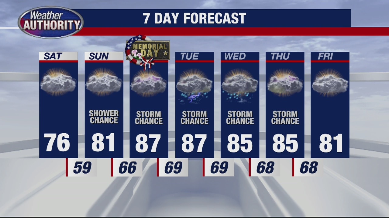
Memorial Day weekend forecast
Some spotty showers and storms but also much hotter!
Some spotty showers and storms but also much hotter!

Spotty showers on Friday but a weekend warm up is coming
Hang on to an umbrella if you plan on being out and about for an extended period of time Friday. Highs should jump into the mid/upper 60s. Though we'll fall into the mid 50s at night 70s are back by Saturday and Sunday. 80s are in the forecast for Memorial Day.
Hang on to an umbrella if you plan on being out and about for an extended period of time Friday. Highs should jump into the mid/upper 60s. Though we'll fall into the mid 50s at night 70s are back by Saturday and Sunday. 80s are in the forecast for Memorial Day.
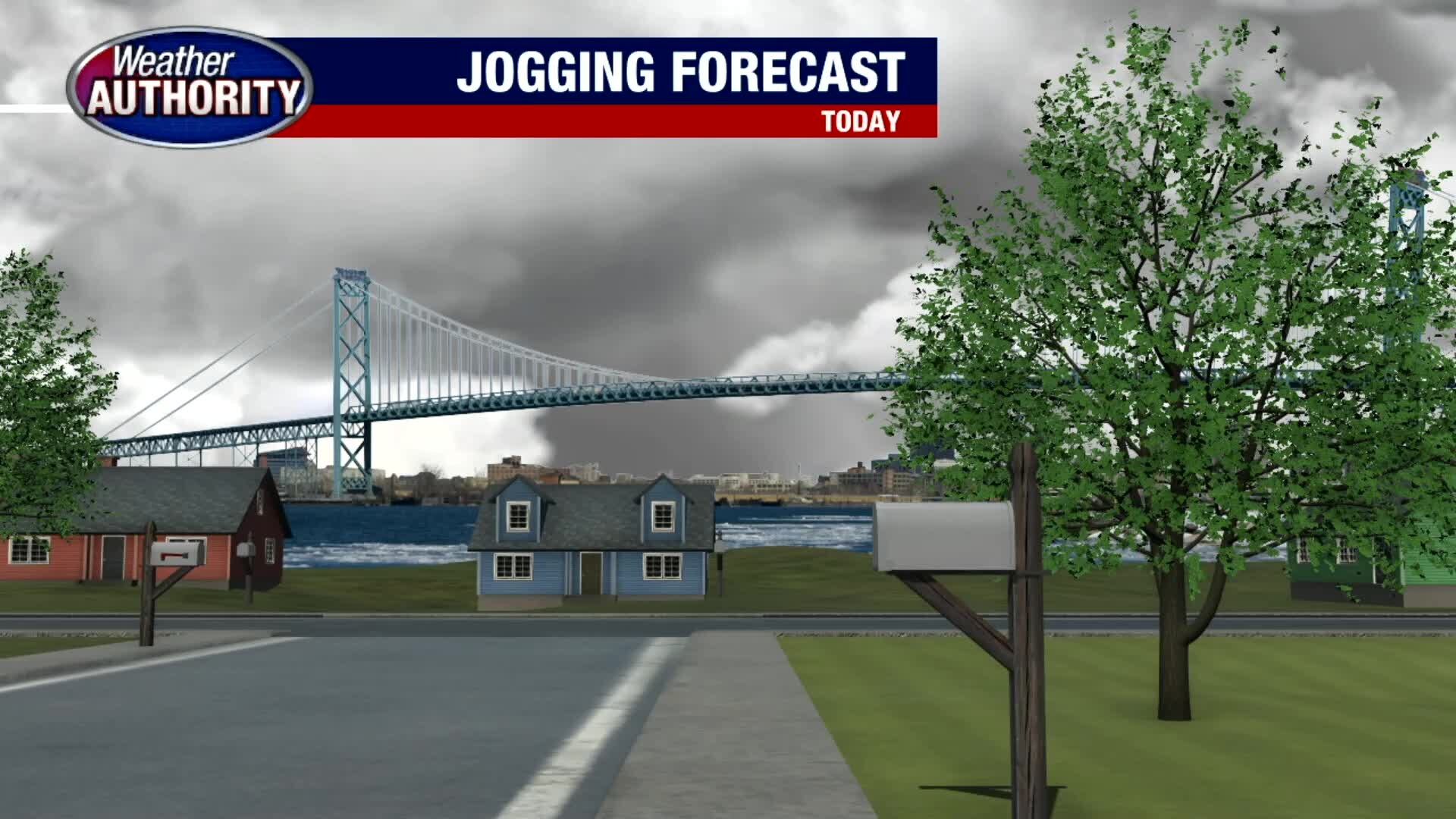
Spotty Friday showers with a weekend warm up
Hang on to an umbrella if you plan on being out and about for an extended period of time Friday. Highs should jump into the mid/upper 60s. Though we'll fall into the mid 50s at night 70s are back by Saturday and Sunday. 80s are in the forecast for Memorial Day.
Hang on to an umbrella if you plan on being out and about for an extended period of time Friday. Highs should jump into the mid/upper 60s. Though we'll fall into the mid 50s at night 70s are back by Saturday and Sunday. 80s are in the forecast for Memorial Day.
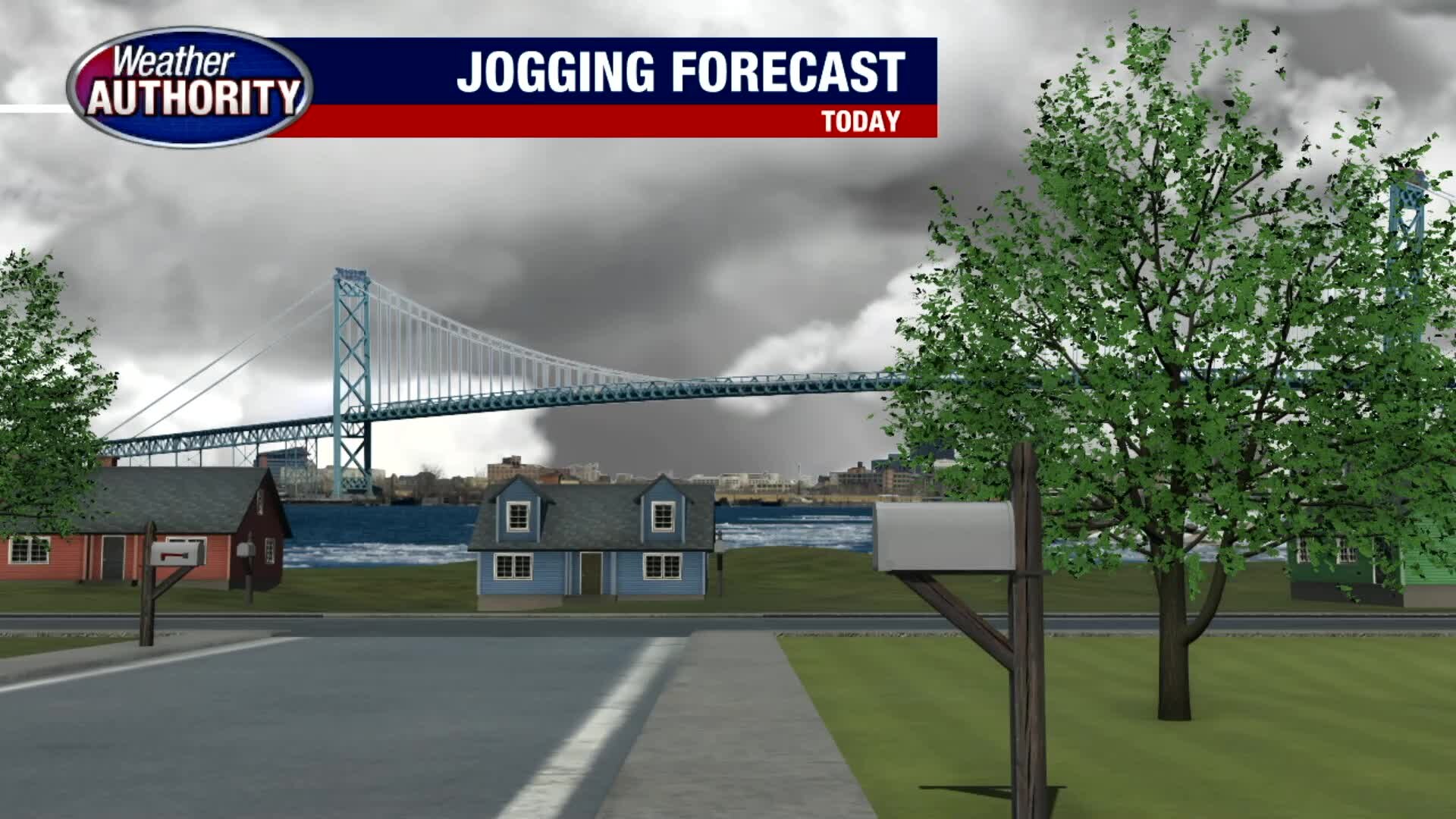
Spotty Friday Showers with Weekend Warm Up
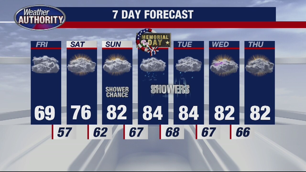
We're keeping our eyes on a few spotty showers this morning under mostly cloudy skies. Hang on to an umbrella if you plan on being out and about for an extended period of time today. Highs should jump into the mid/upper 60s today. Though we'll fall into the mid 50s tonight, 70s are back by Saturday and Sunday. If that's not warm enough for you, 80s are in the forecast Memorial Day Monday.
We're keeping our eyes on a few spotty showers this morning under mostly cloudy skies. Hang on to an umbrella if you plan on being out and about for an extended period of time today. Highs should jump into the mid/upper 60s today. Though we'll fall into the mid 50s tonight, 70s are back by Saturday and Sunday. If that's not warm enough for you, 80s are in the forecast Memorial Day Monday.
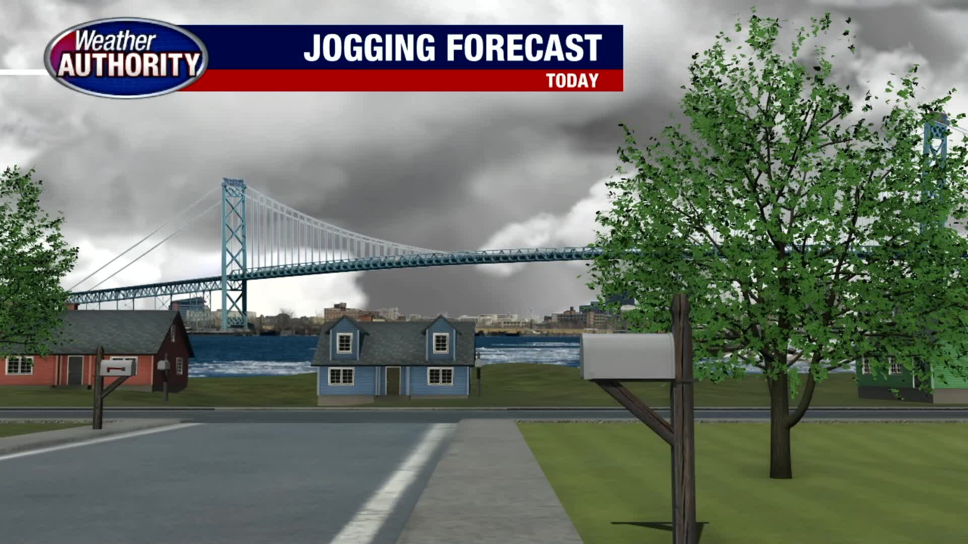
Spotty Friday Showers with Weekend Warm Up
We're keeping our eyes on a few spotty showers this morning under mostly cloudy skies. Hang on to an umbrella if you plan on being out and about for an extended period of time today. Highs should jump into the mid/upper 60s today. Though we'll fall into the mid 50s tonight, 70s are back by Saturday and Sunday. If that's not warm enough for you, 80s are in the forecast Memorial Day Monday!
We're keeping our eyes on a few spotty showers this morning under mostly cloudy skies. Hang on to an umbrella if you plan on being out and about for an extended period of time today. Highs should jump into the mid/upper 60s today. Though we'll fall into the mid 50s tonight, 70s are back by Saturday and Sunday. If that's not warm enough for you, 80s are in the forecast Memorial Day Monday!
Spotty Friday Showers with Weekend Warm Up
We're keeping our eyes on a few spotty showers this morning under mostly cloudy skies. Hang on to an umbrella if you plan on being out and about for an extended period of time today. Highs should jump into the mid/upper 60s today. Though we'll fall into the mid 50s tonight, 70s are back by Saturday and Sunday. If that's not warm enough for you, 80s are in the forecast Memorial Day Monday!
We're keeping our eyes on a few spotty showers this morning under mostly cloudy skies. Hang on to an umbrella if you plan on being out and about for an extended period of time today. Highs should jump into the mid/upper 60s today. Though we'll fall into the mid 50s tonight, 70s are back by Saturday and Sunday. If that's not warm enough for you, 80s are in the forecast Memorial Day Monday!
The warm-up continues
Rich Luterman has the forecast.
Rich Luterman has the forecast.

Dry through most of the week, with a taste of summer for the weekend!
Warmer, muggier with the occasional storm for the weekend.
Warmer, muggier with the occasional storm for the weekend.