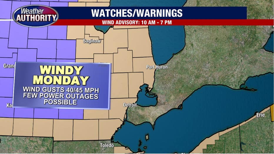
Gusty conditions with wind chill dropping into the teens on Monday
Windy, colder and snowy weather is on the way.
A wind advisory goes into effect at 10 a.m. this morning and runs through 7 p.m. this evening in anticipation of 40-45 mph wind gusts. A wind advisory won't lead to widespread power outages, but isolated issues can occur.
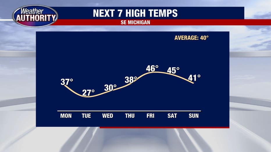
Today's high temperatures were overnight and no more.
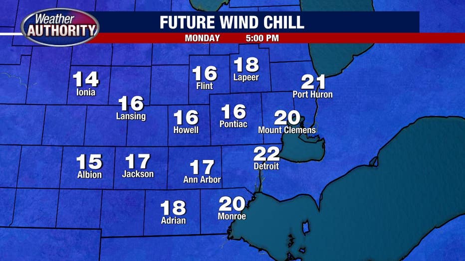
They'll be falling steadily through the day - check out our late day wind chill.
Snow showers will likely be around this afternoon on a hit-or-miss basis. Snow totals will be little to nothing, but quick bursts may lead to reduced visibility and slick roads in spots at times.

A few snow showers may be around on Wednesday, but those chances are fading.
Late Thursday is a better bet for either rain or snow and late Friday we'll see low pressure out west draw in milder air, offering up the chance at 50 again, but that looks like it will be a nighttime high temperature so don't get your hopes up!
Rain Friday night into early Saturday may lead to a few snow showers but for now we don't have our eyes on any big snows.