

Metro Detroit weather: Morning snow ahead of chance of squalls this afternoon
Morning freezing drizzle and some snow
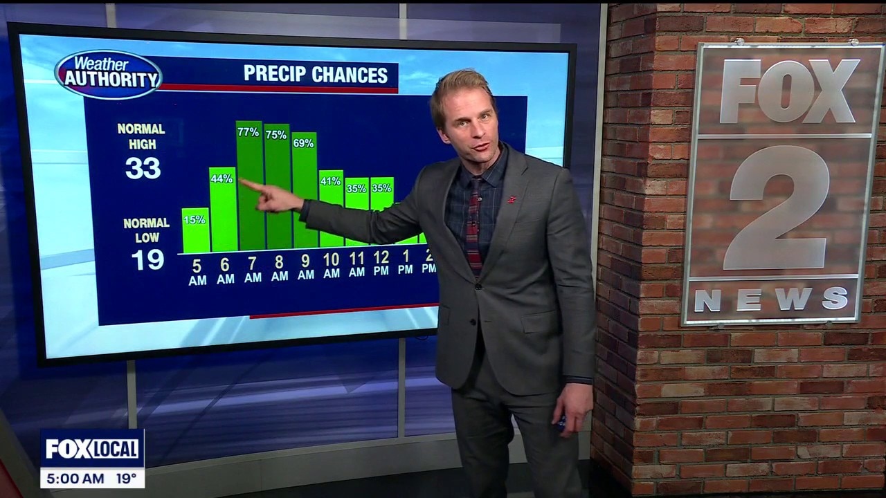
Plan for a slower commute Friday morning as freezing rain and a bit of snow move into Metro Detroit. Accumulation won't be major, but it can still have an impact.
DETROIT (FOX 2) - A bit of freezing drizzle plus snow spreading in will make for a slick commute.
VIEW: Live traffic map
Snow totals through noon wind up on either side of an inch.

Snow squall risk
Temps spike into the low to mid-30s around midday, but that doesn’t last long. An arctic front barrels through this afternoon, winds ramp up fast, and temperatures drop hard. Gusts up to 30–40 mph could trigger brief snow squalls, short-lived, but capable of knocking visibility down quickly.
The main window is noon to 5 pm.

What are snow squalls?
Bursts of snow cause whiteout conditions. There are typically gusty winds as well, leading to limited visibility. This is a snow squall.
A large amount of snow often doesn't fall during a squall. However, that period of little visibility can spell disaster for drivers.
Squall driving tips
If you can avoid driving when snow squalls are possible, the National Weather Service advises staying off roads. If you're already driving when a snow squall begins, attempt to leave the road as soon as possible.
If you are unable to get off of the road, the NWS advises slowing down without slamming the brakes and ensuring that your lights are on. When you are able to pull over, the NWS said to exit your vehicle and get as far away from the road as possible when it is safe to do so.
Cold Weather Advisory
Then comes the cold. Wind chills crash tonight and stay brutal into Saturday morning, bottoming out between 10 and 20 below zero. That’s dangerous cold, and a Cold Weather Advisory is in effect.

A bit closer to average
The good news: the cold won’t last forever.
We slowly moderate over the weekend, and next week finally brings a more noticeable warmup, with temperatures climbing back toward and possibly above average.
