Metro Detroit Weather: Extreme heat, severe weather, flooding all possible this week

Heat, humidity, and thunderstorms return this week
It's going to be a muggy and rain-potential week for the next few days as humidity and hot temperatures make their return.
SOUTHFIELD, MIch. (FOX 2) - Remember a couple of weeks ago when it felt like we had a threat of severe weather every single day? Do you miss that type of weather? If you do, why? And if you don't, brace yourself because it's coming back and we could see more flooding over the next few days.
This week is expected to bring us several rounds of strong to possibly severe thunderstorms as a low-pressure system is once again set up just 200 miles to our west. This will drape a stationary front across Michigan and all the ingredients will be right for weather like we saw in late June and July.
RELATED: Flooding preps - everything you should do today to be ready
LIVE ALERTS: We'll be monitoring this weather all week and will keep you updated on your phones first with the FOX 2 News app. It's free! Get it now and be ready.
Like baking a cake, if you sprinkle in some extreme humidity and heat you have all the ingredients to cook up some severe weather.
The storms are possible beginning Monday afternoon and continuing through the evening. Like most summer days, the window for the highest opportunity will be between 2 and 8 p.m. as the peak heat hits the day.
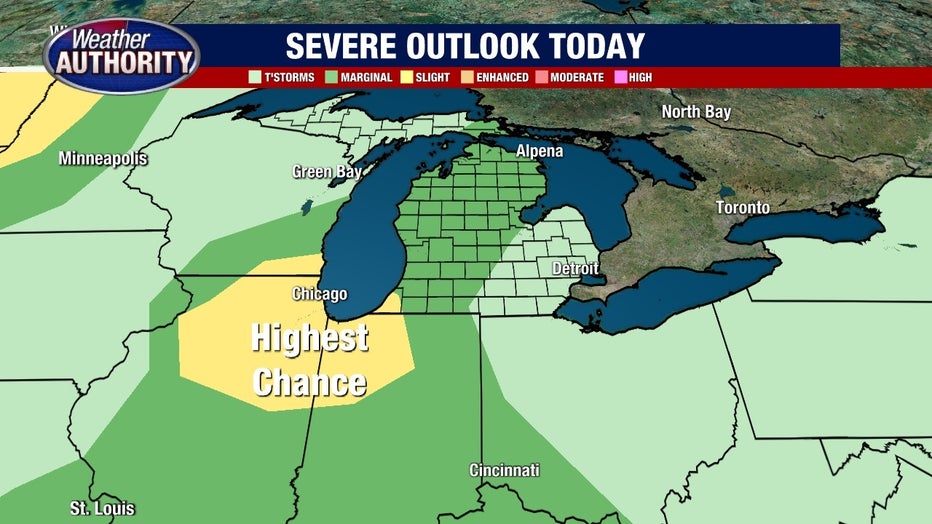
The biggest concern is the torrential downpours that will come with these storms, as rates of 1-2 inches of rain per hour are possible in the worst cells.
This could cause some flooding over the next few days as each day has a similar threat. In other words - the forecast on Monday will be much the same for the rest of the week with severe weather possible each afternoon.

While no watches or warnings are currently issued, the National Weather Service branch has already discussed the potential need for a Flood Watch to account for the heavy rain.
In addition to these heavy rains the storms will likely pack a punch with gusty winds as they scream in from the west. Power outages are possible as they blow through.
Severe Thunderstorms: How Do They Form?
While storms are likely in and around Southeast Michigan on Monday, we're more focused on Tuesday and Wednesday, as the dynamics set up in a stronger fashion those days.
Either way, from now until Thursday night we'll be keeping a close eye on the skies as these storms develop and on the thermometers as the Heat Index appears to rise to a dangerous 94-98 degree range.