

More snowmakers on the way for Southeast Michigan this weekend

A few different snowy chances this weekend
Most snow will fall late in the day Saturday into early Sunday
(FOX 2) - After starting the month with three weeks of no snow, boy have we caught up this week!
After Wednesday's snow storm, we continue to keep the snow in our weekend forecast. We wake up to an icy and frigid Friday start with temperatures in the low 20s.
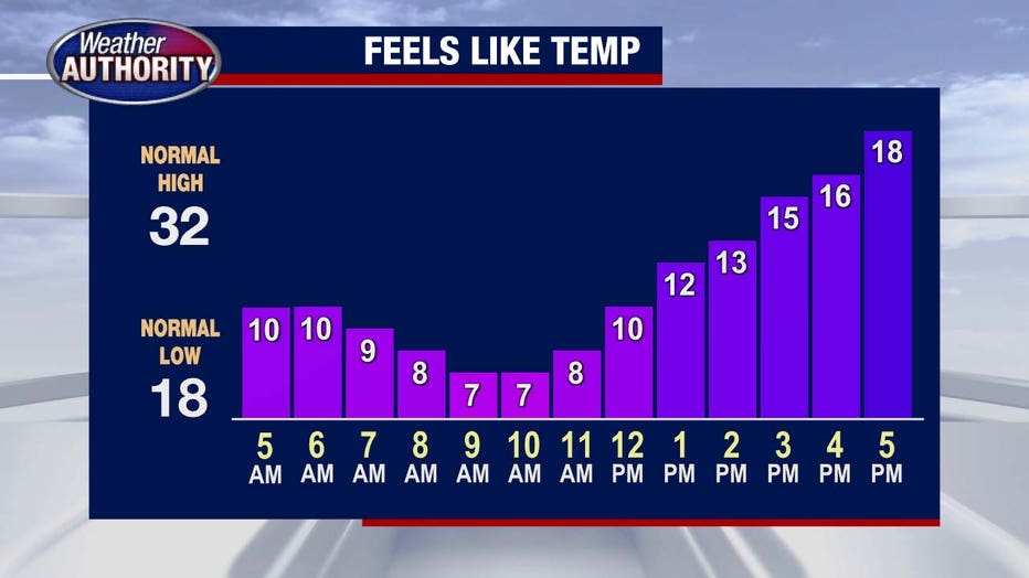
If you parked outside, give yourself a few extra minutes to scrape the windows. High temperatures this afternoon will build to about 35 degrees, but thanks to a strong wind it will feel like half that. Bundle up!
By Friday evening we will begin to see another snowmaker affect us. A quick moving clipper system will bring light snow and accumulations of less than an inch through Friday night. Low temperatures drop to the mid-20s.
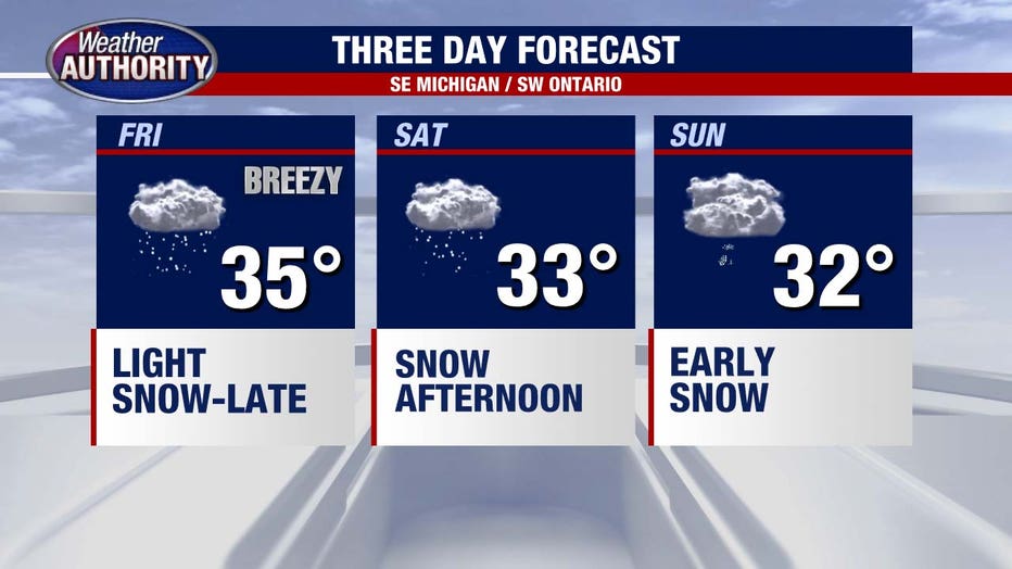
Saturday will be mostly cloudy early before transitioning to a snowy afternoon. High temperatures will be in the lower 30s, but again it will feel like low to mid-20s.
A Saturday afternoon snow maker will arrive and affect us through the evening and night hours. Overall snow totals will likely fall in the 1-3 inch range while some spots farther north could creep even higher (perhaps near 2-4 inches depending on where the "bullseye" sets up).
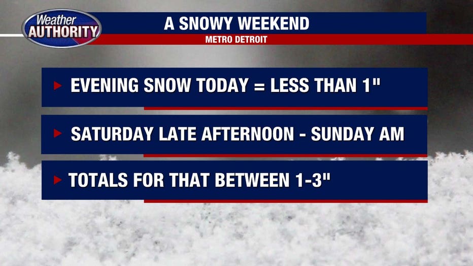
Snow continues through Sunday morning before wrapping up around 10:00 AM. We will be shoveling that accumulating snow through the afternoon as high temperatures get to 32°.
Some lingering flurries could impact us Sunday as well.