Southeast Michigan rain ends midday Tuesday as temperatures cool through the week

Cooler Tuesday
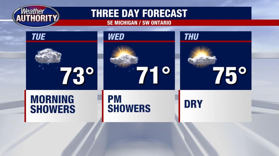
A cold front brings widespread rain this morning, tapering off by noon. Cooler temperatures setting up behind it. Meteorologist Lori Pinson has your forecast
(FOX 2) - It's a wet morning, without question. Radar estimated rainfall totals near 2 inches in spots.
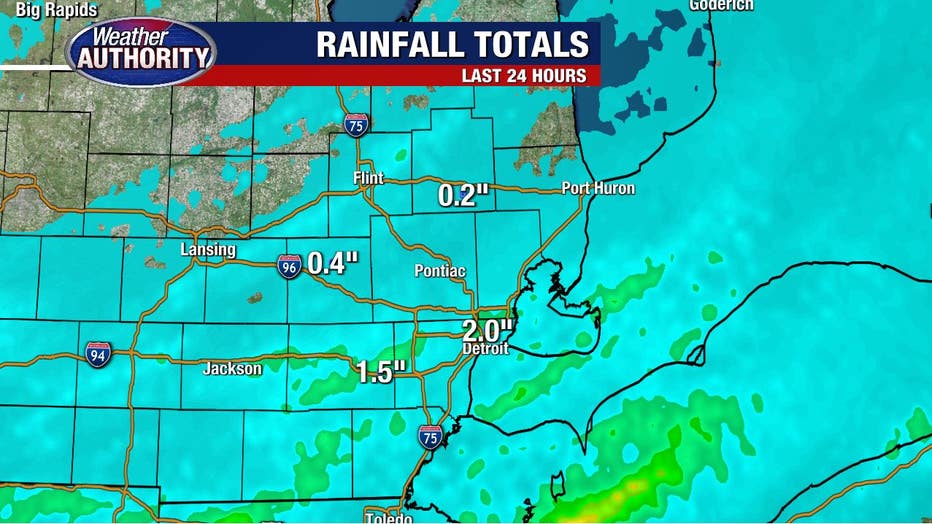
Our flood watch continues until 8 a.m. to account for ponding on the roads and localized flooding.
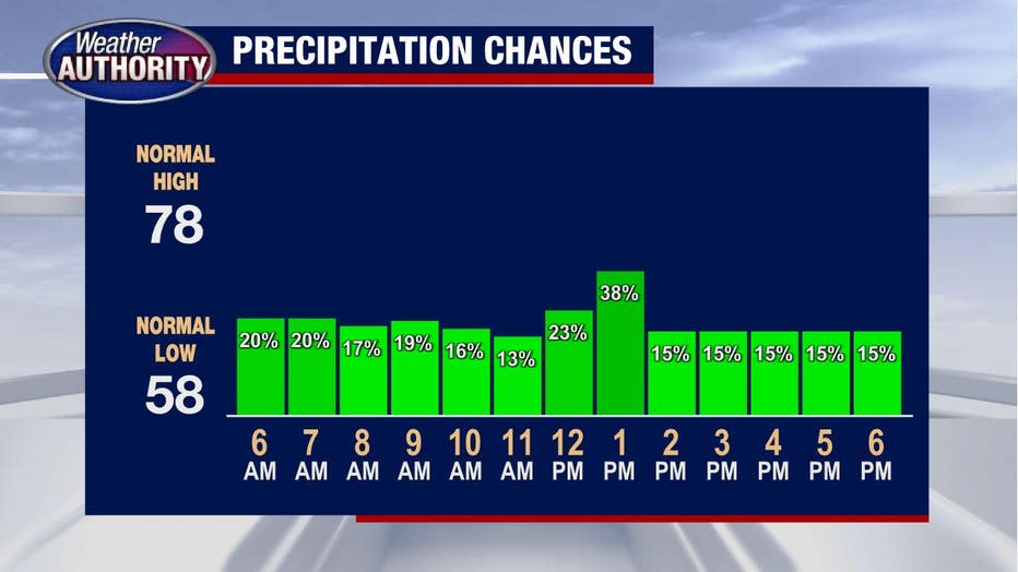
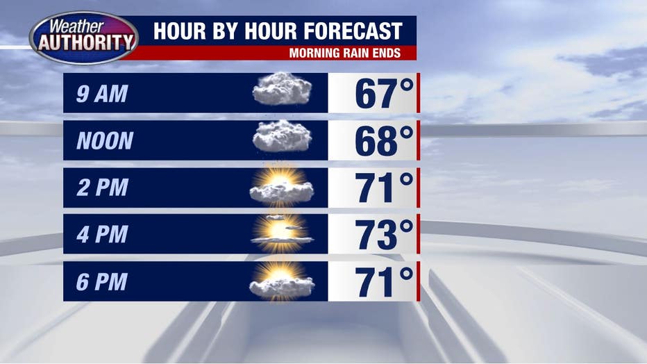
Rain chances fade through the morning with nothing more than an isolated shower left over by noon.
The clouds will clear up and allow for a bright finish to the day as high pressure builds in.
Skies stay clear tonight and temperatures fade with the potential for fog to form.
We'll move beyond the fog Wednesday morning with another round of rain late in the day. Our Wednesday system will be quicker and have less moisture which means no flooding concerns midweek.
Rain is possible again Friday and the weekend rain picture is a bit blurry with different models pointing in different directions, but enough data remains to point at a dry weekend. For now.
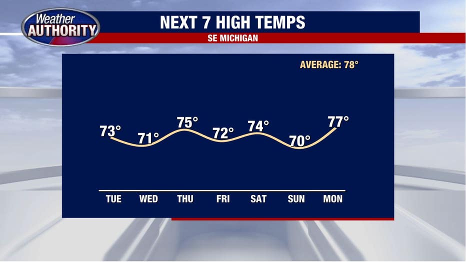
One thing that is clear is the cooler than average (78°) weather will stick through the weekend.