Dangerously cold temps settle in for Friday

FOX 2 (WJBK) - Hello gang, we have a wind chill advisory late Thursday night into Friday morning with values as low as -15.
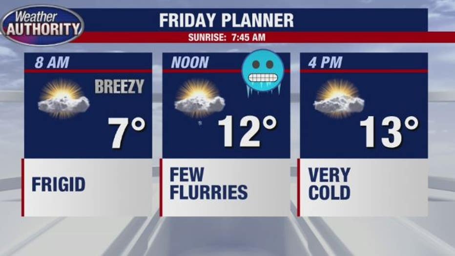
An arctic front crosses the area early Thursday evening with some snow showers. Get ready for a frigid-Friday with dangerous wind chill readings.
It stays brisk and cold Friday night and Saturday before a general thaw begins Sunday. We will see highs in the 40s next week, and there is even a chance to reach 50.
For the rest of Thursday evening and overnight, it turns much colder with a breeze and a few snow showers with a low of 6.
Friday: Partly cloudy, breezy and frigid with a few flurries and a high of 14.
Saturday: Party cloudy, still brisk and cold with a high near 30.
Sunday: Mostly cloudy but not as cold and a high of 38.
Monday: Mostly cloudy with a high of 37.
Tuesday: Cloudy and milder with a few rain showers and a high of 47.
Stay warm,
-Luterman