Metro Detroit weather: A dry Wednesday before rain returns

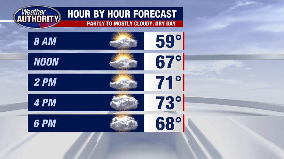
DETROIT (FOX 2) - Hello, good morning, here we are, celebrating hump day on a dry note! Rain returns tomorrow, but today it's just a touch cooler to start the day with temps fading into the 50's/low60's under mixed sky conditions. Expect a rebound back into the '70s under partly sunny skies.
The opportunity for rain presents itself late tonight and tomorrow morning ahead of an approaching cold front. Instability won't be great, but stronger non-severe wind gusts are possible with any storms that may form.
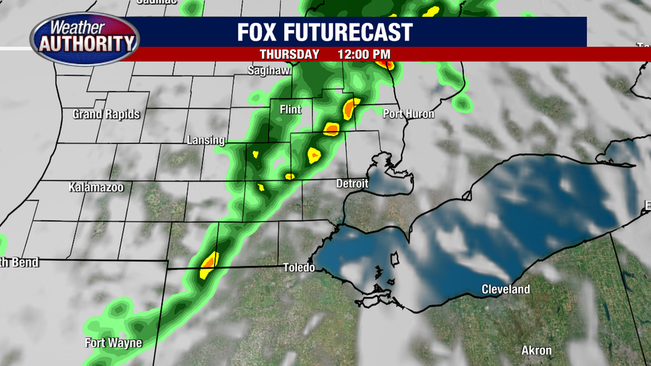
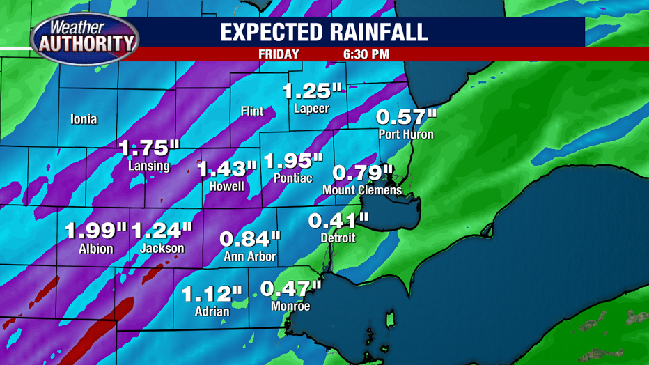
Rain totals Thursday will be held in check. Many of us .25" or less with higher localized amounts within any storms, but higher rain totals arrive to end the week. The cold front that provokes the Thursday rain will stall out as low pressure from the south develops and rides along the front, bringing with it an abundance of moisture. Friday will be wet with the wettest part of the day looking to be late into the evening and through the night. We all get rain of differing amounts and please do take these numbers with a grain of sail, but here's a glimpse of what may come down. An inch or more of rain is quite plausible.
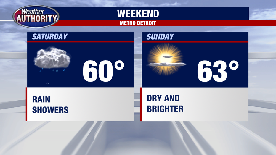
Much cooler air is coming for the weekend with a dry and bright finish.