Metro Detroit weather: Cool and cloudy Thursday before temperatures hit 50s this weekend

Big warmup coming to Metro Detroit
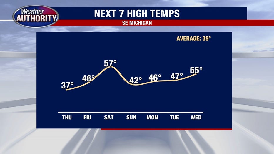
Temperatures will rise to the high 50s this weekend and stay mild into next week.
DETROIT (FOX 2) - We're continuing our slow crawl away from the coldest air of the season but I definitely wouldn't call your morning warm.
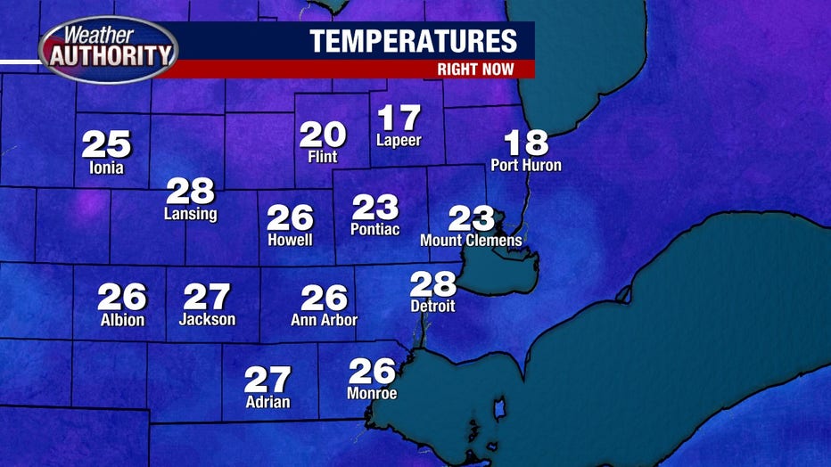
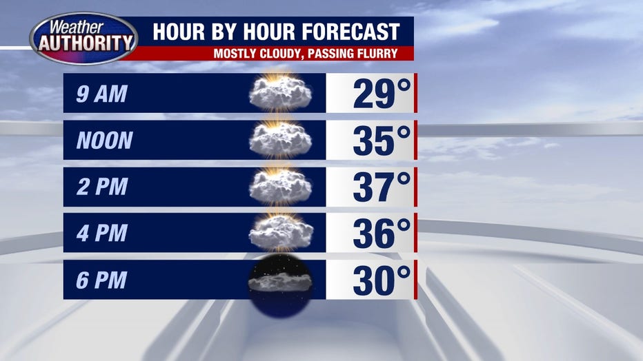
Temps move above freezing by noon but stop shy of 40 this afternoon under mostly cloudy skies and while we might squeeze out a few showers (rain or snow if it happens), it won't amount to much.
Our big late week/weekend warmup is still on tap. Temperatures will rise into the 50's Friday night and stick around through Saturday morning.
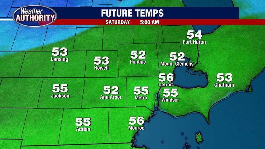
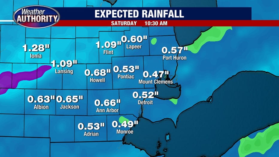
The warmup is courtesy of low pressure that will also bring rain and strong winds. Our wind will be from the SW Saturday morning and the west by afternoon gusts up to 50 mph. This won't be too far off from what we felt earlier this week. Wet weather will arrive Friday evening and continue into Saturday morning, totaling half an inch or so.
We'll turn cooler Sunday but temps move back closer to warm next week.