

Michigan snow forecast: What to expect from Friday snowstorm

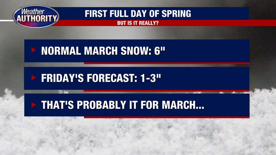
DETROIT (FOX 2) - March snow is not uncommon for us here in Southeast Michigan. In fact, we average a little more than 6 inches every year. But considering how little snow we've seen this year, it seems like any snow is a shock. Which is why this Friday storm system is grabbing some attention!
Before we get to that, let's talk about today. Some snow flurries have already impacted the area, leaving a light coating of snow in spots. This will be a trend that continues through the afternoon before tapering off later today. The colder weather continues through the rest of the work week with highs in the upper thirties and lows between 20 and 25. Thursday will be a mix of sun and clouds yet dry.

Snow flurries possible Wednesday with larger system expected Friday
Could see between 1-3" on Friday.
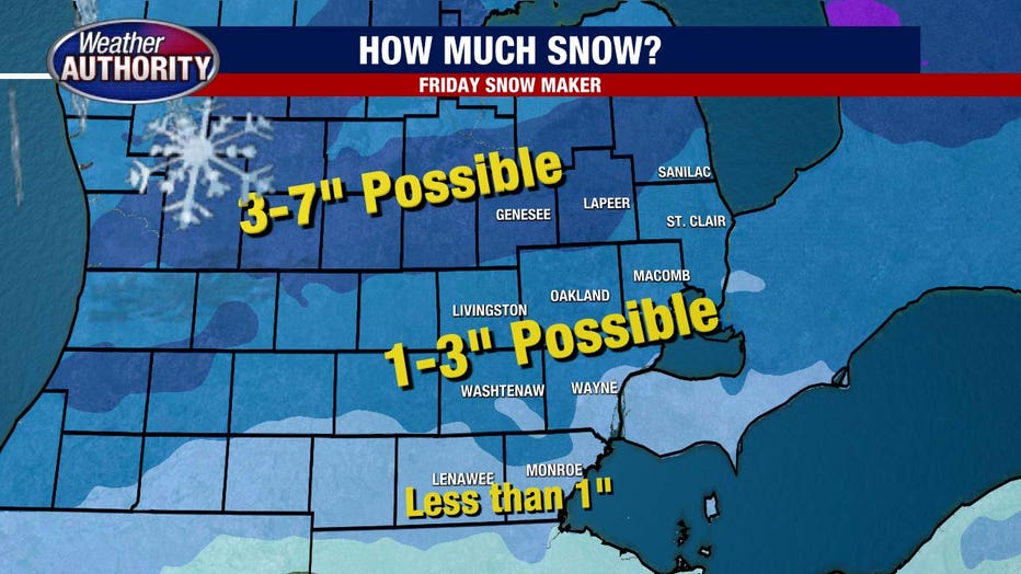
Friday of course has all the eyes on it. A moderate snowstorm will track across Michigan beginning in the morning and continue through the afternoon. Currently, the bullseye is in Mid-Michigan, where spots could see between 3-7 inch of heavy wet snow. The snow totals quickly taper as you move into Southeast Michigan to a more reasonable 1-3 inches.
Specifically northern Livingston, Oakland and Macomb counties will be closer to 3 inches while Wayne and Washentaw will be nearer 1 inch. Areas south, into Monroe and Lenawee will be less than 1 inch.
Snow timing looks between 9 a.m. and 5 p.m. and depending on the intensity of the snow, plan for slower commute times home on Friday afternoon. The weekend will remain chilly, so unfortunately, if it piles up, we're going to have to shovel.
By next week, we're back in the 50s.
Track the weather wherever you are with the FOX 2 Weather App. It's completely free and shows live radar, temperatures, incoming weather, and so much more. It also works anywhere in the world! Wherever you go, take the FOX 2 Weather App with you.