Tropical Storm Cristobal remnants land in Michigan Wednesday; heavy rain expected, hail possible
We've been lucky so far this late Spring/early Summer in our lack of severe weather. That may all change Wednesday.
The remnants of Tropical Storm Cristobal will be the primary culprit here as it travels directly north from where it made landfall in Louisiana to us here in Michigan. These tropical systems bring with them a bunch of moisture (aka rain) and atmospheric instability. Plus, if you've seen a tropical system on a satellite loop you notice it rotates. That's... not a good thing.

Strong and Severe Storms Possible tonight
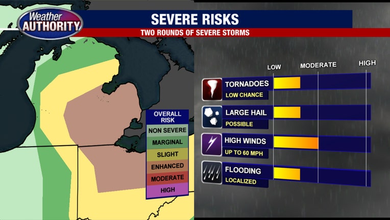
Two rounds of severe weather are possible: late Tuesday night and again Wednesday evening
Beginning late Tuesday night we'll see some storms rise from the south and impact us. These storms have the potential to be strong, possibly even severe, as they move north until roughly 3 a.m. We are expecting several rounds of quick-moving heavy rain, lightning, and gusty winds perhaps as high as 45 mph.
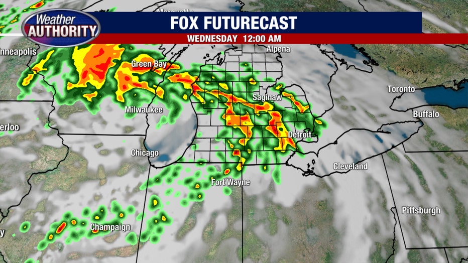
These storms diminish quickly Wednesday morning around 8 but don't let your guard down, there's a lot more are on the way.
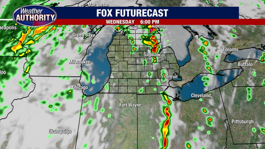
The second round of severe weather will likely be more intense than the first, happening between 4 p.m. and 10 p.m. Wednesday. The continuous spin of what remains of Cristobal combined with the instability of a hot day and eventually a cold front swinging through will bring threats of high winds (nearly 50 mph), damaging hail, lightning, and possible tornadoes.
This is perhaps our highest chance for tornadoes so far this year and it has us here at The Weather Authority on high alert. While impossible to pinpoint exactly where a tornado may form, the Storm Prediction Center (a branch of the National Weather Service) has listed all of SE Michigan as a Category 3 on a 1-5 scale for Severe T'Storms that may produce rotating storms.
Get the FOX 2 News App for live traffic alerts, breaking news, and more
This level of severity extends all the way up to the Thumb.
FOX 2 will be watching for updated information all night long - so keep your phones nearby. And don't forget to download the FOX 2 Weather Authority app for your iPhone and Android. It has live radar, severe weather notifications, and a ton of detailed information. Tap here to get it for free today.
After 10PM the threat for severe storms falls as rain lingers overnight and cooler air filters into Michigan for the remainder of the week.