Rain and snow system upgraded to Winter Storm Warning for SE Michigan

FOX 2 (WJBK) - Hello gang, there is a Winter Storm Warning Friday afternoon, evening and night.
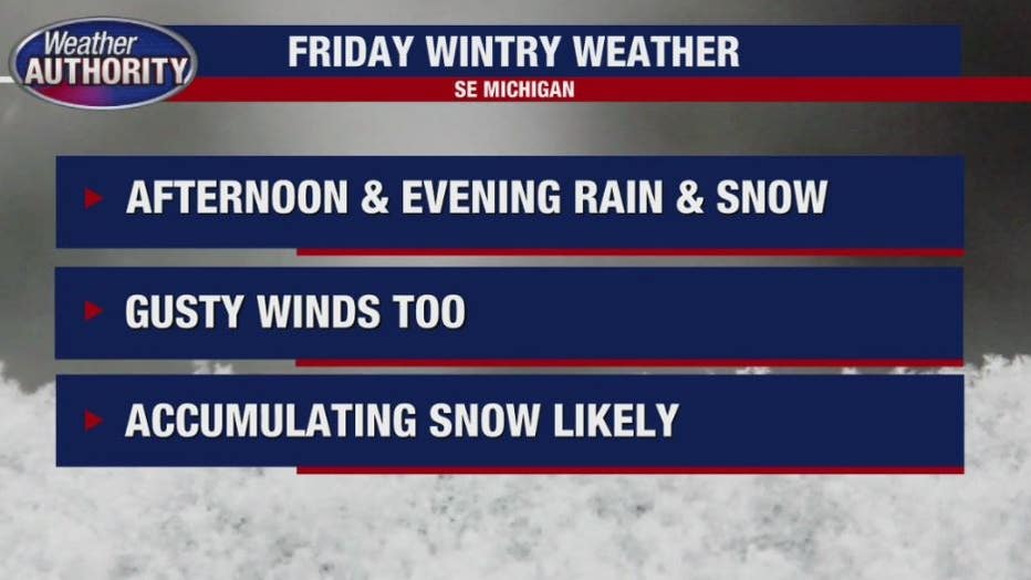
Snow accumulation is likely for the region but many areas will see some rain mixing in at times - which will impact storm totals. The low end of the forecast assures three to five inches most likely. There may be eight inches at the high end for southeastern Michigan.
The National Weather Service is calling for a range of 6 to 10 inches with Livingston, Oakland, Macomb, St. Clair, Washtenaw, Wayne, Lenawee and Monroe counties under the warning.
The NWS is calling for very heavy snow rates on the order of 1-2 or more inches per hour over a three to six-hour period. The peak rates will occur Friday afternoon into Friday evening followed by moderate snow after midnight.
We will see a mix of snow and rain and wind Friday and accumulations are likely.
The wintry mix, mainly consisting of rain will begin at about 2 p.m. with the system turning to snow and at the end of system, the snow is set to end at 2 a.m.
Some school districts have announced closures for Friday - most canceling afternoon sessions. See the list HERE.
For the rest of Thursday evening/night, mostly cloudy, cool and dry with a low near 30.
On Friday: Snow and some rain which could be heavy through the afternoon and evening hours. Windy and cool with a high of 39.
Saturday: Mostly cloudy, breezy and cool with a high of 42
Sunday: Sun and clouds, chilly with a high of 43.
Monday: Mostly cloudy, shower chance and a high of 49.
Tuesday: Partly sunny and a high of 43.
ENJOY,
Luterman