

Weekend Rain Chances
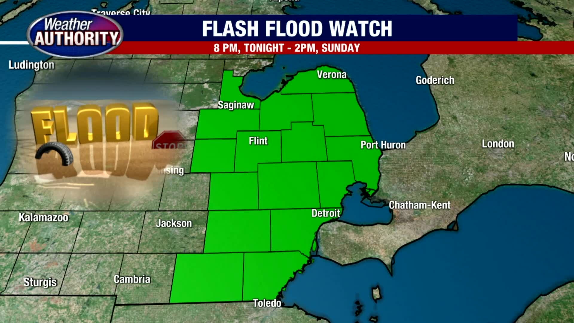
Flash Flood Watch will go into effect at 8pm tonight through 2pm, Sunday. After a beautiful start this Saturday morning, expect a mix of clouds and sunshine this afternoon. With an area of low pressure moving in from the south, look for scattered rain and a few storms to move in by late morning and into the afternoon. By late day Sunday in total, we could pick up between 0.50" to 1.50"+ of rainfall. Highs should top out in the low 80s Saturday and Sunday with highs falling into the 70s by next week.
Flash Flood Watch will go into effect at 8pm tonight through 2pm, Sunday. After a beautiful start this Saturday morning, expect a mix of clouds and sunshine this afternoon. With an area of low pressure moving in from the south, look for scattered rain and a few storms to move in by late morning and into the afternoon. By late day Sunday in total, we could pick up between 0.50" to 1.50"+ of rainfall. Highs should top out in the low 80s Saturday and Sunday with highs falling into the 70s by next week.

Some showers heading in this weekend
Sunday looks wet with some storms
Sunday looks wet with some storms
Sunday Rain and Storm Chances
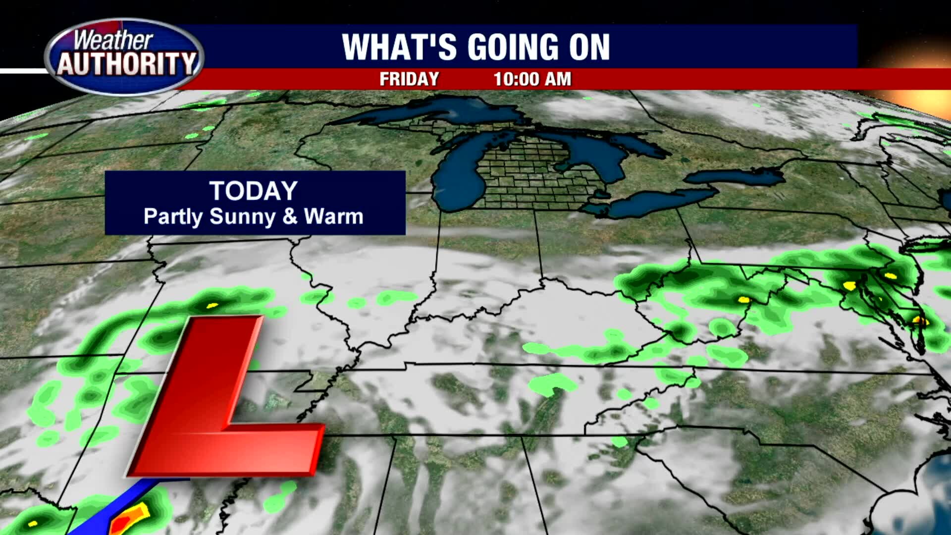
Outdoor plans Friday and Saturday look great. Temperatures should top out in the low 80s today and this weekend. We are keep a close eye on an area of low pressure that is moving toward Michigan from the south. That will eventually bring in scattered showers and thunderstorms late evening Saturday and into Sunday. If you need to get outdoor errands done, I would suggest getting it completed today or Saturday given our rain and storm chances Sunday and lingering into early next week.
Outdoor plans Friday and Saturday look great. Temperatures should top out in the low 80s today and this weekend. We are keep a close eye on an area of low pressure that is moving toward Michigan from the south. That will eventually bring in scattered showers and thunderstorms late evening Saturday and into Sunday. If you need to get outdoor errands done, I would suggest getting it completed today or Saturday given our rain and storm chances Sunday and lingering into early next week.

Fantastic Friday weather with some rain to finish the weekend.
Next week we're cooling down!
Next week we're cooling down!

Colder temps, rain moving in from the west
The humidity was low on Thursday while we're waiting for some wet weather to come our way.
The humidity was low on Thursday while we're waiting for some wet weather to come our way.

'Downhill from here' NWS reminds all of Detroit that warmest summer days are over and winter is coming
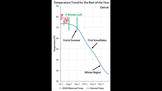
Technically, there's still more than a month left in summer - it ends Sept. 22 - and there's still 4 weeks left in 'meteorological summer, but the National Weather Service said Thursday that our warmest days are behind us.
Technically, there's still more than a month left in summer - it ends Sept. 22 - and there's still 4 weeks left in 'meteorological summer, but the National Weather Service said Thursday that our warmest days are behind us.

A nice end to the week
Less humidity and comfortable temperatures
Less humidity and comfortable temperatures

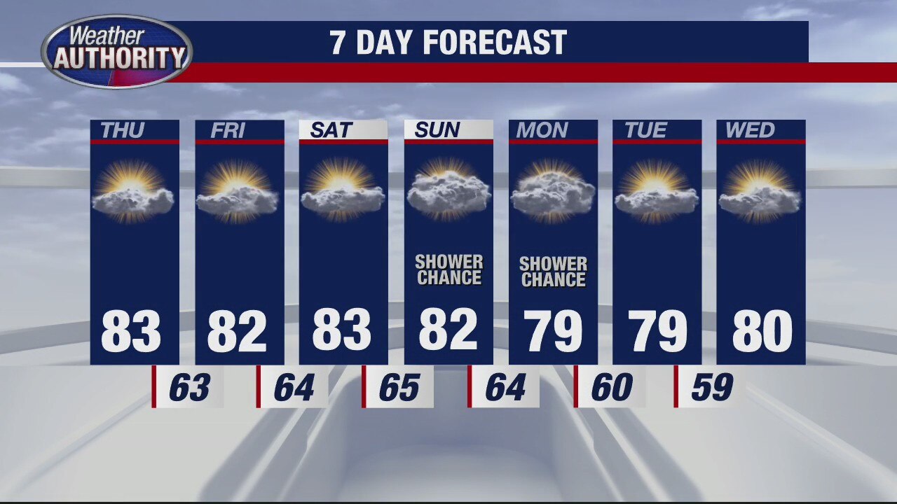
Pleasant weather on the way, rain returns to finish the weekend.
A cooler stretch of weather looks to arrive next week.
A cooler stretch of weather looks to arrive next week.
Great looking stretch of weather ahead
Rich Luterman has the forecast.
Rich Luterman has the forecast.

Some Wednesday wet weather, but don't expect a washout.
Isolated or scattered showers and storms will be around today.
Isolated or scattered showers and storms will be around today.

Warm, but no 90s in sight
Rich Luterman has the forecast.
Rich Luterman has the forecast.

Rain Chances Overnight and Wednesday
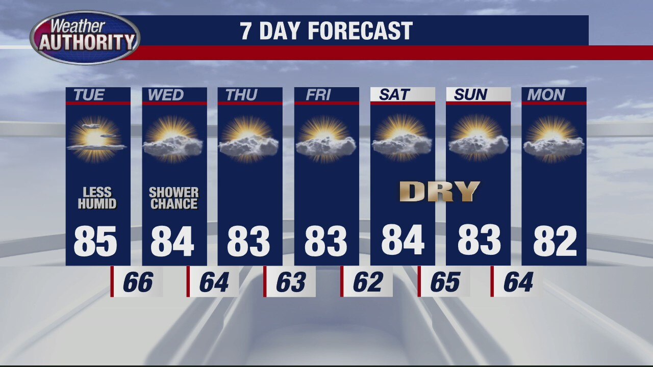
We are off to a beautiful start this Tuesday with noticeably lower humidity. Temperatures should eventually make it into the mid 80s for highs this afternoon with a westerly breeze between 5 to 15 mph. Overnight into Wednesday, a few spotty showers and perhaps an isolated thunderstorm is possible. No severe weather is expected. Temperatures should level out in the low and mid 80s through the end of the week.
We are off to a beautiful start this Tuesday with noticeably lower humidity. Temperatures should eventually make it into the mid 80s for highs this afternoon with a westerly breeze between 5 to 15 mph. Overnight into Wednesday, a few spotty showers and perhaps an isolated thunderstorm is possible. No severe weather is expected. Temperatures should level out in the low and mid 80s through the end of the week.

Huge drop in humidity, not much rain coming.
A few showers are possible this Wednesday.
A few showers are possible this Wednesday.
Less humid for Tuesday
Rich Luterman has the forecast.
Rich Luterman has the forecast.

Detroit Tigers Opening Day Forecast
If you are heading to downtown Detroit around Comerica Park for opening day, bring an umbrella. An isolated shower or storm chance is possible with the passage of a cold front. High temperatures should top out in the upper 80s under partly sunny skies with a west breeze between 10 to 20 mph. By first pitch at 7:10 PM, temperatures should fall into the low 80s with a spotty shower or storm. Our rain threat will diminish as we head through the evening so should the Tigers game tonight run late, rain should not be an issue.
If you are heading to downtown Detroit around Comerica Park for opening day, bring an umbrella. An isolated shower or storm chance is possible with the passage of a cold front. High temperatures should top out in the upper 80s under partly sunny skies with a west breeze between 10 to 20 mph. By first pitch at 7:10 PM, temperatures should fall into the low 80s with a spotty shower or storm. Our rain threat will diminish as we head through the evening so should the Tigers game tonight run late, rain should not be an issue.

Another sweaty day with some relief in sight!
Before the relief arrives, we'll be dodging some storms this afternoon.
Before the relief arrives, we'll be dodging some storms this afternoon.

Hot and Humid Sunday
After a nice and mild morning, get ready for some serious heat and humidity this afternoon. Along with lots of sunshine, we are expecting temperatures to surge into the low 90s this afternoon. Make sure you are drinking plenty of water and wearing your sunscreen. When we make it into the 90s today, it will be the 13th time this year that we have done so. Temperatures will be warm tonight only falling into the mid 70s. Showers and storms are expected with the passage of a cold front on Monday. A few of the storms that develop could be heavy and strong at time with highs in the mid 80s. Rain and storms could impact Opening Day for our Detroit Tigers.
After a nice and mild morning, get ready for some serious heat and humidity this afternoon. Along with lots of sunshine, we are expecting temperatures to surge into the low 90s this afternoon. Make sure you are drinking plenty of water and wearing your sunscreen. When we make it into the 90s today, it will be the 13th time this year that we have done so. Temperatures will be warm tonight only falling into the mid 70s. Showers and storms are expected with the passage of a cold front on Monday. A few of the storms that develop could be heavy and strong at time with highs in the mid 80s. Rain and storms could impact Opening Day for our Detroit Tigers.

Hotter Sunday, Rain On The Way
Meteorologist Lori Pinson has your forecast
Meteorologist Lori Pinson has your forecast
Beautiful Weekend Ahead
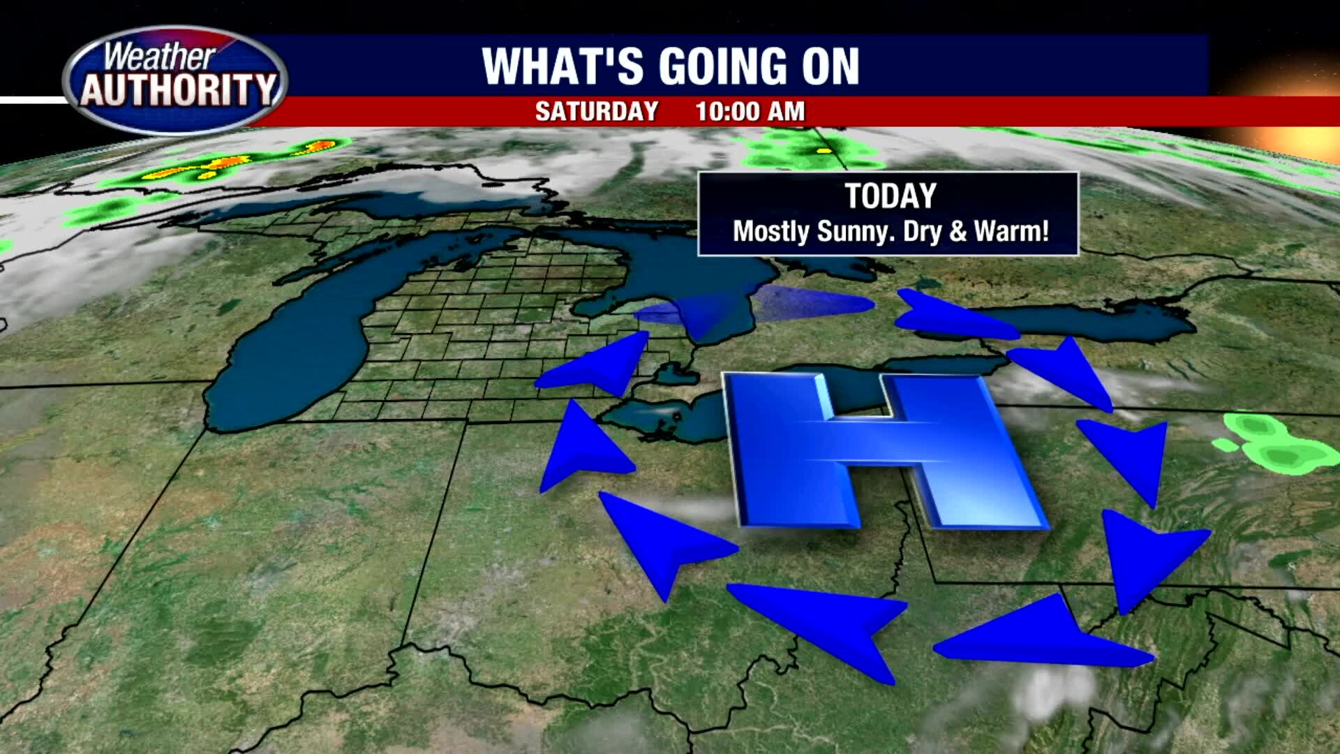
We are off to a nice and mild start this Saturday morning with patchy fog in a few spots. Heading toward lunch time, temperatures will rebound nicely into the low 80s before topping out in the mid and upper 80s this afternoon under mostly sunny skies. If you are heading to the beach, do not forget your sunscreen and water. Sunday looks equally as nice with lots of sunshine and temperatures rocketing into the low 90s with more humidity. Showers and thunderstorms are expected along a cold front that is set to move through Monday. A few of the storms could be heavy and strong, so we will make sure to keep an eye on that. Otherwise, enjoy the sunshine and warm air this weekend.
We are off to a nice and mild start this Saturday morning with patchy fog in a few spots. Heading toward lunch time, temperatures will rebound nicely into the low 80s before topping out in the mid and upper 80s this afternoon under mostly sunny skies. If you are heading to the beach, do not forget your sunscreen and water. Sunday looks equally as nice with lots of sunshine and temperatures rocketing into the low 90s with more humidity. Showers and thunderstorms are expected along a cold front that is set to move through Monday. A few of the storms could be heavy and strong, so we will make sure to keep an eye on that. Otherwise, enjoy the sunshine and warm air this weekend.

Weekend Warm Up
We are in store for a beautiful end to our workweek with temperatures in the mid 80s along with a mix of sunshine with a few clouds. It will be a great afternoon to get out and enjoy one of our local parks in town. Temperatures should fall into the mid 60s overnight under mostly clear skies. Mostly sunny skies are expected once again on Saturday with highs in the upper 80s. Low 90s are back by Sunday with scattered rain and storms in our forecast by Monday.
We are in store for a beautiful end to our workweek with temperatures in the mid 80s along with a mix of sunshine with a few clouds. It will be a great afternoon to get out and enjoy one of our local parks in town. Temperatures should fall into the mid 60s overnight under mostly clear skies. Mostly sunny skies are expected once again on Saturday with highs in the upper 80s. Low 90s are back by Sunday with scattered rain and storms in our forecast by Monday.