

Cold to slowly lift Tuesday before a pair of messy weather days in Metro Detroit
The cold will slowly ease, but Thursday is the day to watch.
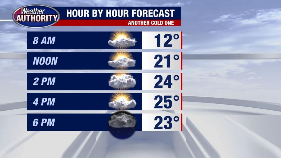
A cold day with skies drifting between mostly cloudy to partly sunny.
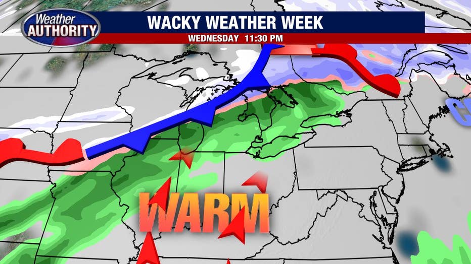
Temperatures increase overnight and will top out close to 50 Wednesday with a wind you'll notice and rain showers by the end of the day.
The rain will increase in coverage and intensity Wednesday night.
Rain will turn to snow at some point Thursday with both sleet and freezing rain possible in between. Everything I've said to this point has high confidence.
The rest becomes a bit murkier as there are basically two camps showing up in the data. One bringing higher snow totals our way and the other cutting those totals down with sleet and ice.
There is no reason to choose one over the other, so for now, I'll shoot right down the middle and leave you with 2-5 inches of snow Thursday, but do know those numbers will likely change as the picture becomes more clear.

Your takeaway is rain late Wednesday turning to snow Thursday with sleet and ice in between.
Totals remain to be seen, but a mess looks like a good bet Thursday.