Detroit Halloween forecast: first snow of season possible
SOUTHFIELD, Mich. (FOX 2) - Halloween is here and unfortunately, it's going to be a very wet, cold, and even a bit snowy All Hallows Eve in the Detroit area.
The average date for the first snowfall in southeast Michigan is November 17. This year, it could be earlier... much earlier. As in, Thursday night, October 31st.
It's a combination of two weather systems colliding together right over us. Tropical moisture is moving up from the south, while cold air is rushing in from the Rockies.
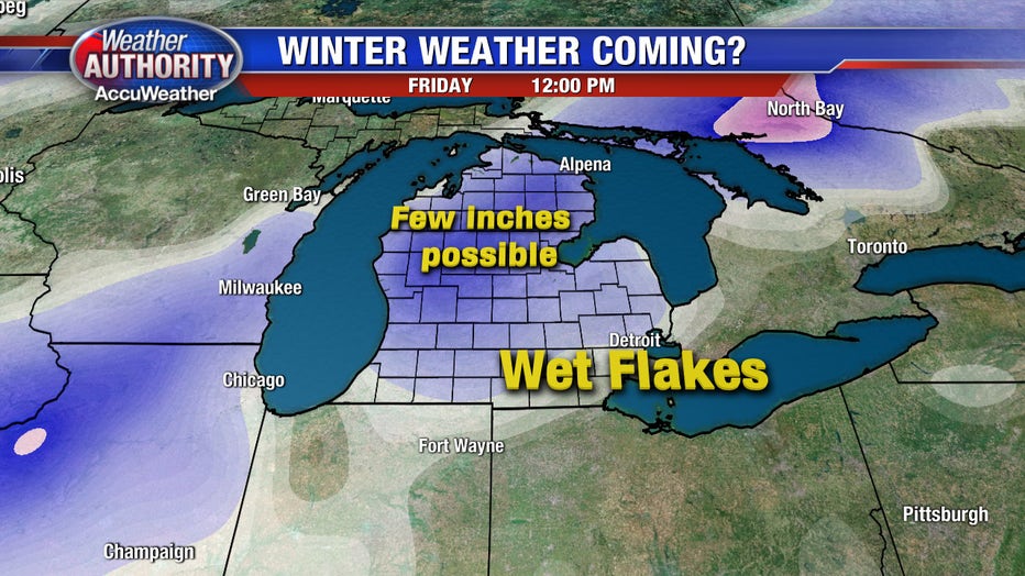
The key ingredient is the cold air. Will it wrap up into the rain enough to transition it to snowflakes? It looks like it might, especially for central and northern Michigan.
Southern Michigan has a better chance of seeing wet snowflakes mixing in with the rain but it isn't out of the question for a light coating to end up on grassy surfaces in some spots.
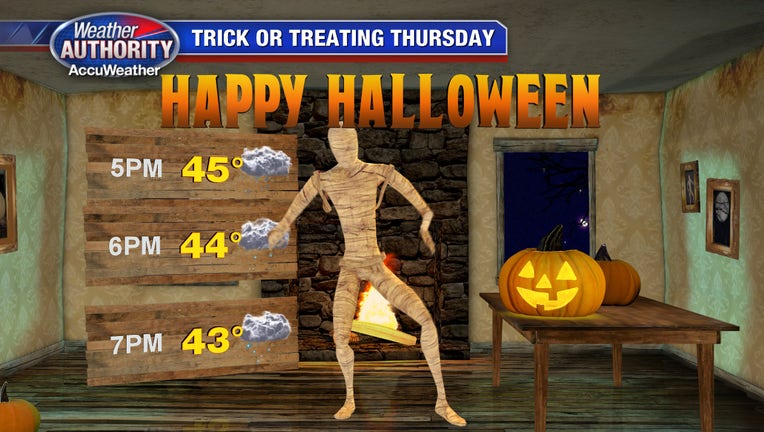
As for Trick-or-Treat Weather: it's going to be wet and it's going to be chilly. Thursday will be rainy almost from beginning to end so the kids will need to cross their fingers to get a break while they collect candy. Temperatures will be in the middle and lower 40s throughout the whole evening so get some hot cider ready when the little ones get home.
While you're out Thursday night, check out the FOX 2 Weather App to track the radar and the snow if you live west of the Detroit metro area.
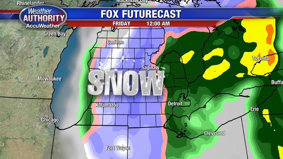
The transition to snowflakes will likely happen around midnight Friday morning and last until about 6 a.m. At that point, the weather story will change from snow to very strong wind. Winds will be gusting to nearly 35 mph most of the morning and into the afternoon. With a Friday high temp near 44, it will be quite cold!
Good luck, have fun and stay warm!