Heavy storms hit Southeast Michigan by mid-morning with occasional showers in the afternoon

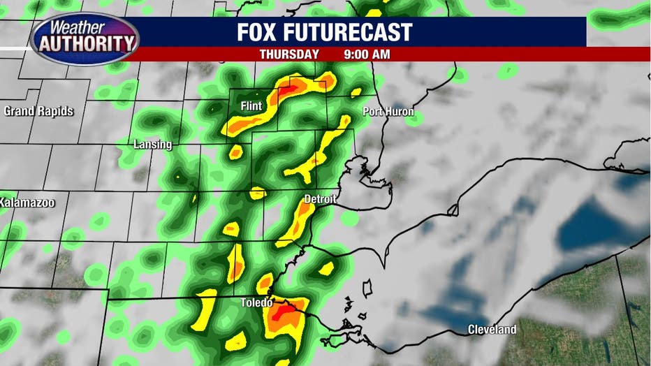
Thursday morning showers and storms!
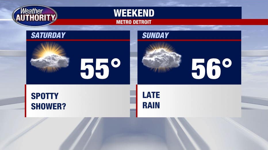
The cold front ushers in colder air Friday through the weekend.
The wet weather arrives! We've had some rain overnight and early this morning with the main event yet to come.
A solid line of rain with embedded thunder and heavy storms within it will move through Southeast Michigan centered on mid-morning. Here's a snapshot of 6-9 a.m. and you'll notice most of the area with the wet weather at that time.
We'll see a lull in the action behind the initial push of moisture with a few showers redeveloping this afternoon and lasting into the evening before tapering off overnight.
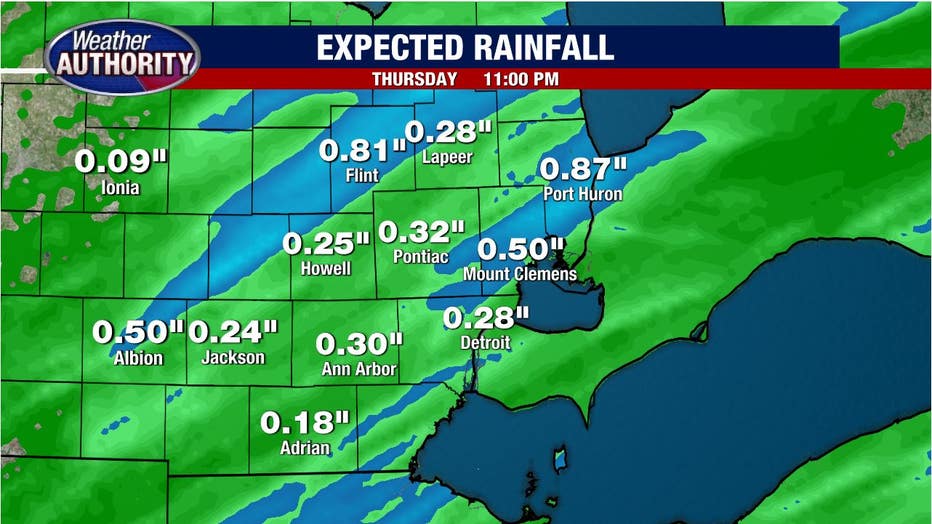
Rain totals should be around .25 inches with some spots picking up .5-1 inch considering the potential for heavy rain within the morning storms.
Cooler air rushes in and temperatures top out in the 50's Friday through the weekend.
Rain chances look limited this weekend, but I'll still keep at least the off-chance for a spotty shower in the Saturday forecast with rain arriving late Sunday but more likely Sunday night.