

Labor Day weekend ends with pleasant weather, storms expected Tuesday night
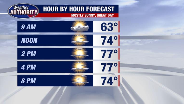
Plan for a gorgeous day to wind down the extended holiday weekend.
Overnight clouds and showers tied to a shortwave will end as that wave moves east, allowing for mostly sunny skies and temperatures climbing into the 70s this afternoon with a bit of a breeze out of the west at 10-20 mph developing.
Weather will remain calm tonight with lows falling into the 50s leading to a nice start to your Tuesday.
Tuesday morning will be dry with storms arriving late in the day ahead of a cold front, which means the day will turn warmer and more humid with high temperatures in the 80s.
Here's a look at one of our in-house models showing a line of storms knocking on our doorstep late Tuesday.
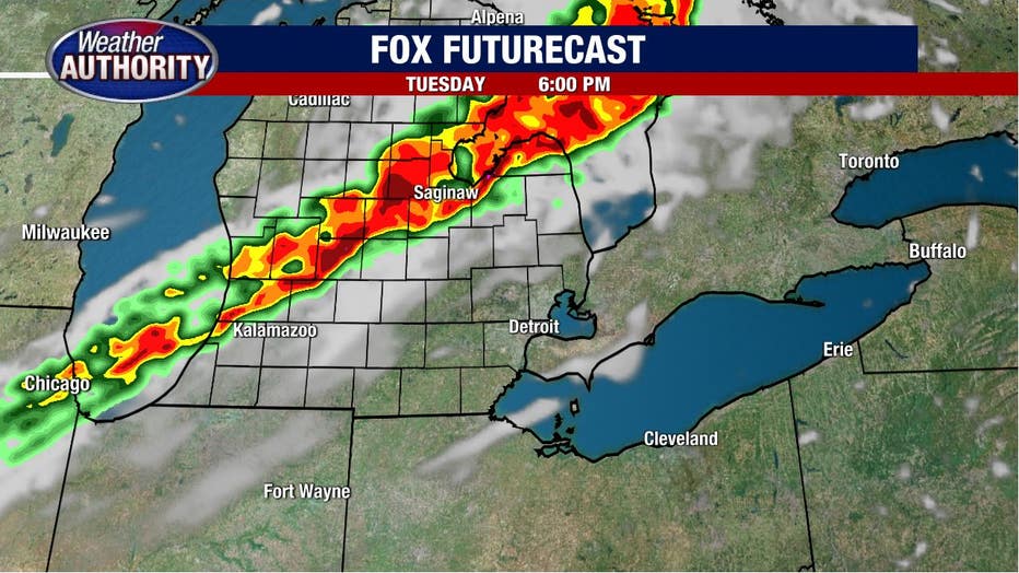
They'll work through the area by evening and last through the first part of the night.
There is a marginal to slight risk (1 and 2 on a scale of 1 to 5) for severe weather.
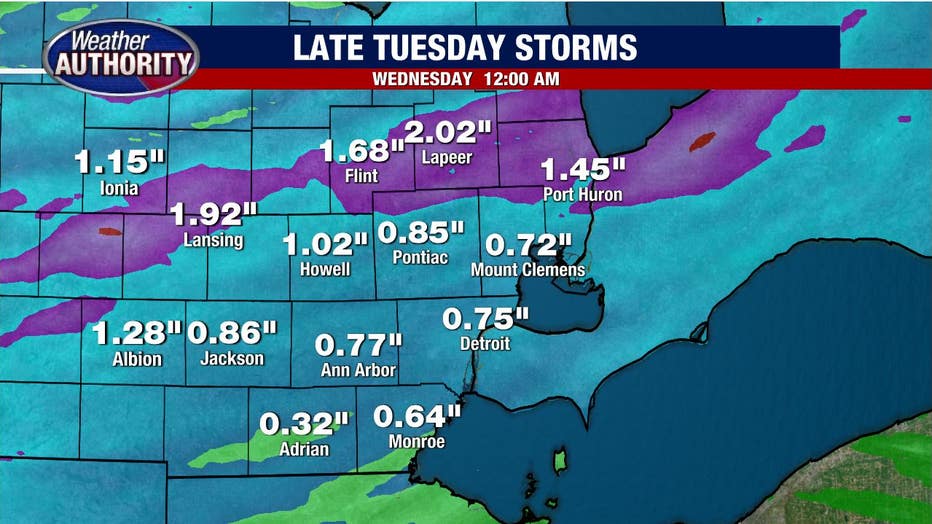
Strong winds and large hail will be the greatest risks with rain totals between .25 inches - 1.50 inches with localized higher totals possible.
Temps will cool beyond Tuesday with nothing more than a spotty late-day shower possibly Wednesday and Thursday.