

Metro Detroit weather: Another foggy start to a dry day before the rain arrives
Dense Fog Advisory
Patchy dense fog is bringing the visibility down to 0 in some locations. Give yourself extra time if you're headed out this morning. Rain moving in overnight. Meteorologist Lori Pinson has your forecast.
DETROIT (FOX 2) - Foggy conditions again this morning with a bit more coverage.
A Dense Fog Advisory is in effect until 10 a.m. for Lapeer, Livingston, Macomb, Oakland and St. Clair counties. Several cities are reporting reduced visibilities. Zero visibility from Port Huron to Pontiac and Windsor, south to Adrian.
Allow yourself extra time and use your low beams. When you use your high beams, light reflects off the droplets in fog, reducing visibility. Low beams are better. Light is directed down, resulting in less reflection and better visibility. This radiational fog forming when the ground cools rapidly overnight (our high temperature yesterday was 53 degrees) under clear skies with a light wind.
That light wind keeps wind chills in check this morning. But watching those cities with readings below freezing. Lapeer and Port Huron have temperatures in the 20s this morning. Freezing fog becomes a concern there as the water droplets from the fog settle on a surface with below freezing temperatures. That could produce some slick spots.
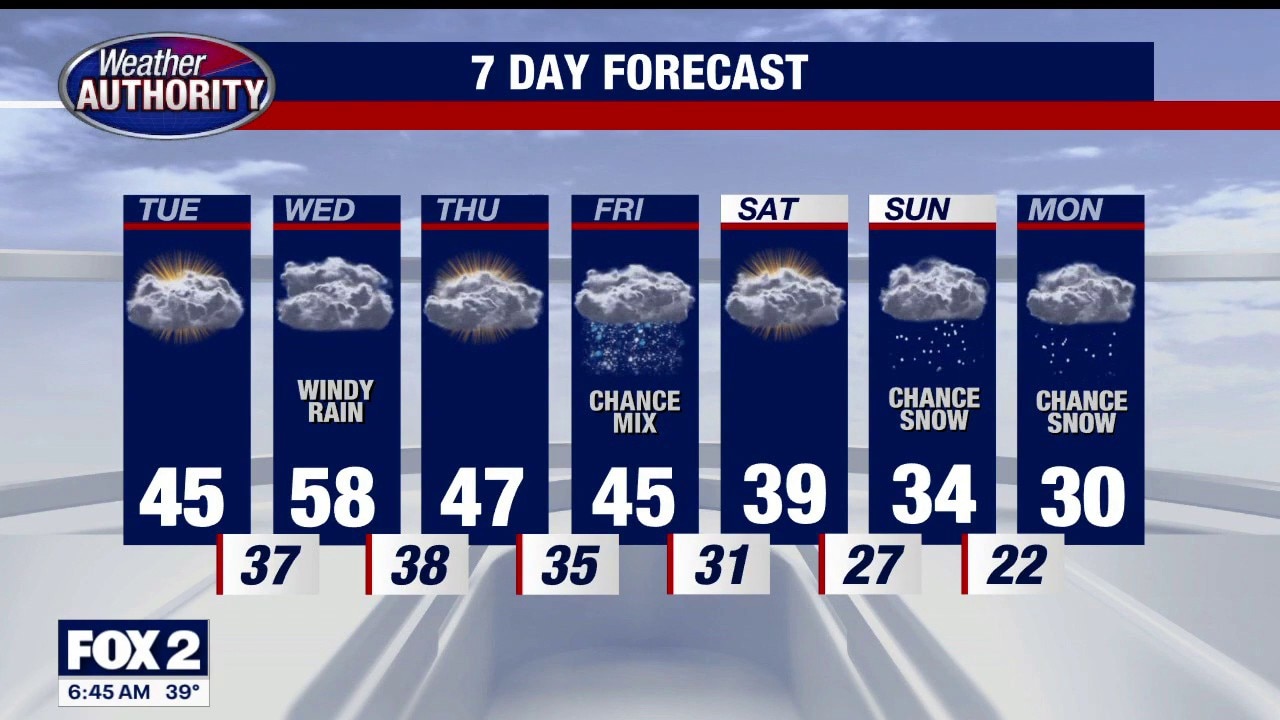
Cloudy and dry today with rain developing overnight extending into your Wednesday morning commute. Highs Wednesday could be near 60 degrees. Behind the exiting system, temperatures will fall, reminding us it’s winter.
Snow is in the forecast for Sunday and Monday.