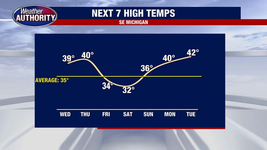
Metro Detroit weather: Dry day before next band of snow Thursday

Sunny day before snowy Thursday
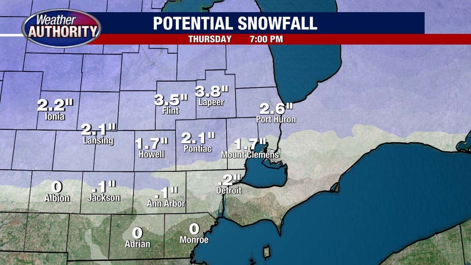
Snow is back in the forecast for Thursday. Totals vary depending on where you are, and temperatures in the 40s will impact those totals.
The sun will show herself again today as high pressure sweeps into the Great Lakes, setting the stage for our next weather maker.
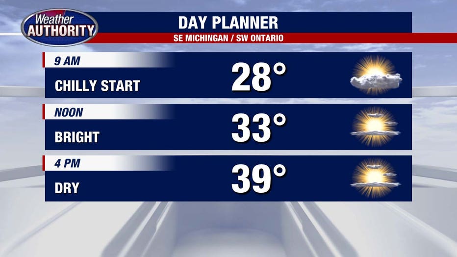
As we look ahead, a weather transition is on the horizon. Starting Thursday morning, between 7 and 9 a.m., we anticipate the arrival of snow in the north and rain in the greener southern regions. This marks the beginning of a few hour stretch of dynamic weather.
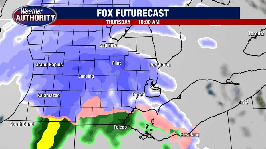
The flurry of activity winds down by early in the afternoon and there will be melting involved as temps head for 40° by day's end. Snow totals will range: higher north, lower south. I-94 from Detroit to Ann Arbor and south, I'll say an inch or under, with 1-3" north to I-69 and higher numbers up into Sanilac County.
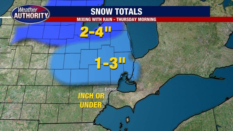
Here's a more detailed look at snow potential:
We'll turn colder Friday and that feel will stick for the weekend.
Track the weather wherever you are with the FOX 2 Weather App. It's completely free and shows live radar, temperatures, incoming weather, and so much more. It also works anywhere in the world! Wherever you go, take the FOX 2 Weather App with you.