

Metro Detroit weather: Scattered Thunderstorms move in Monday afternoon

Thunderstorms in the Monday forecast
After beautiful weather this weekend in Metro Detroit, thunderstorms will move through the area Monday.
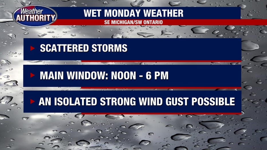
DETROIT (FOX 2) - After a gorgeous weekend, we'll shift things up a bit today. Scattered storms develop this afternoon as a muggier air mass seeps in.
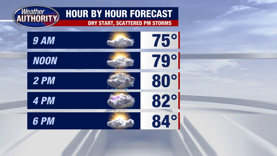
Our main window for storms will be noon - 5 p.m. and while I don't anticipate an overwhelming severe threat, an isolated severe wind gust can't be ruled out. The Storm Prediction Center has SE Michigan under the lowest risk category.
The cold front pushes east overnight and high pressure builds in leading to a cooler and drier Tuesday. That feel does not last long with high heat coming Wednesday.
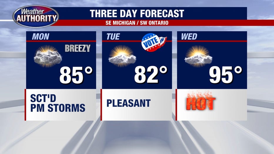
A stray morning storm Wednesday can't be ruled out as the warm front lifts back in, but a better bet for storms will be Wednesday night and Thursday as the cold front gets hung up around the Michigan/Ohio border. That front will be the focus for multiple rounds of rain. I'll keep a chance for storms for Thursday, but optimistically say the front sage south to finish the week.