

Rain continues for east Michigan Monday making for slick morning driving

Chilly Week Ahead
Frost Advisory overnight for temperatures in the 30s. Below average readings continue for Sunday with the added threat of rain. Meteorologist Lori Pinson has your forecast
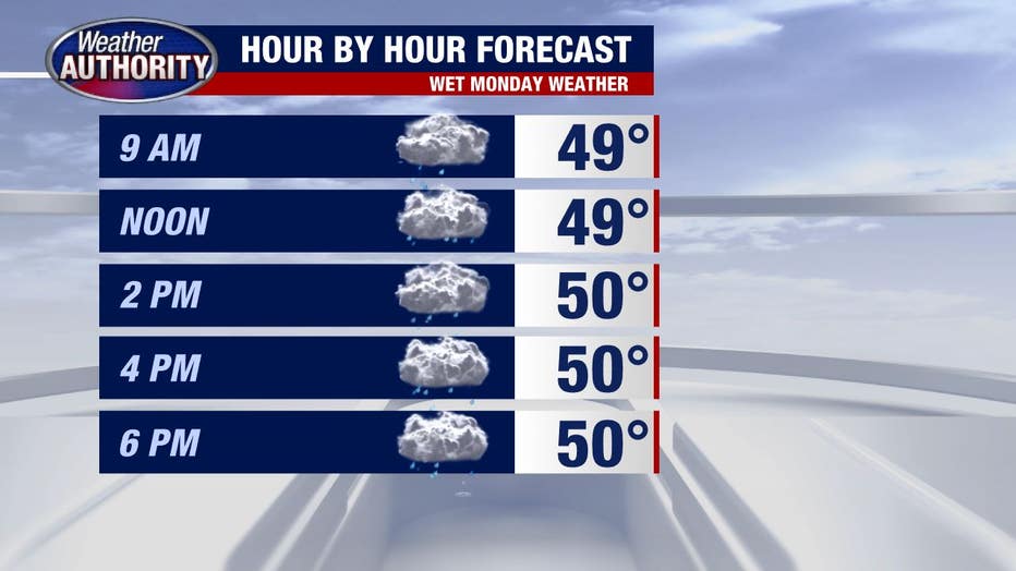
Wet weather wins the day! After a wet night, more rain is falling across Southeast Michigan and for now, it's light.
Heavier rain may show itself at times through the morning commute leading to slick travel and possibly some water-covered roads.
Rain will stick around most of the day but it looks like we see a bit of a lull late afternoon and evening.
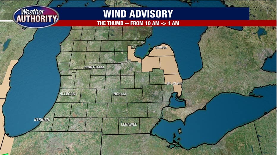
The rain is courtesy of low pressure which will act to kick up the wind out of the Northeast.
Wind gusts up to 45 mph are likely along the shores of Lake Huron in St. Clair County up to the thumb leading to a wind advisory in those locations.
The rest of us will feel the wind and it won't be nice, considering the wet and cool weather. But gusts up to 25 mph won't warrant an advisory.
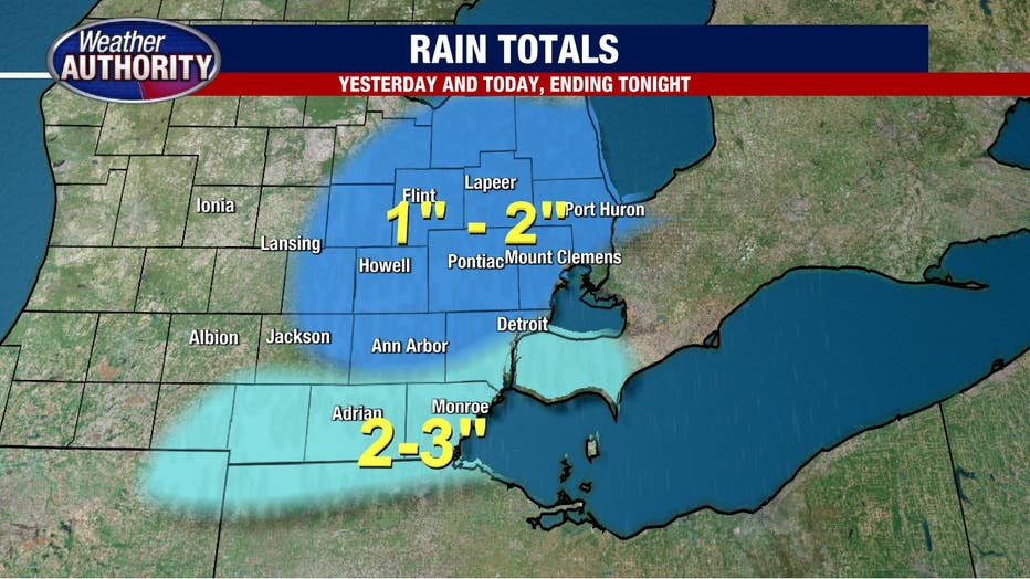
Rain totals for today look to be half-an-inch to an inch and we will still likely wind up with 1-3 inches accounting for what fell yesterday and overnight.
The lowest numbers will be to the north and the highest totals coming in our southern communities. Low lying areas with spots with poor drainage may have some issues, but overall flooding concerns are minor.
We'll wake up to a mainly dry Tuesday with nothing more than a spotty shower leftover and we'll carve out a dry midweek with another system set to arrive Thursday night and last into Friday bringing our next round of rain.
That will spill into Saturday, but this morning's data (fingers crossed tightly) paint a dry Saturday afternoon. Stay tuned.