Snow this weekend? Cooldown heading for SE Michigan offers a chance

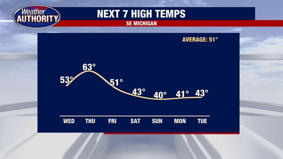
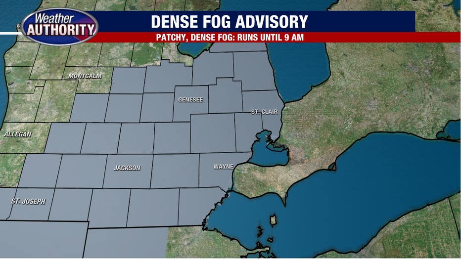
Wednesday morning fog, dense in spots, then the 50's and 60's ahead of a huge weekend cooldown.
A dense fog advisory is in effect until 10 am.
A dense fog advisory is in effect for all of Southeast Michigan through 10 a.m. Visibility is great in spots and awful in others. Plan on quickly changing visibility through the commute.
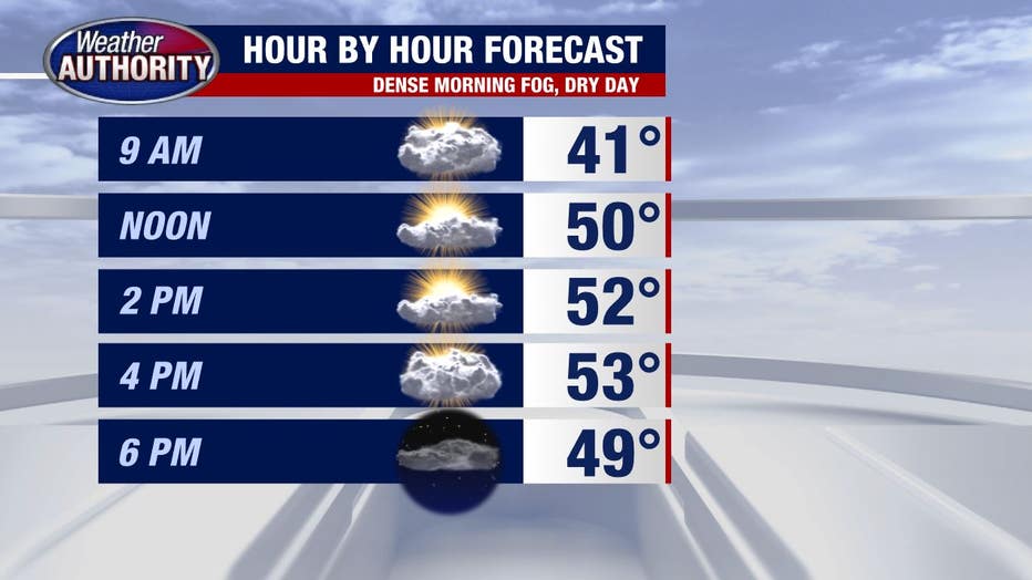
Once we move past the fog, no issues through the day as some sun will poke through and we'll squeeze out a dry day ahead of our next rainmaker.
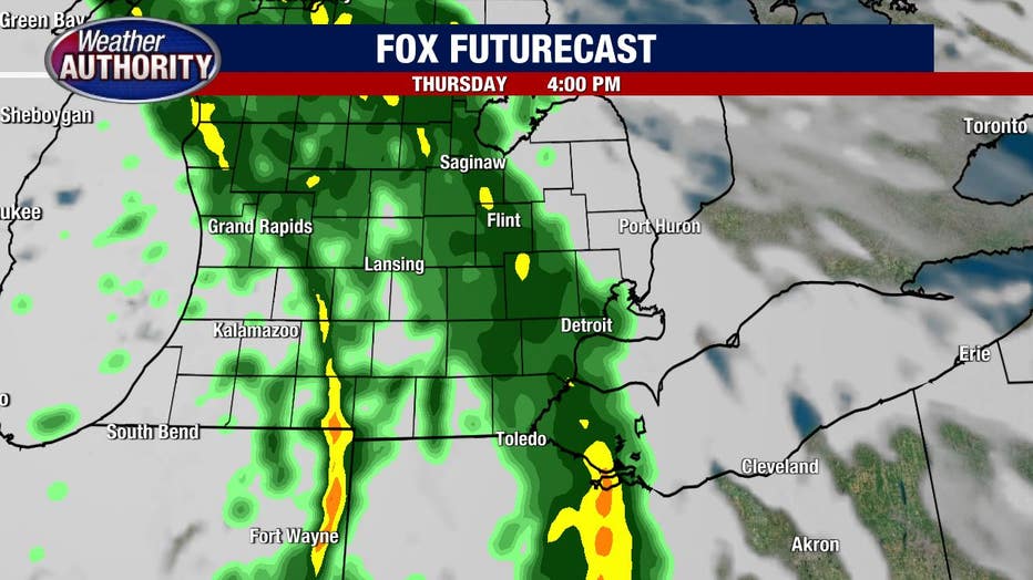
Nothing more than a spotty shower will fall tonight, leading to a dry Thursday morning, but Veteran's Day will finish wet.
The wind picks up as low pressure winding up out west will draw in warmer and wetter weather. Rain totally looks to be around .25-.50 inches. Check out FOX Futurecast afternoon on your Veteran's Day.
And that's the last of the warm weather for a while. Temperatures take a dramatic turn towards winter beginning Friday and lasting through the weekend.
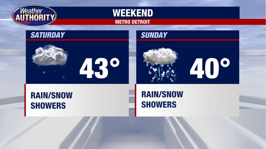
Rain and snow showers will be around over the weekend with at least the potential for our first minor accumulating snow of the season come Sunday as a system drops from the Great Plains into the Great Lakes (some snow for us) or the Ohio Valley (snow to our south).
It will act to keep the cold around into next week.