

Summer heat returns with temperatures back in the 80s, storms expected Tuesday night

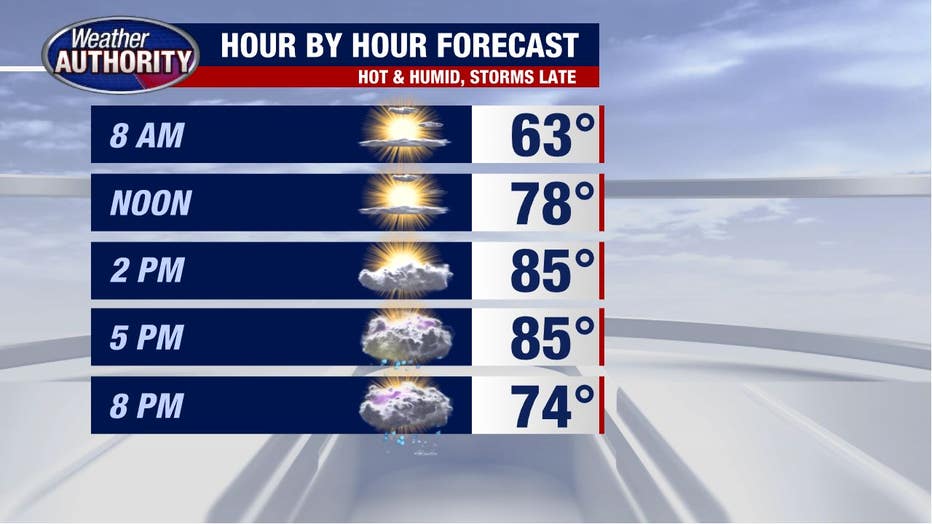
Tuesday forecast: cool start, hot finish with storms on the way!
Severe weather is possible late this afternoon and evening.
After a cool start to the morning, summer's making a comeback!
We're back to the 80's by afternoon with a big increase in humidity and windy conditions developing out ahead of an approaching cold front.
A solid line of storms will develop ahead of the cold front and blow through late in the day. Here's a look at 4 p.m. at which point some of our northern and western communities may be seeing the storms begin to move in.
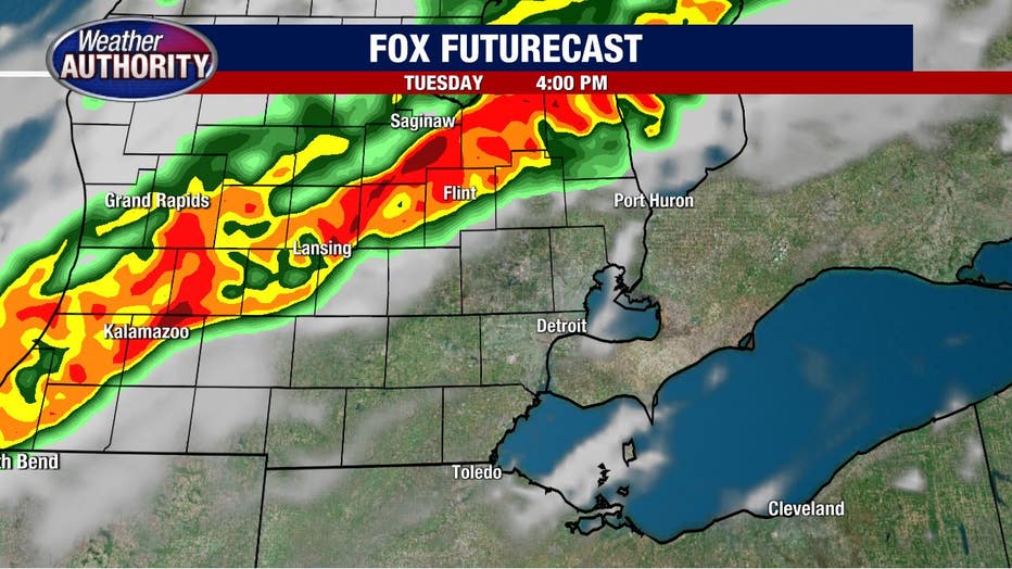
The storms will be moving south and east and by 8 p.m. the storms will be impacting most if not all of Southeast Michigan.
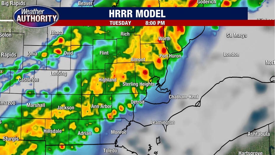
We'll wind things down around or before midnight and the rest of the night will be quiet.
The storms look to be likely for everyone, with severe weather possible. The Storm Prediction Center has all of Southeast Michigan in a marginal and slight risk for severe weather. That's a 1 and a 2 on a 5 point scale.
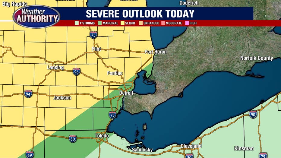
Strong wind will be the greatest threat with localized flooding rains possible. The threat for a tornado is quite low, but not zero.
Once the front clears the area, the remainder of the week will be cooler and drier with nothing more than a spotty late day shower possible Wednesday and Thursday (which most of us won't see!).