

Temperatures climb into the 40s in Southeast Michigan before rain Monday night
We'll get an early-week warm-up that turns colder by midweek and possibly snowy by Friday.
Monday morning will be dominated by 20s and 30s with afternoon temperatures in the low 40s and an abundance of high clouds which may allow for some sun to make it through.

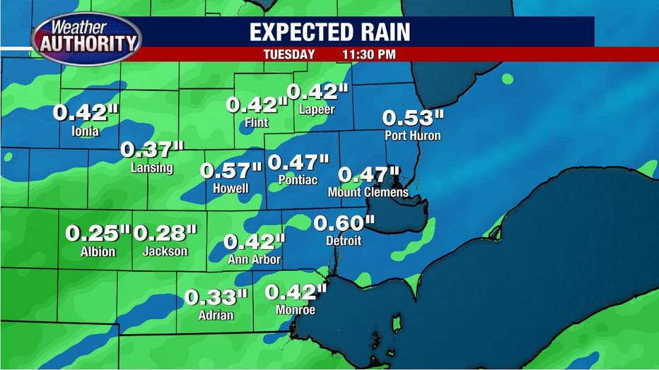
By the evening, rain showers will dot the region and continue overnight right on into Tuesday before ending. Rain totals look to range from .30-.50 inches.
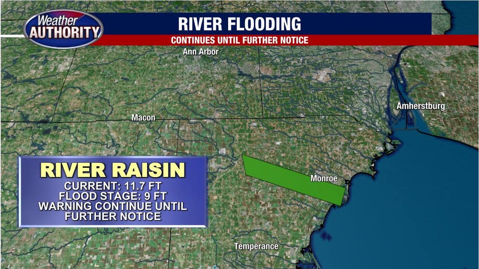
Factor in our melting snow and area creeks, streams and rivers will likely rise.
Which isn't the greatest news in Monroe County, where ice jams are contributing to river flooding, which will continue until further notice.
The rain will end by Tuesday night with colder air returning midweek and sticking around through the weekend.
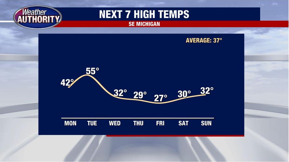
Low pressure moves into the Ohio Valley by the end of the week, leading to our next chance for snow.
It's several days away, so plan for changes, but as things stand at the moment, minor accumulations are likely Thursday night/Friday.