

Temperatures sink to the low 70s for Metro Detroit, spotty showers possible

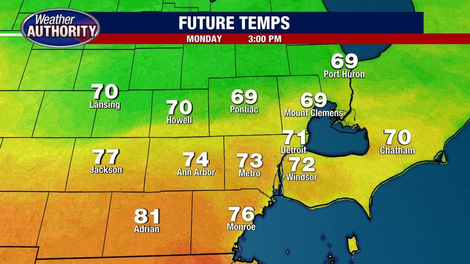
After a hot finish to the weekend with highs of 84 degrees, we'll take a step back today with temperatures topping out in the 70s for most of us.
It might reach the 80s in our extreme southern communities while some of our northern locales will be stuck in the 60s.
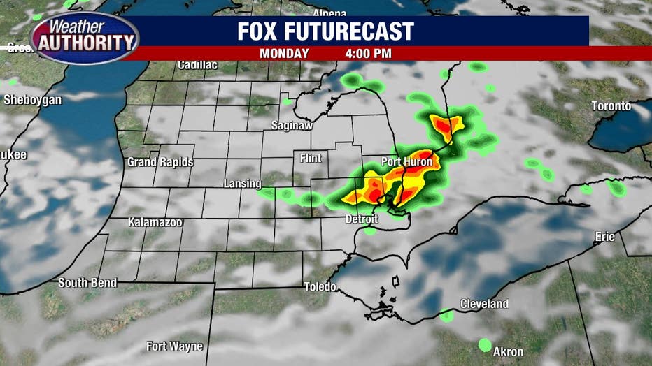
I don't expect much rain this morning with just a few spotty showers possible. I'd bet a little more on a few storms to fire up this afternoon.
While the chance exists area-wide, I would say the areas most favored are north. Here's a snapshot of what one of our in-house models is projecting this afternoon. Notice the storms north.
This picture isn't a perfect depiction of what will happen, rather an illustration of a general trend.
Our storm chances should quiet down overnight and we will begin Tuesday dry with a cold front back to our west.
Ahead of the front temperatures will zip back up to the 80s with humidity set to rise.
Much of the day will be dry and windy with a line of storms set to roll into Southeast Michigan sometime late in the afternoon, or more likely, the evening.
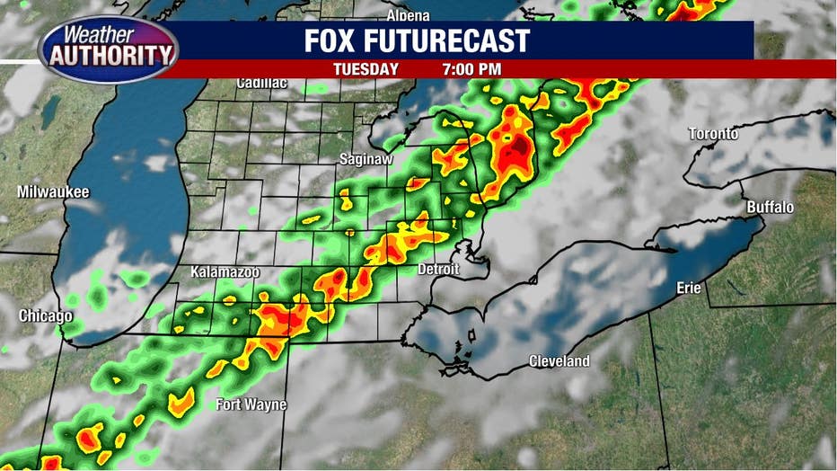
Damaging winds or hail will be possible with any storms that form today but I wouldn't call severe weather likely.
We are under a marginal risk which is a 1 on a 5 point scale.
Severe weather is a bit more likely with the storms that move in Tuesday evening as we are under a slight risk (a 2 on a 5 point scale) for severe weather.