Temperatures trend up the rest of the week with rain and storms growing more likely over the weekend

(FOX 2) - Wednesday brought some intense rain (and hail!) in some spots thanks to afternoon and evening storms. Those are now in the rearview mirror as we look ahead to the next 48 hours.
Plan on a much drier stretch!
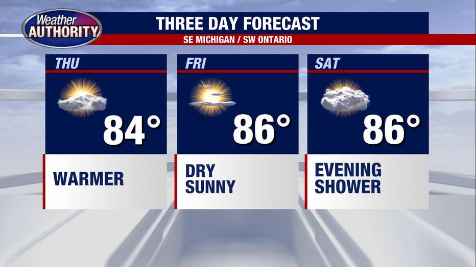
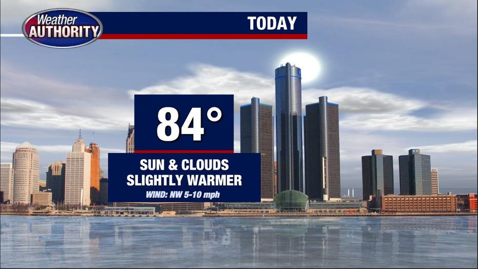
Thursday will be hotter with high temperatures reach to nearly 84 degrees. Rain won't be an issue, but some morning fog may linger before giving way to partly cloudy skies.
Overall a nice day as humidity remains a non factor.
Friday will continue the trend of "hotter" as highs climb to about 86 degrees. It will again remain dry as we wrap the work week up and head into the weekend.
Saturday still looks hot and muggier, meaning the 86 degrees will feel closer to 89 or 90. Folks headed to Woodward for the Dream Cruise should remind themselves to bring water and sunscreen (and maybe an umbrella?).
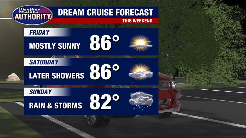
Spotty showers will begin to develop after 2 p.m. with precipitation chances getting higher still after 6 p.m. Some rain could be heavy, and we may even see a few storms popping up.
Sunday is wetter still, as rain showers and storms affect us on and off most of the day.
READ NEXT: West Nile Virus found in Michigan blood donor
People with outdoor plans should keep an eye to the sky (and the other eye on the Fox 2 Weather App) as the rain comes and goes. The unsettled weather hangs around until at least Tuesday.