Heat advisory in effect as heat index approaches 100 degrees Wednesday

A midweek heat advisory as our afternoon heat index approaches 100°
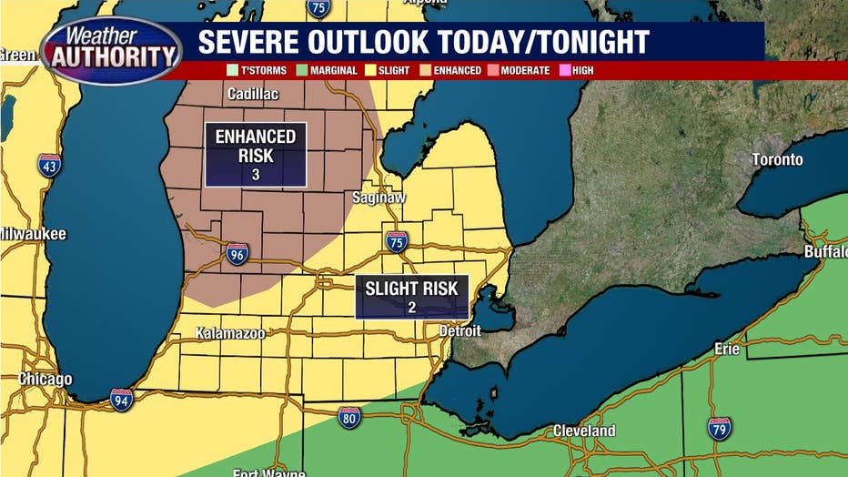
More storms possible tonight with severe weather possible
The heat and humidity keep cranking!
There is a heat advisory is in effect for most of Southeast Michigan as afternoon heat indexes approach 100°F.

There is a bit of wet weather early this morning coming to a close with nothing more than an isolated shower or storm for the morning commute.
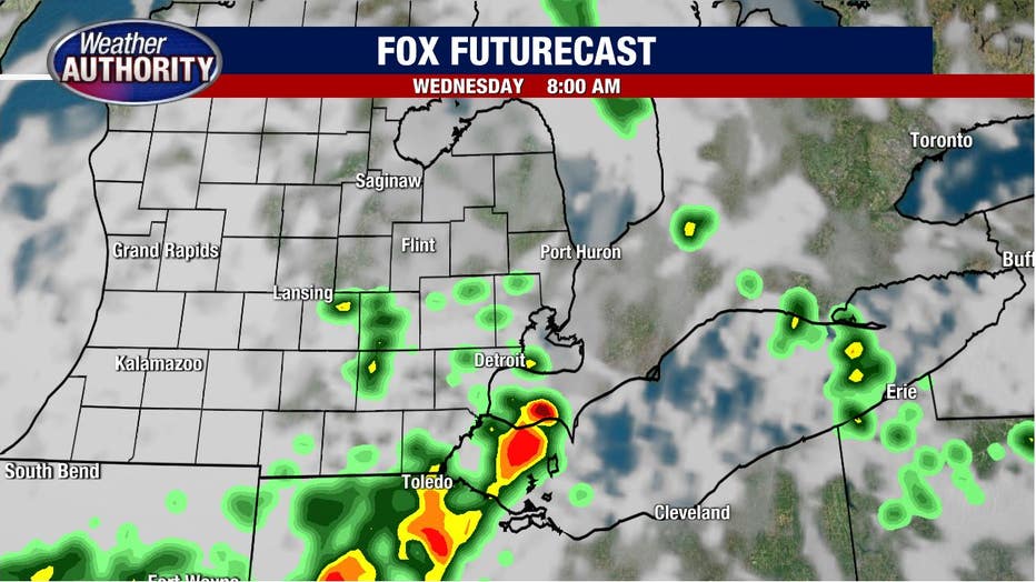
Our afternoon will be hot and humid with an isolated storm possible mid-to-late afternoon, which means most of the day will wind up dry.
Meanwhile, another round of storms will be rocking to our north and west.
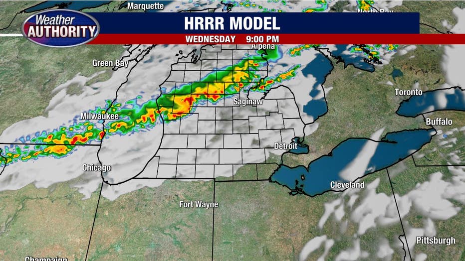
Those will once again try to make it into Southeast Michigan tonight and if they manage to maintain their strength will pose a risk of damaging winds.
Some data breaks them up totally before they arrive in Southeast Michigan, so this is again not a sure thing we get the severe weather, yet the Storm Prediction Center has Southeast Michigan under the slight risk for severe weather with greater chances lying to our north and west.
The heat and humidity will remain in full force Thursday with an ill-defined storm chance remaining as a cold front approaches and gets hung up on Friday, keeping rain showers in the forecast.
Come the weekend all of our rain talk will be over for a while. Gorgeous weather is on tap Saturday and Sunday.