

New interactive Great Lakes map reveals shipwrecks around Michigan
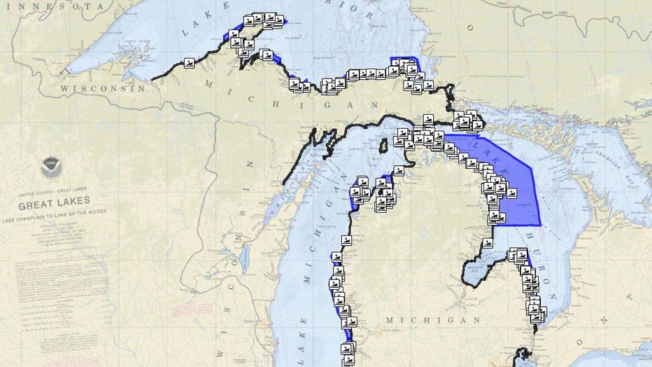
LANSING, Mich. - A new interactive map highlighting some of thousands of wrecks that litter the Great Lakes now reveals shipwrecks on the lakebeds of Michigan waters.
The heyday of Great Lakes sailing may be long gone, but evidence of its busy history and the often destructive ends that many of its members met now populate the lakebeds of Lake Michigan, Huron, and Superior. Of the 6,000 wrecks estimated to lie below, about 1,500 are shipwrecks submerged in Michigan waters.
Recently launched by the Michigan Shipwrecks StoryMap, audiences can now click around and discover for themselves some of those time capsules.
“This new tool gives divers, kayakers, snorkelers, and armchair explorers a chance to learn more about these underwater archaeological sites and the circumstances that led to the shipwrecks,” said Sandra Clark, director of the Michigan History Center in a news release. “It’s a wonderfully interactive way to help people connect with this part of Michigan’s maritime history.”
When one of the shipwreck icons labeling each wreck on the map is selected, a wealth of knowledge is pulled up. The vessel type, the time and place it was built, when the ship was lost and how it went down is just some of the information that's offered.
Along with shipwrecks, audiences can also search lighthouses and boating access sites - depending on how they limit their search. If people have a specific site or wreck in mind they'd like to search, they can also type that in as well.
For any prospective kayakers, the app also tells paddlers which ones are accessible as well.
As more shipwrecks are documented and logged, they'll be added to the list.
For more information, go to midnr.maps.arcgis.com/apps.
Jack Nissen is a reporter at FOX 2 Detroit. You can contact him at (248) 552-5269 or at Jack.Nissen@Foxtv.com