

Wind gusts cause temps. to plummet across Southeast Michigan, winter weather advisory extended to 10 a.m.

FOX 2 - Southeast Michigan got a winter blast of snow and cold air tonight as a weather advisory for the viewing area was extended to 10 a.m. Friday.
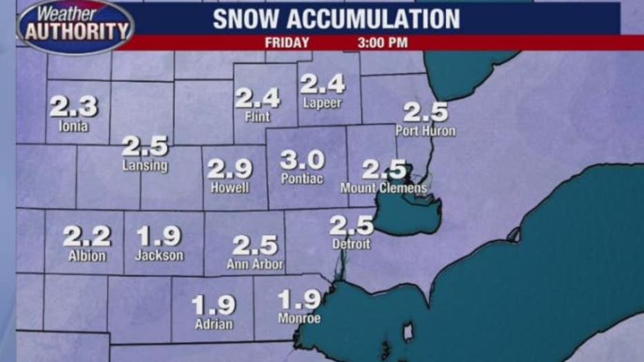
Snow accumulations between two to four inches fell last night, leaving slippery roads, narrow visibility, and a slow-moving morning commute. The heavy snow ended around midnight before the extreme cold set in.
>>WATCH the latest update on tonight's weather below or app users tap here for the live page.
A narrow band of moderate to heavy snow lifted from southwest to northeast across the area tonight. The heaviest snow fell between 7 p.m. and midnight where snowfall rates reached one inch per hour. Snow rates decreased after midnight, mixing with drizzle south of M-59.
A strong cold front then passed east through the area, which brought strong wind gusts and falling temperatures.
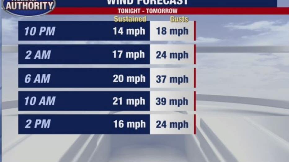
Wind also picked up after 10 p.m. last night and will keep temperatures low until about 2 p.m. Friday. Residents can expect gusts up to 39 miles per hour overnight.
On Friday the high is expected to be 16 with a wind chill of 0 and wind averaging about 25 miles per hour.
Download FOX 2's free weather authority app for the latest weather and live radar HERE.
Get the latest Weather Alerts HERE.
Click HERE for the latest traffic delays including a real-time map of closures and crashes.
Check out the latest school closing information HERE.
Flying? Check out all the latest information on airport delays HERE.