

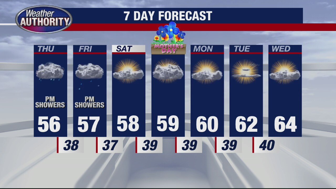
Afternoon showers likely Thursday
Rich Luterman has the forecast.
Rich Luterman has the forecast.

A break from the rain, with more wet weather lurking later this week
Temps are turning cooler too!
Temps are turning cooler too!

The cool-down is coming
Rich Luterman has the forecast.
Rich Luterman has the forecast.

A "milder" day today before cooler air arrives
A few sprinkles cannot be totally ruled out either.
A few sprinkles cannot be totally ruled out either.

A less wet Tuesday with a few showers possible, cooling mid week!
Some morning fog will greet you too!
Some morning fog will greet you too!
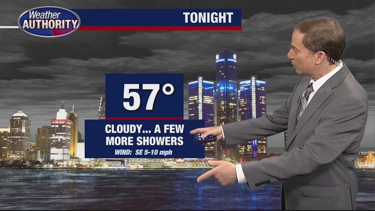
Another round of rain tonight
Rich Luterman has the forecast.
Rich Luterman has the forecast.

Wet weather returns with the start of the work week
Rain showers and cooler air will fill in this week.
Rain showers and cooler air will fill in this week.

Warm Sunday
After a warm start this morning, we are expecting a hot afternoon with highs in the low 80s. Though a few showers are possible, most of the wet weather should hold off until Monday. You will need your rain jackets and an umbrella to get things going first thing Monday morning.
After a warm start this morning, we are expecting a hot afternoon with highs in the low 80s. Though a few showers are possible, most of the wet weather should hold off until Monday. You will need your rain jackets and an umbrella to get things going first thing Monday morning.

Warmer Sunday
Not as cold tonight as temperatures continue their above average climb into Sunday. Meteorologist Lori Pinson has your forecast
Not as cold tonight as temperatures continue their above average climb into Sunday. Meteorologist Lori Pinson has your forecast

Not as cold tonight
A strong southwest flow will keep temperatures out of the freezing range overnight and warm up our daytime highs to above 70 degrees! Meteorologist Lori Pinson has your forecast
A strong southwest flow will keep temperatures out of the freezing range overnight and warm up our daytime highs to above 70 degrees! Meteorologist Lori Pinson has your forecast
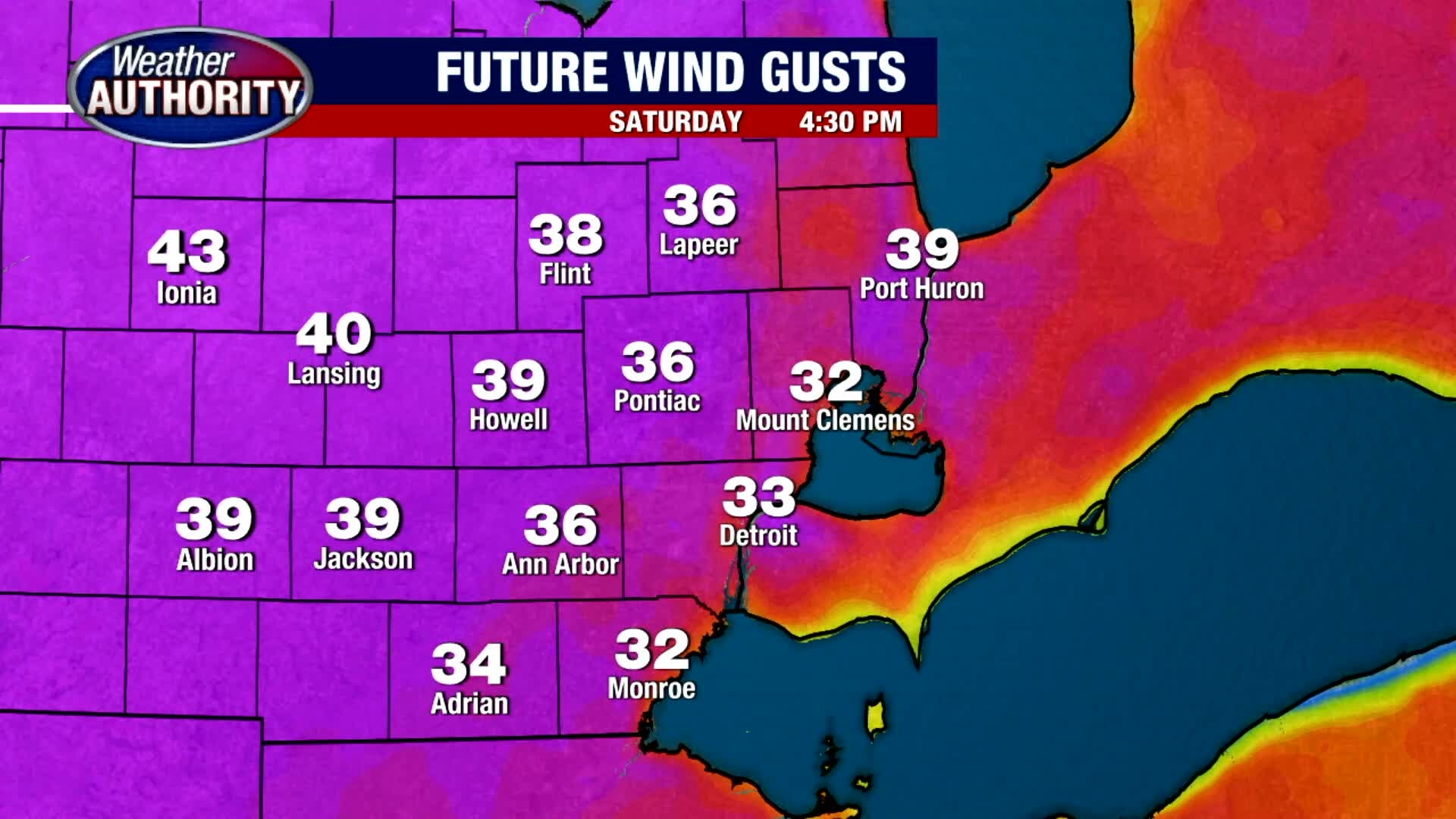
Mostly Sunny and Windy Saturday
After a chilly morning, expect a mild afternoon with highs in the upper 60s. Though rain showers are expected north of Metro Detroit, most of the area should stay dry today with a slight chance for a stray shower overnight. Near 80 degree heat is expected tomorrow.
After a chilly morning, expect a mild afternoon with highs in the upper 60s. Though rain showers are expected north of Metro Detroit, most of the area should stay dry today with a slight chance for a stray shower overnight. Near 80 degree heat is expected tomorrow.

Big Weekend Warm Up
After a cold start and possible frost Saturday morning, temperatures will warm up to around 70 for highs! Meteorologist Lori Pinson has your forecast.
After a cold start and possible frost Saturday morning, temperatures will warm up to around 70 for highs! Meteorologist Lori Pinson has your forecast.
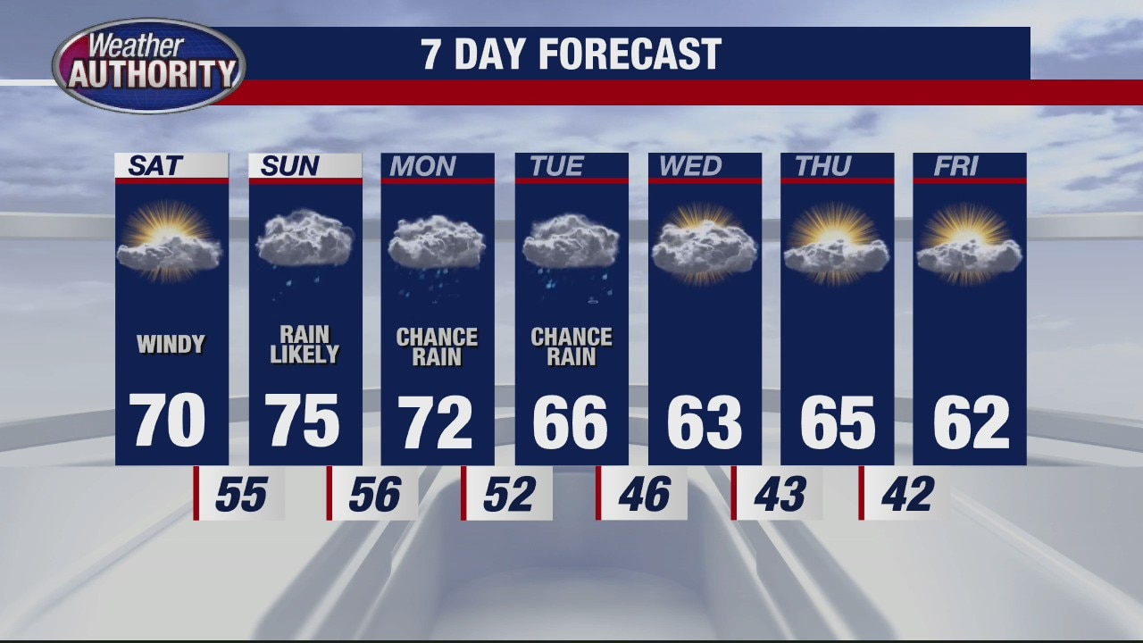
Metro Detroit weekend weather forecast includes sun, rain
Lori Pinson has what you can expect this weekend.
Lori Pinson has what you can expect this weekend.

Cold Night Ahead
A chance for patchy frost tonight will give way to a weekend warm up! Meteorologist Lori Pinson has your forecast
A chance for patchy frost tonight will give way to a weekend warm up! Meteorologist Lori Pinson has your forecast

Metro Detroit weather: Sun remains before rain chances return this weekend
Lori Pinson has your weekend forecast.
Lori Pinson has your weekend forecast.

Metro Detroit weather: Cool, windy Friday ahead
Rich Luterman has what to expect for Friday.
Rich Luterman has what to expect for Friday.
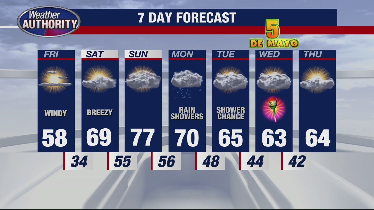
Drier weather ahead after rain soaks Metro Detroit
Rich Luterman has your Metro Detroit weather forecast.
Rich Luterman has your Metro Detroit weather forecast.

Thursday forecast: It's back to reality! Cooler and wetter weather arrives.
High temps don't make it to 60 today.
High temps don't make it to 60 today.
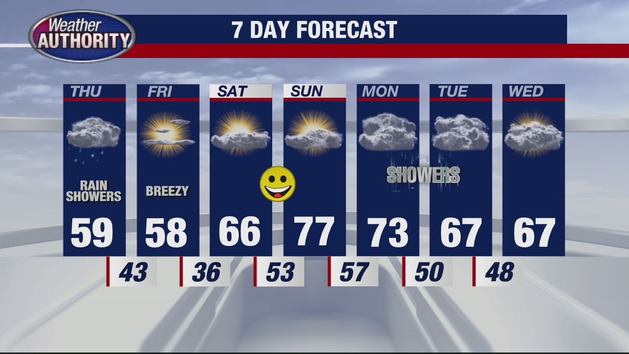
Cooler with chance of rain Thursday
Rich Luterman has the forecast.
Rich Luterman has the forecast.

Wednesday warmth continues! Scattered storms return.
High temps approach 80 this afternoon.
High temps approach 80 this afternoon.