


A warm Friday with temps in the 50s
Sunday showers could lead to Monday snowflakes
Sunday showers could lead to Monday snowflakes
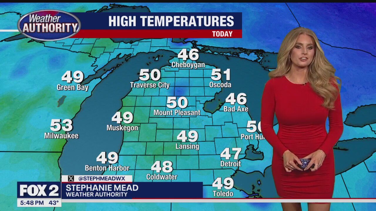
Warmer and dry end to the week!
Warmer end to the week with highs in the lower 50s Friday! Next chance for rain arrives Sunday with highs cooling to the upper 30s to lower 40s early next week.
Warmer end to the week with highs in the lower 50s Friday! Next chance for rain arrives Sunday with highs cooling to the upper 30s to lower 40s early next week.


Infant tossed by Tennessee tornado found alive in downed tree
A 4-month old boy has survived after a tornado in Tennessee sucked him up from his family’s mobile home.
A 4-month old boy has survived after a tornado in Tennessee sucked him up from his family’s mobile home.
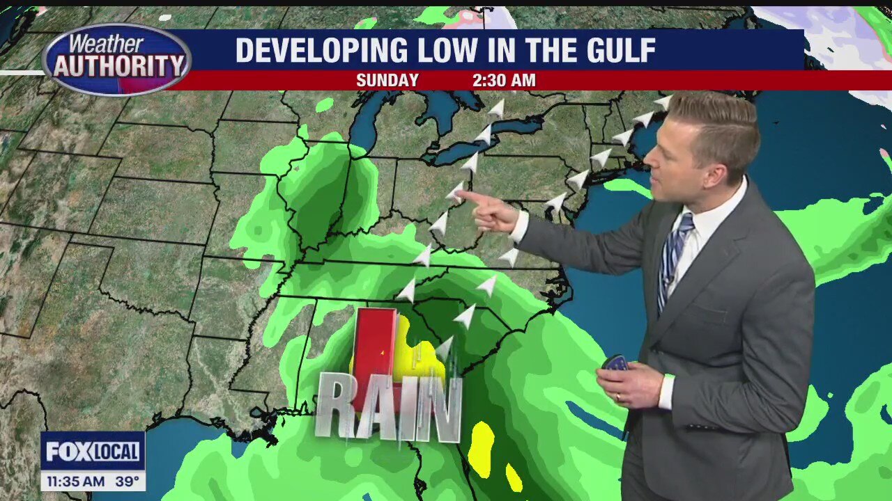
Some weekend forecast changes
Showers may move in on Sunday thanks to a developing system
Showers may move in on Sunday thanks to a developing system


White Christmas chances dwindling as only 18% of US is snow-covered with no cold air in sight
There are no signs of any arctic air masses invading the country until at least January, resulting in a considerable shortage of snow in many major cities across the nation.
There are no signs of any arctic air masses invading the country until at least January, resulting in a considerable shortage of snow in many major cities across the nation.


Metro Detroit weather: Milder temperatures to wind down the week
Temperatures are milder Thursday, and they climb even more for Friday.
Temperatures are milder Thursday, and they climb even more for Friday.
More sun, less cold
Temperatures start creeping up on Thursday. Alan Longstreet has what to expect.
Temperatures start creeping up on Thursday. Alan Longstreet has what to expect.

Mostly cloudy and not as cold for Thursday
Rich Luterman has the forecast.
Rich Luterman has the forecast.

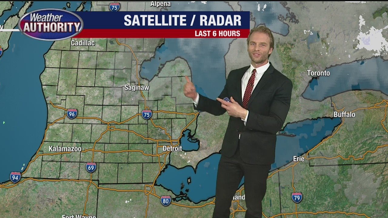
Dry, quiet stretch of weather continues
Temps climb into the lower 50s on Friday
Temps climb into the lower 50s on Friday


Metro Detroit weather: Chilly Wednesday before temps jump to end week
We'll take a minor step back today on the way to our late week warmup.
We'll take a minor step back today on the way to our late week warmup.

Temps drop a bit before end of week warmup
Wednesday is cold, but the sun and lack of wind make up for the dip.
Wednesday is cold, but the sun and lack of wind make up for the dip.
Partly sunny and chilly for Wednesday
Rich Luterman has the forecast.
Rich Luterman has the forecast.


White Christmas chances dwindling as December warmth expected to dominate US weather
So far, the beginning of meteorological winter, which runs from Dec. 1 to Feb. 29, has been mild. Right now, there are no indications of arctic air invading the country, the FOX Forecast Center said. This situation has resulted in a substantial lack of snow for many major cities nationwide.
So far, the beginning of meteorological winter, which runs from Dec. 1 to Feb. 29, has been mild. Right now, there are no indications of arctic air invading the country, the FOX Forecast Center said. This situation has resulted in a substantial lack of snow for many major cities nationwide.


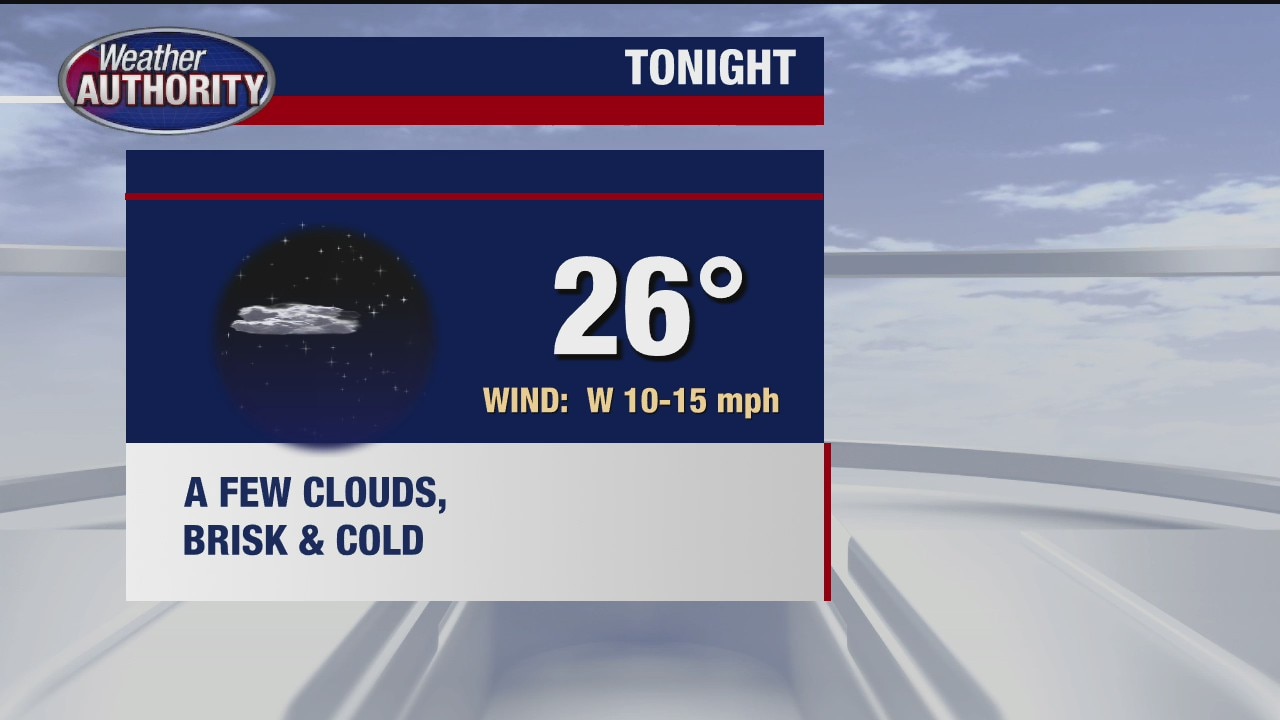
Metro Detroit weather: Cold day with wind chills near freezing
Today will be another cold December day in Detroit.
Today will be another cold December day in Detroit.

Another cold day
Tuesday will be windy and cold with some sun.
Tuesday will be windy and cold with some sun.

Partly cloudy and breezy for Tuesday
Rich Luterman has the forecast.
Rich Luterman has the forecast.

A dry and quiet week ahead
Temps remain seasonal but begin to spike by Friday.
Temps remain seasonal but begin to spike by Friday.

Colder, Breezy, Dry Monday
After record breaking high temperatures this weekend, readings continue to fall to the 30s this morning with wind chills in the 20s. Mainly dry week with temperatures rebounding. Meteorologist Lori Pinson has your forecast.
After record breaking high temperatures this weekend, readings continue to fall to the 30s this morning with wind chills in the 20s. Mainly dry week with temperatures rebounding. Meteorologist Lori Pinson has your forecast.


Colder day Monday
Monday is noticeably colder than the weekend, but another warm up is on the way again at the end of this week.
Monday is noticeably colder than the weekend, but another warm up is on the way again at the end of this week.

Weather forecast for the week is unusual for mid-December
Very quiet weather this week which is a little unusual for mid-December. We will see some sunshine as well over the next 4-5 days.
Very quiet weather this week which is a little unusual for mid-December. We will see some sunshine as well over the next 4-5 days.